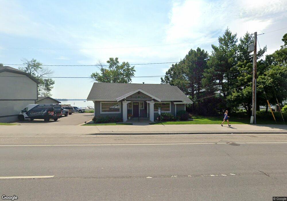
4524 Highway 61 N Saint Paul, MN 55110
Estimated Value: $1,501,835
--
Bed
--
Bath
4,004
Sq Ft
$375/Sq Ft
Est. Value
About This Home
This home is located at 4524 Highway 61 N, Saint Paul, MN 55110 and is currently estimated at $1,501,835, approximately $375 per square foot. 4524 Highway 61 N is a home located in Ramsey County with nearby schools including Lakeaires Elementary School, Central Middle School, and Liberty Classical Academy.
Ownership History
Date
Name
Owned For
Owner Type
Purchase Details
Closed on
Aug 14, 2020
Sold by
Taylor Edwin J and Taylor Diana S
Bought by
Gun Club Llc
Current Estimated Value
Home Financials for this Owner
Home Financials are based on the most recent Mortgage that was taken out on this home.
Original Mortgage
$1,116,000
Outstanding Balance
$988,124
Interest Rate
2.9%
Mortgage Type
Future Advance Clause Open End Mortgage
Estimated Equity
$513,711
Purchase Details
Closed on
Jun 28, 2017
Sold by
Freels Geraldine Wa and Freels Frank H
Bought by
Freels Geraldine A
Purchase Details
Closed on
Dec 1, 2001
Sold by
Meyer James A and Meyer Rosemary L
Bought by
Taylor Edwin J and Taylor Diana S
Create a Home Valuation Report for This Property
The Home Valuation Report is an in-depth analysis detailing your home's value as well as a comparison with similar homes in the area
Home Values in the Area
Average Home Value in this Area
Purchase History
| Date | Buyer | Sale Price | Title Company |
|---|---|---|---|
| Gun Club Llc | $1,200,000 | Ancona Title & Escrow | |
| Freels Geraldine A | -- | None Available | |
| Taylor Edwin J | $259,439 | -- |
Source: Public Records
Mortgage History
| Date | Status | Borrower | Loan Amount |
|---|---|---|---|
| Open | Gun Club Llc | $1,116,000 |
Source: Public Records
Tax History Compared to Growth
Tax History
| Year | Tax Paid | Tax Assessment Tax Assessment Total Assessment is a certain percentage of the fair market value that is determined by local assessors to be the total taxable value of land and additions on the property. | Land | Improvement |
|---|---|---|---|---|
| 2025 | $23,670 | $860,300 | $360,000 | $500,300 |
| 2023 | $23,670 | $817,000 | $360,000 | $457,000 |
| 2022 | $13,830 | $580,000 | $240,000 | $340,000 |
| 2021 | $14,284 | $463,300 | $240,000 | $223,300 |
| 2020 | $14,178 | $478,600 | $240,000 | $238,600 |
| 2019 | $13,152 | $451,500 | $240,000 | $211,500 |
| 2018 | $12,356 | $430,000 | $240,000 | $190,000 |
| 2017 | $12,486 | $409,500 | $240,000 | $169,500 |
| 2016 | $13,010 | $0 | $0 | $0 |
| 2015 | $13,620 | $382,700 | $240,000 | $142,700 |
| 2014 | $14,182 | $0 | $0 | $0 |
Source: Public Records
Map
Nearby Homes
- 1917 Webber St
- 1905 Birch Lake Ave
- 1828 Whitaker St
- 1825 2nd St
- 1744 Birch Lake Ave
- 4485 Margaret St
- 4181 White Bear Ave N
- 4864 Woodcrest Rd
- 4107 White Bear Ave N
- 2184 Floral Dr
- 1525 Pine Pointe
- 1785 Thury Ct
- 4969 Georgia Ln
- 1513 Pine Pointe
- 2431 S Shore Blvd
- 2239 10th St
- 4969 Stewart Ave
- 4926 Johnson Ave
- 4035 Highland Ave
- 219X 12th St
- 4526 Highway 61 N
- 4534 Highway 61 N
- 4538 Highway 61 N
- 4538 U S 61
- 4542 Highway 61 N
- 4548 U S 61
- 4552 Highway 61 N
- 4530 Highway 61 N
- 4556 Highway 61 N
- 4531 Lincoln Ave
- 4539 Lincoln Ave
- 4558 Highway 61 N
- 4549 Lincoln Ave
- 4549 Lincoln Ave Unit 2
- 4523 Lincoln Ave
- 4555 Lincoln Ave
- 11 Bald Eagle Island
- 44 Bald Eagle Point
- 56XX W Bald Eagle Blvd
- 56XX W Bald Eagle Blvd