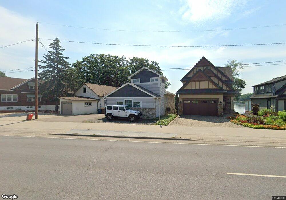
4538 Highway 61 N Saint Paul, MN 55110
Estimated Value: $765,000 - $1,101,000
4
Beds
3
Baths
3,172
Sq Ft
$280/Sq Ft
Est. Value
About This Home
This home is located at 4538 Highway 61 N, Saint Paul, MN 55110 and is currently estimated at $889,048, approximately $280 per square foot. 4538 Highway 61 N is a home located in Ramsey County with nearby schools including Lakeaires Elementary School, Central Middle School, and Liberty Classical Academy.
Ownership History
Date
Name
Owned For
Owner Type
Purchase Details
Closed on
Nov 10, 2021
Sold by
Haglund Susan M
Bought by
Hagluad Bruca C
Current Estimated Value
Purchase Details
Closed on
Jan 29, 2019
Sold by
Haglund Bruce C and Haglund Susan
Bought by
Haglund 4542 Llc
Purchase Details
Closed on
Oct 7, 2013
Sold by
Lucio Kim O
Bought by
Haglund Bruce
Purchase Details
Closed on
Apr 27, 2000
Sold by
Brooks David A and Brooks Karen R
Bought by
Hagen Ventures Llc
Purchase Details
Closed on
Sep 16, 1998
Sold by
Miller Harry E and Schottmuller Ria G
Bought by
Brooks David A
Purchase Details
Closed on
Aug 26, 1998
Sold by
Lutheran Social Services
Bought by
Miller Harry E and Schottmuller Ria G
Create a Home Valuation Report for This Property
The Home Valuation Report is an in-depth analysis detailing your home's value as well as a comparison with similar homes in the area
Home Values in the Area
Average Home Value in this Area
Purchase History
| Date | Buyer | Sale Price | Title Company |
|---|---|---|---|
| Hagluad Bruca C | -- | None Available | |
| Haglund 4542 Llc | -- | None Available | |
| Haglund Bruce | $309,090 | None Available | |
| Hagen Ventures Llc | $155,739 | -- | |
| Brooks David A | $153,000 | -- | |
| Miller Harry E | $147,500 | -- |
Source: Public Records
Tax History Compared to Growth
Tax History
| Year | Tax Paid | Tax Assessment Tax Assessment Total Assessment is a certain percentage of the fair market value that is determined by local assessors to be the total taxable value of land and additions on the property. | Land | Improvement |
|---|---|---|---|---|
| 2025 | $8,746 | $839,600 | $248,700 | $590,900 |
| 2023 | $8,746 | $632,900 | $186,200 | $446,700 |
| 2022 | $7,098 | $560,300 | $186,200 | $374,100 |
| 2021 | $6,936 | $523,200 | $55,900 | $467,300 |
| 2020 | $6,216 | $524,000 | $186,200 | $337,800 |
| 2019 | $5,522 | $442,900 | $186,200 | $256,700 |
| 2018 | $5,376 | $422,600 | $186,200 | $236,400 |
| 2017 | $4,796 | $422,600 | $186,200 | $236,400 |
| 2016 | $5,074 | $0 | $0 | $0 |
| 2015 | $4,664 | $372,400 | $186,200 | $186,200 |
| 2014 | $5,048 | $0 | $0 | $0 |
Source: Public Records
Map
Nearby Homes
- 1917 Webber St
- 1905 Birch Lake Ave
- 1828 Whitaker St
- 1825 2nd St
- 1744 Birch Lake Ave
- 4485 Margaret St
- 4181 White Bear Ave N
- 4864 Woodcrest Rd
- 4107 White Bear Ave N
- 2184 Floral Dr
- 1525 Pine Pointe
- 1785 Thury Ct
- 4969 Georgia Ln
- 1513 Pine Pointe
- 2431 S Shore Blvd
- 2239 10th St
- 4969 Stewart Ave
- 4926 Johnson Ave
- 4035 Highland Ave
- 219X 12th St
- 4538 U S 61
- 4534 Highway 61 N
- 4542 Highway 61 N
- 4548 U S 61
- 4526 Highway 61 N
- 4552 Highway 61 N
- 4556 Highway 61 N
- 4524 Highway 61 N
- 4558 Highway 61 N
- 4560 Lake Ave
- 11 Bald Eagle Island
- 44 Bald Eagle Point
- 56XX W Bald Eagle Blvd
- 56XX W Bald Eagle Blvd
- 4564 Lake Ave
- 4568 Lake Ave
- 4555 Lincoln Ave
- 1986 Highway 96 E
- 4549 Lincoln Ave
- 4549 Lincoln Ave Unit 2