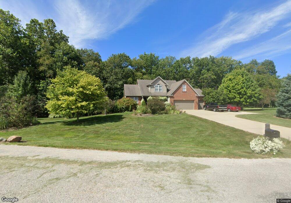
4562 S 95 E Bringhurst, IN 46913
Estimated Value: $305,000 - $340,000
4
Beds
3
Baths
1,926
Sq Ft
$169/Sq Ft
Est. Value
About This Home
This home is located at 4562 S 95 E, Bringhurst, IN 46913 and is currently estimated at $325,201, approximately $168 per square foot. 4562 S 95 E is a home located in Carroll County with nearby schools including Carroll Elementary School and Carroll Senior High School.
Ownership History
Date
Name
Owned For
Owner Type
Purchase Details
Closed on
Jun 28, 2005
Sold by
Willoughby James F and Willoghby Melody
Bought by
Lane Keith D and Lane Melisa A
Current Estimated Value
Home Financials for this Owner
Home Financials are based on the most recent Mortgage that was taken out on this home.
Original Mortgage
$235,600
Outstanding Balance
$120,075
Interest Rate
5.69%
Mortgage Type
New Conventional
Estimated Equity
$205,126
Purchase Details
Closed on
Jan 15, 2002
Sold by
Willoughby James R
Bought by
Citation Homes Inc
Purchase Details
Closed on
Mar 15, 2000
Sold by
Eller Dr Alvan L and Eller Arlene C
Bought by
Willoughby James F and Willoughby Melody
Create a Home Valuation Report for This Property
The Home Valuation Report is an in-depth analysis detailing your home's value as well as a comparison with similar homes in the area
Purchase History
| Date | Buyer | Sale Price | Title Company |
|---|---|---|---|
| Lane Keith D | -- | None Available | |
| Citation Homes Inc | $20,000 | -- | |
| Willoughby James F | $20,500 | -- |
Source: Public Records
Mortgage History
| Date | Status | Borrower | Loan Amount |
|---|---|---|---|
| Open | Lane Keith D | $235,600 |
Source: Public Records
Tax History
| Year | Tax Paid | Tax Assessment Tax Assessment Total Assessment is a certain percentage of the fair market value that is determined by local assessors to be the total taxable value of land and additions on the property. | Land | Improvement |
|---|---|---|---|---|
| 2025 | $1,046 | $263,400 | $43,000 | $220,400 |
| 2024 | $1,046 | $224,500 | $43,000 | $181,500 |
| 2023 | $1,291 | $234,000 | $52,500 | $181,500 |
| 2022 | $1,291 | $234,100 | $52,500 | $181,600 |
| 2021 | $1,390 | $241,900 | $52,500 | $189,400 |
| 2020 | $1,302 | $237,100 | $52,500 | $184,600 |
| 2019 | $1,207 | $218,400 | $39,500 | $178,900 |
| 2018 | $1,215 | $220,600 | $39,500 | $181,100 |
| 2017 | $1,141 | $220,600 | $39,500 | $181,100 |
| 2016 | $1,042 | $209,700 | $39,500 | $170,200 |
| 2014 | $935 | $199,400 | $41,300 | $158,100 |
Source: Public Records
Map
Nearby Homes
Your Personal Tour Guide
Ask me questions while you tour the home.