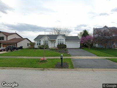
459 Barnaby Dr Oswego, IL 60543
North Oswego NeighborhoodEstimated Value: $337,000 - $386,000
2
Beds
2
Baths
1,400
Sq Ft
$258/Sq Ft
Est. Value
About This Home
This home is located at 459 Barnaby Dr, Oswego, IL 60543 and is currently estimated at $360,629, approximately $257 per square foot. 459 Barnaby Dr is a home located in Kendall County with nearby schools including Long Beach Elementary School, Plank Junior High School, and Oswego East High School.
Ownership History
Date
Name
Owned For
Owner Type
Purchase Details
Closed on
Nov 20, 2009
Sold by
Matlosz Alice A
Bought by
Rossini Mindy Jo
Current Estimated Value
Home Financials for this Owner
Home Financials are based on the most recent Mortgage that was taken out on this home.
Original Mortgage
$181,649
Outstanding Balance
$124,345
Interest Rate
5.02%
Mortgage Type
FHA
Purchase Details
Closed on
Sep 18, 1996
Sold by
Harris Bank Naperville
Bought by
Matlosz Alice A
Home Financials for this Owner
Home Financials are based on the most recent Mortgage that was taken out on this home.
Original Mortgage
$49,000
Interest Rate
7.44%
Create a Home Valuation Report for This Property
The Home Valuation Report is an in-depth analysis detailing your home's value as well as a comparison with similar homes in the area
Home Values in the Area
Average Home Value in this Area
Purchase History
| Date | Buyer | Sale Price | Title Company |
|---|---|---|---|
| Rossini Mindy Jo | $185,000 | First American Title | |
| Matlosz Alice A | $154,000 | -- |
Source: Public Records
Mortgage History
| Date | Status | Borrower | Loan Amount |
|---|---|---|---|
| Open | Rossini Mindy Jo | $51,694 | |
| Open | Rossini Mindy Jo | $181,649 | |
| Previous Owner | Matlosz Alice A | $49,000 |
Source: Public Records
Tax History Compared to Growth
Tax History
| Year | Tax Paid | Tax Assessment Tax Assessment Total Assessment is a certain percentage of the fair market value that is determined by local assessors to be the total taxable value of land and additions on the property. | Land | Improvement |
|---|---|---|---|---|
| 2023 | $7,181 | $93,223 | $24,032 | $69,191 |
| 2022 | $7,181 | $85,526 | $22,048 | $63,478 |
| 2021 | $6,988 | $80,685 | $20,800 | $59,885 |
| 2020 | $6,764 | $77,582 | $20,000 | $57,582 |
| 2019 | $6,659 | $75,367 | $20,000 | $55,367 |
| 2018 | $6,717 | $73,788 | $18,345 | $55,443 |
| 2017 | $6,658 | $70,950 | $17,639 | $53,311 |
| 2016 | $6,371 | $67,251 | $16,719 | $50,532 |
| 2015 | $6,138 | $62,270 | $15,481 | $46,789 |
| 2014 | -- | $58,746 | $14,605 | $44,141 |
| 2013 | -- | $59,340 | $14,753 | $44,587 |
Source: Public Records
Map
Nearby Homes
- 247 Springbrook Trail S Unit 1
- 261 Springbrook Trail S Unit 1
- 251 Springbrook Trail S
- 171 Springbrook Trail S
- 0000 Fifth St
- 511 Homeview Dr
- 233 Mondovi Dr
- 295 Kendall Point Dr
- 314 Bluegrass Pkwy
- 221 Ashley Ct
- 108 Buckingham Ct
- 2071 Wiesbrook Dr
- 82 Paddock St
- 121 Preakness Dr
- 109 Oxford Ct
- 700 Wilmore Dr
- 117 Preakness Dr
- 210 Woodford Rd
- 310 Cascade Ln Unit 310
- 231 Grays Dr Unit 1