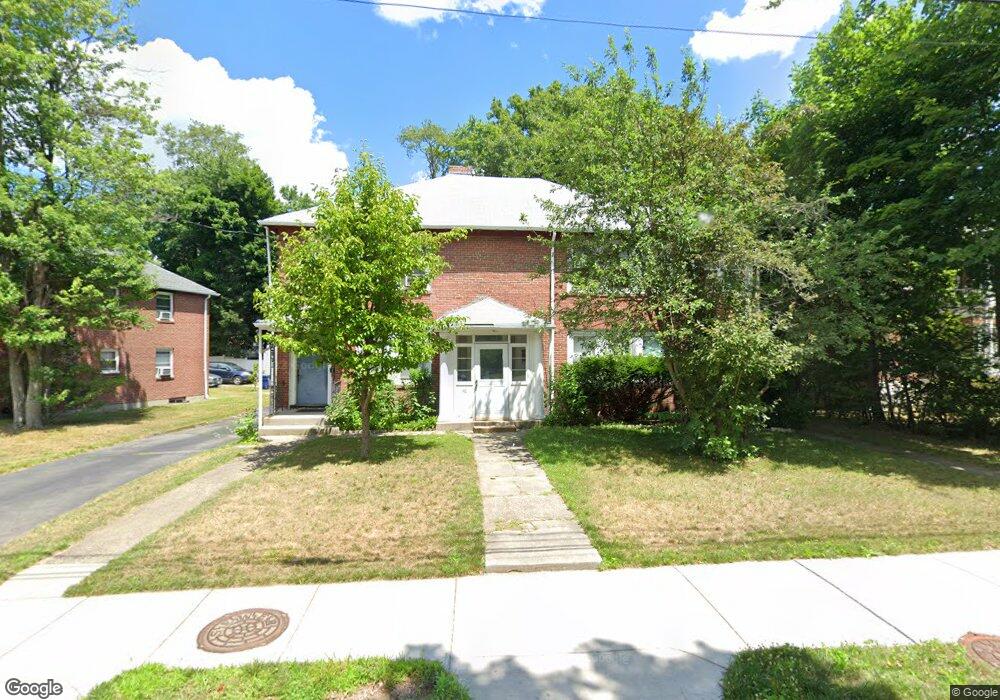
46-48 Westchester Rd Newton, MA 02458
Newton Corner NeighborhoodEstimated Value: $1,441,000 - $1,771,000
5
Beds
2
Baths
2,826
Sq Ft
$560/Sq Ft
Est. Value
About This Home
This home is located at 46-48 Westchester Rd, Newton, MA 02458 and is currently estimated at $1,581,286, approximately $559 per square foot. 46-48 Westchester Rd is a home located in Middlesex County with nearby schools including Cabot Elementary School, F.A. Day Middle School, and Newton North High School.
Ownership History
Date
Name
Owned For
Owner Type
Purchase Details
Closed on
Mar 23, 2015
Sold by
Thea Kathy and Thea Liann
Bought by
46-48 Westchester Road
Current Estimated Value
Purchase Details
Closed on
Apr 23, 1999
Sold by
Laine Rt and Laine David E
Bought by
Merlis Joan
Create a Home Valuation Report for This Property
The Home Valuation Report is an in-depth analysis detailing your home's value as well as a comparison with similar homes in the area
Home Values in the Area
Average Home Value in this Area
Purchase History
| Date | Buyer | Sale Price | Title Company |
|---|---|---|---|
| 46-48 Westchester Road | -- | -- | |
| Merlis Joan | $212,500 | -- |
Source: Public Records
Mortgage History
| Date | Status | Borrower | Loan Amount |
|---|---|---|---|
| Previous Owner | Merlis Joan | $177,000 | |
| Previous Owner | Merlis Joan | $303,448 |
Source: Public Records
Tax History Compared to Growth
Tax History
| Year | Tax Paid | Tax Assessment Tax Assessment Total Assessment is a certain percentage of the fair market value that is determined by local assessors to be the total taxable value of land and additions on the property. | Land | Improvement |
|---|---|---|---|---|
| 2025 | $12,378 | $1,263,100 | $941,300 | $321,800 |
| 2024 | $11,969 | $1,226,300 | $913,900 | $312,400 |
| 2023 | $11,471 | $1,126,800 | $742,900 | $383,900 |
| 2022 | $10,976 | $1,043,300 | $687,900 | $355,400 |
| 2021 | $10,299 | $957,200 | $631,100 | $326,100 |
| 2020 | $9,993 | $957,200 | $631,100 | $326,100 |
| 2019 | $9,349 | $894,600 | $589,800 | $304,800 |
| 2018 | $9,287 | $858,300 | $555,900 | $302,400 |
| 2017 | $8,756 | $787,400 | $510,000 | $277,400 |
| 2016 | $8,221 | $722,400 | $467,900 | $254,500 |
| 2015 | $7,838 | $675,100 | $437,300 | $237,800 |
Source: Public Records
Map
Nearby Homes
- 44 Blake St Unit 2
- 127-129 Withington Rd Unit 1
- 110 Harvard St Unit A
- 10 Washington Park
- 10 Washington Park Unit 2
- 10 Washington Park Unit 1
- 300 Cabot St
- 48 Harvard St Unit 1
- 230 Bellevue St Unit 1
- 686 Centre St
- 3 Cedar St
- 35 George St Unit 35
- 37 George St Unit 37
- 14 Summit St
- 22 Walnut Place Unit 1
- 642 Centre St
- 324 Adams St Unit 2
- 77 Court St Unit 205
- 59 Hyde Ave
- 73 Elmore St
- 46 Westchester Rd Unit 48
- 48 Westchester Rd Unit 48
- 50 Westchester Rd Unit 52
- 36 Westchester Rd Unit 38
- 52 Westchester Rd Unit 2
- 56 Westchester Rd Unit 58
- 174 Cabot St
- 172 Cabot St
- 172 Cabot St Unit 2
- 172 Cabot St Unit 172
- 176 Cabot St
- 28 Westchester Rd
- 26 Westchester Rd
- 43 Westchester Rd Unit 1
- 47 Westchester Rd Unit 49
- 166 Cabot St Unit 168
- 178 Cabot St
- 41-43 Westchester Rd
- 41 Westchester Rd Unit 43
- 182 Cabot St Unit 184