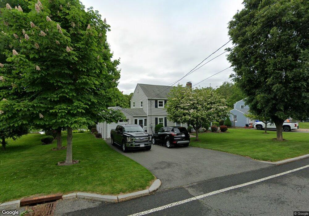
460 Roosevelt Ave Springfield, MA 01118
East Forest Park NeighborhoodEstimated Value: $347,000 - $370,000
3
Beds
2
Baths
1,332
Sq Ft
$266/Sq Ft
Est. Value
About This Home
This home is located at 460 Roosevelt Ave, Springfield, MA 01118 and is currently estimated at $354,766, approximately $266 per square foot. 460 Roosevelt Ave is a home located in Hampden County with nearby schools including Mary A. Dryden Veterans Memorial School, M Marcus Kiley Middle, and Springfield High School of Science and Technology.
Ownership History
Date
Name
Owned For
Owner Type
Purchase Details
Closed on
Jun 17, 1992
Sold by
Healy Gerald M and Healy Evelyn M
Bought by
Vear Richard S and Cannata Beverly A
Current Estimated Value
Home Financials for this Owner
Home Financials are based on the most recent Mortgage that was taken out on this home.
Original Mortgage
$88,000
Interest Rate
8.67%
Mortgage Type
Purchase Money Mortgage
Create a Home Valuation Report for This Property
The Home Valuation Report is an in-depth analysis detailing your home's value as well as a comparison with similar homes in the area
Home Values in the Area
Average Home Value in this Area
Purchase History
| Date | Buyer | Sale Price | Title Company |
|---|---|---|---|
| Vear Richard S | $110,000 | -- |
Source: Public Records
Mortgage History
| Date | Status | Borrower | Loan Amount |
|---|---|---|---|
| Open | Vear Richard S | $84,000 | |
| Closed | Vear Richard S | $88,000 |
Source: Public Records
Tax History Compared to Growth
Tax History
| Year | Tax Paid | Tax Assessment Tax Assessment Total Assessment is a certain percentage of the fair market value that is determined by local assessors to be the total taxable value of land and additions on the property. | Land | Improvement |
|---|---|---|---|---|
| 2025 | $5,124 | $326,800 | $48,000 | $278,800 |
| 2024 | $4,624 | $287,900 | $48,000 | $239,900 |
| 2023 | $4,846 | $281,500 | $45,700 | $235,800 |
| 2022 | $4,406 | $234,100 | $45,700 | $188,400 |
| 2021 | $4,135 | $218,800 | $41,500 | $177,300 |
| 2020 | $3,933 | $201,400 | $41,500 | $159,900 |
| 2019 | $3,887 | $197,500 | $41,500 | $156,000 |
| 2018 | $3,875 | $196,900 | $41,500 | $155,400 |
| 2017 | $3,598 | $183,000 | $41,500 | $141,500 |
| 2016 | $3,395 | $172,700 | $41,500 | $131,200 |
| 2015 | $3,369 | $171,300 | $41,500 | $129,800 |
Source: Public Records
Map
Nearby Homes
- 54 S Shore Dr
- 384 Abbott St
- 236 Pondview Dr
- 74 Oregon St
- 100 Derryfield Ave
- 97 Lancaster St
- 91 Lancaster St
- 7 Ashbrook St
- 75 Carnavon Cir
- 283 Plumtree Rd
- 190 Whittum Ave
- 141 Hartford Terrace
- 74 Judith St
- 867 Roosevelt Ave
- 34 Ina St
- 138 Abbott St
- 134 Eddywood St
- 74 Leatherleaf Dr
- 100 Abbott St
- 95 Benz St
- 450 Roosevelt Ave
- 470 Roosevelt Ave
- 480 Roosevelt Ave
- 440 Roosevelt Ave
- 465 Roosevelt Ave
- 453 Roosevelt Ave
- 477 Roosevelt Ave
- 445 Roosevelt Ave
- 490 Roosevelt Ave
- 16 Arvesta St
- 430 Roosevelt Ave
- 435 Roosevelt Ave
- 17 Arvesta St
- 491 Roosevelt Ave
- 63 S Branch Pkwy
- 69 S Branch Pkwy
- 24 Arvesta St
- 18 Kipling St
- 75 S Branch Pkwy
- 420 Roosevelt Ave