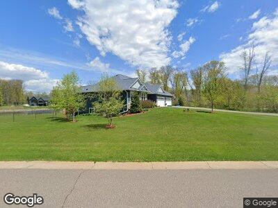
4605 141st Ln NE Andover, MN 55304
3
Beds
3
Baths
2,046
Sq Ft
2.5
Acres
About This Home
This home is located at 4605 141st Ln NE, Andover, MN 55304. 4605 141st Ln NE is a home with nearby schools including McKinley Elementary School, Roosevelt Middle School, and Blaine Senior High School.
Ownership History
Date
Name
Owned For
Owner Type
Purchase Details
Closed on
Feb 5, 2021
Sold by
Gray Heather L and Gray Israel M
Bought by
Gray Heather L and Gray Israel M
Home Financials for this Owner
Home Financials are based on the most recent Mortgage that was taken out on this home.
Original Mortgage
$358,000
Outstanding Balance
$323,825
Interest Rate
2.7%
Mortgage Type
New Conventional
Estimated Equity
$555,548
Purchase Details
Closed on
Jul 24, 2018
Sold by
Horgen Rodney C and Lemieux Judy L
Bought by
Horgen Heather L
Purchase Details
Closed on
Aug 17, 2017
Sold by
Hen Properties Llc
Bought by
Lemleux Horgen Rodney C and Lemleux Horgen
Create a Home Valuation Report for This Property
The Home Valuation Report is an in-depth analysis detailing your home's value as well as a comparison with similar homes in the area
Home Values in the Area
Average Home Value in this Area
Purchase History
| Date | Buyer | Sale Price | Title Company |
|---|---|---|---|
| Gray Heather L | -- | Ancona Title & Escrow | |
| Horgen Heather L | $15,954 | None Available | |
| Lemleux Horgen Rodney C | $157,500 | First American Title Insuran |
Source: Public Records
Mortgage History
| Date | Status | Borrower | Loan Amount |
|---|---|---|---|
| Open | Gray Heather L | $358,000 | |
| Closed | Horgen Heather L | $358,000 | |
| Closed | Horgen Heather | $360,000 |
Source: Public Records
Tax History Compared to Growth
Tax History
| Year | Tax Paid | Tax Assessment Tax Assessment Total Assessment is a certain percentage of the fair market value that is determined by local assessors to be the total taxable value of land and additions on the property. | Land | Improvement |
|---|---|---|---|---|
| 2025 | $6,903 | $773,000 | $250,500 | $522,500 |
| 2024 | $6,903 | $735,900 | $233,000 | $502,900 |
| 2023 | $6,219 | $755,400 | $233,000 | $522,400 |
| 2022 | $5,872 | $706,600 | $190,400 | $516,200 |
| 2021 | $5,236 | $595,700 | $152,200 | $443,500 |
| 2020 | $4,897 | $528,500 | $116,300 | $412,200 |
| 2019 | $696 | $482,500 | $112,200 | $370,300 |
| 2018 | $15 | $88,200 | $0 | $0 |
Source: Public Records
Map
Nearby Homes
- 14400 Packard St NE
- 4818 145th Ave NE
- 14633 Packard St NE
- 14636 Packard St NE
- 14775 Stutz St NE
- 14885 Stutz St NE
- 4105 138th Ave NE
- 14642 Cord St NE
- 14805 Stutz St NE
- 14985 Stutz St NE
- 14770 Packard St NE
- 4963 149th Ave NE
- 14881 Stutz St NE
- 4015 136th Ave NE
- XXX0 137th Ln
- 15001 Stutz St NE
- 4763 132nd Ct NE
- 4751 132nd Ct NE
- 4757 132nd Ct NE
- 4773 132nd Ct NE
- 4605 141st Ln NE
- 4602 141st Ln NE
- 14210 Opal St NE
- 4623 141st Ln NE
- 4623 141st Ln NE
- 4608 143rd Ave NE
- 14226 Opal St NE
- 4624 141st Ln NE
- 4719 141st Ln NE
- 14213 Opal St NE
- 4718 141st Ln NE
- 14227 Opal St NE
- 14136 Packard St NE
- 4611 139th Ln NE
- 14214 Packard St NE
- 14146 Packard NE
- 4728 141st Ln NE
- 4728 141st Ln NE
- 4728 141st Ln NE
- 4609 143rd Ave NE