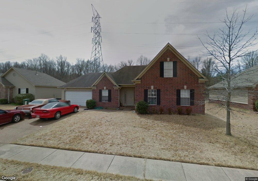
4611 Allendale Dr Memphis, TN 38128
Raleigh NeighborhoodEstimated Value: $174,000 - $237,000
4
Beds
3
Baths
2,511
Sq Ft
$80/Sq Ft
Est. Value
About This Home
This home is located at 4611 Allendale Dr, Memphis, TN 38128 and is currently estimated at $201,965, approximately $80 per square foot. 4611 Allendale Dr is a home located in Shelby County with nearby schools including Lucy Elementary School, Woodstock Middle School, and Bolton High School.
Ownership History
Date
Name
Owned For
Owner Type
Purchase Details
Closed on
Oct 27, 2008
Sold by
Bank Of America
Bought by
Bullard Nicholas and Cowan Kirsten
Current Estimated Value
Home Financials for this Owner
Home Financials are based on the most recent Mortgage that was taken out on this home.
Original Mortgage
$78,859
Interest Rate
5.03%
Mortgage Type
FHA
Purchase Details
Closed on
Mar 13, 2008
Sold by
Settles Shirley
Bought by
Bank Of America
Purchase Details
Closed on
Apr 9, 2007
Sold by
Bronze Builders Llc
Bought by
Settles Shirley
Home Financials for this Owner
Home Financials are based on the most recent Mortgage that was taken out on this home.
Original Mortgage
$145,200
Interest Rate
6.15%
Mortgage Type
Purchase Money Mortgage
Purchase Details
Closed on
Jul 7, 2004
Sold by
Hyneman Bronze Llc
Bought by
Bronze Builders Llc
Create a Home Valuation Report for This Property
The Home Valuation Report is an in-depth analysis detailing your home's value as well as a comparison with similar homes in the area
Home Values in the Area
Average Home Value in this Area
Purchase History
| Date | Buyer | Sale Price | Title Company |
|---|---|---|---|
| Bullard Nicholas | $78,859 | Landcastle Title Llc | |
| Bank Of America | $96,000 | None Available | |
| Settles Shirley | $145,200 | West Tennessee Title | |
| Bronze Builders Llc | -- | Memphis Title Company |
Source: Public Records
Mortgage History
| Date | Status | Borrower | Loan Amount |
|---|---|---|---|
| Previous Owner | Bullard Nicholas | $78,859 | |
| Previous Owner | Settles Shirley | $145,200 |
Source: Public Records
Tax History Compared to Growth
Tax History
| Year | Tax Paid | Tax Assessment Tax Assessment Total Assessment is a certain percentage of the fair market value that is determined by local assessors to be the total taxable value of land and additions on the property. | Land | Improvement |
|---|---|---|---|---|
| 2025 | $1,309 | $40,800 | $4,500 | $36,300 |
| 2024 | $1,309 | $38,600 | $4,125 | $34,475 |
| 2023 | $1,309 | $38,600 | $4,125 | $34,475 |
| 2022 | $1,309 | $38,600 | $4,125 | $34,475 |
| 2021 | $1,332 | $38,600 | $4,125 | $34,475 |
| 2020 | $1,058 | $26,125 | $4,125 | $22,000 |
| 2019 | $1,058 | $26,125 | $4,125 | $22,000 |
| 2018 | $1,058 | $26,125 | $4,125 | $22,000 |
| 2017 | $1,074 | $26,125 | $4,125 | $22,000 |
| 2016 | $1,062 | $24,300 | $0 | $0 |
| 2014 | $1,062 | $24,300 | $0 | $0 |
Source: Public Records
Map
Nearby Homes
- 4335 N Grand Cedar Ln
- 3953 Otter Dr
- 4136 Hampton Manor Ln
- 4350 Shadow Leaf Cove S
- 3928 Springfield Dr
- 3914 Springfield Dr
- 4626 St Elmo Ave
- 4087 Singleton Pkwy
- 3885 Lakemont Dr
- 4409 E Hunters Glen St
- 3836 Lakehurst Dr
- 4563 Blue River Dr
- 4236 Appian Dr
- 0 Singleton Park Unit 10193357
- 4118 Austin Peay Hwy
- 4841 Northdale Dr
- 0 Egypt Central Rd Unit RTC3009208
- 0 Egypt Central Rd Unit 10198246
- 4807 Royal Run Dr
- 4693 Waterfront Oak Dr
- 4615 Allendale Dr
- 4619 Allendale Dr
- 4605 Allendale Dr
- 4605 Allendale Dr
- 4599 Allendale Dr
- 4155 Rosswood Dr
- 4177 Rosswood Dr
- 4595 Allendale Dr
- 4608 Allendale Dr
- 4600 Allendale Dr
- 4635 Allendale Dr
- 4185 Rosswood Dr
- 4585 Allendale Dr
- 4596 Allendale Dr
- 4641 Allendale Dr
- 4638 Allendale Dr
- 4196 Cedar Meadow Dr
- 4579 Allendale Dr
- 4619 Cedar Pine Dr
- 4176 Rosswood Dr