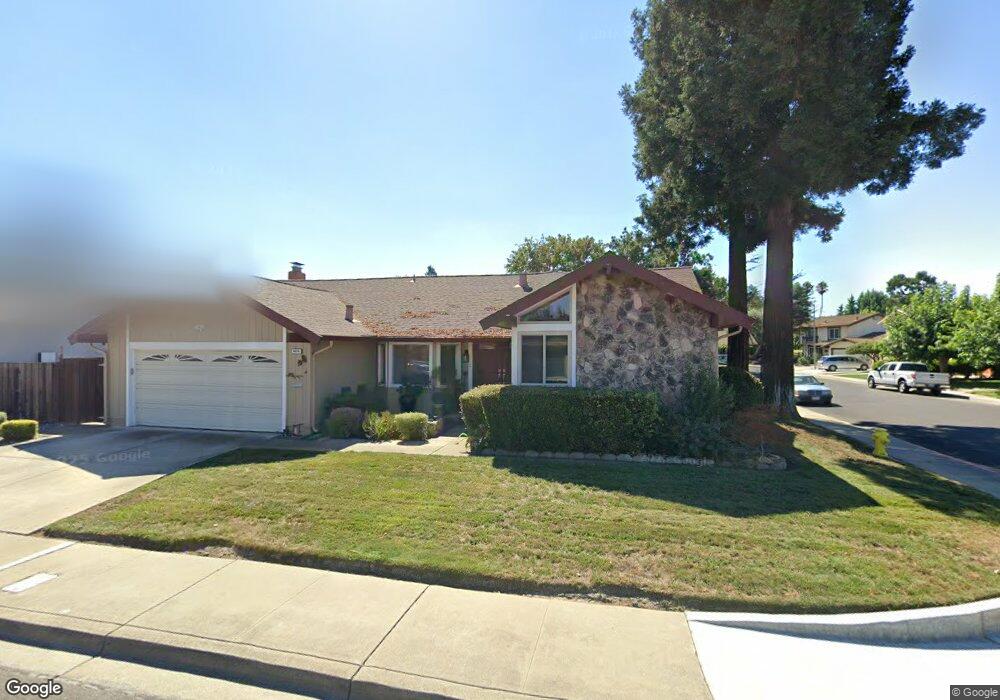
4654 Canary Dr Pleasanton, CA 94566
Amador Valley NeighborhoodEstimated Value: $1,653,764 - $1,795,000
4
Beds
2
Baths
1,808
Sq Ft
$958/Sq Ft
Est. Value
About This Home
This home is located at 4654 Canary Dr, Pleasanton, CA 94566 and is currently estimated at $1,731,691, approximately $957 per square foot. 4654 Canary Dr is a home located in Alameda County with nearby schools including Alisal Elementary School, Harvest Park Middle School, and Amador Valley High School.
Ownership History
Date
Name
Owned For
Owner Type
Purchase Details
Closed on
Apr 3, 2019
Sold by
David E And Margaret J Boyd Trust
Bought by
Mo David K and Lin Chiung Fang
Current Estimated Value
Home Financials for this Owner
Home Financials are based on the most recent Mortgage that was taken out on this home.
Original Mortgage
$980,000
Outstanding Balance
$861,594
Interest Rate
4.3%
Mortgage Type
New Conventional
Estimated Equity
$870,097
Purchase Details
Closed on
Dec 19, 2008
Sold by
Boyd David E and Boyd Margaret J
Bought by
The David E & Margaret J Boyd Trust
Home Financials for this Owner
Home Financials are based on the most recent Mortgage that was taken out on this home.
Original Mortgage
$250,000
Interest Rate
6.03%
Mortgage Type
New Conventional
Create a Home Valuation Report for This Property
The Home Valuation Report is an in-depth analysis detailing your home's value as well as a comparison with similar homes in the area
Home Values in the Area
Average Home Value in this Area
Purchase History
| Date | Buyer | Sale Price | Title Company |
|---|---|---|---|
| Mo David K | $1,225,000 | Chicago Title Company | |
| The David E & Margaret J Boyd Trust | -- | None Available | |
| Boyd David E | -- | Security Union Title Ins Co |
Source: Public Records
Mortgage History
| Date | Status | Borrower | Loan Amount |
|---|---|---|---|
| Open | Mo David K | $980,000 | |
| Previous Owner | Boyd David E | $250,000 |
Source: Public Records
Tax History
| Year | Tax Paid | Tax Assessment Tax Assessment Total Assessment is a certain percentage of the fair market value that is determined by local assessors to be the total taxable value of land and additions on the property. | Land | Improvement |
|---|---|---|---|---|
| 2025 | $15,758 | $1,366,487 | $409,946 | $956,541 |
| 2024 | $15,758 | $1,339,696 | $401,909 | $937,787 |
| 2023 | $15,579 | $1,313,431 | $394,029 | $919,402 |
| 2022 | $14,758 | $1,287,682 | $386,304 | $901,378 |
| 2021 | $14,381 | $1,262,435 | $378,730 | $883,705 |
| 2020 | $14,198 | $1,249,500 | $374,850 | $874,650 |
| 2019 | $1,462 | $124,850 | $42,250 | $82,600 |
| 2018 | $1,431 | $122,402 | $41,422 | $80,980 |
| 2017 | $1,395 | $120,002 | $40,610 | $79,392 |
| 2016 | $1,281 | $117,650 | $39,814 | $77,836 |
| 2015 | $1,257 | $115,883 | $39,216 | $76,667 |
| 2014 | $1,276 | $113,613 | $38,448 | $75,165 |
Source: Public Records
Map
Nearby Homes
- 2070 Raven Rd
- 4823 Pipit Ct
- 4178 Francisco St
- 4019 Rennellwood Way
- 4586 Gatetree Cir
- 1621 Harvest Rd
- 1565 Mendoza Ct
- 4067 Alvarado St
- 4034 Francisco St
- 4563 Gatetree Cir
- 2128 Alexander Way
- 1681 Holly Cir
- 4012 Cid Way
- 2229 Delucchi Dr
- 1135 Tiffany Ln
- 1747 Nursery Way
- 3080 Casadero Ct
- 1421 Calle Enrique
- 5658 Belleza Dr
- 4452 Del Valle Pkwy
- 4642 Canary Dr
- 1878 Foxswallow Cir
- 1892 Foxswallow Cir
- 4630 Canary Dr
- 1805 Foxswallow Cir
- 1819 Foxswallow Cir
- 4649 Canary Dr
- 4661 Canary Dr
- 1906 Foxswallow Cir
- 4637 Canary Dr
- 1833 Foxswallow Cir
- 4673 Canary Dr
- 4618 Canary Dr
- 4625 Canary Dr
- 1918 Foxswallow Cir
- 2093 Greenwood Rd
- 2071 Greenwood Rd
- 4685 Canary Dr
- 1875 Foxswallow Cir
- 4630 Cope Ct
Your Personal Tour Guide
Ask me questions while you tour the home.