D
Seller's Agent in 2025
Dan Foley
BA Property & Lifestyle Advisors
(774) 230-6671
1 in this area
26 Total Sales
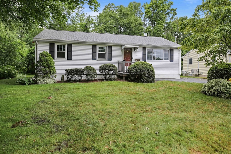
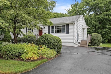
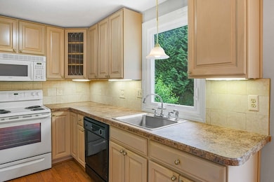
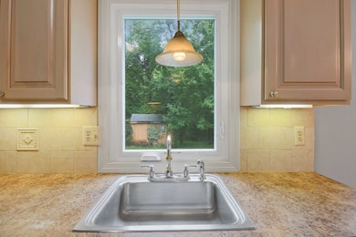
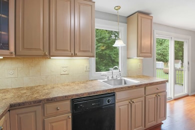

Welcome to this charming and easy to maintain 3BR,1Bath Ranch in Worcester’s sought-after 01605 neighborhood! With 1000+ sq ft of properly laid out living space, this home is ideal for first-time buyers looking to stop renting or those looking to downsize without compromising comfort or convenience.Enjoy peace of mind with recent updates including-brand new roof, newer refrigerator, fully insulated, & recently updated electrical system. The partially finished basement offers great flexibility to expand your living space over time, setup a hobby area, or consider creating a future in-law suite/ADU (AccessoryDwellingUnit).Low-maintenance, professionally landscaped, and easy to care for; this home offers all the essentials in a convenient location. This quiet neighborhood is close to shopping, parks, Indian Lake, highway access, and the newly constructed Nelson Place Elementary School. Why rent or manage morehouse than you need? Come see the smart, simple choice—and make it yours!
| Date | Type | Sale Price | Title Company |
|---|---|---|---|
| Quit Claim Deed | $415,000 | -- | |
| Deed | $415,000 | -- | |
| Deed | $104,000 | -- | |
| Deed | $104,000 | -- | |
| Deed | $127,500 | -- |
| Date | Status | Loan Amount | Loan Type |
|---|---|---|---|
| Open | $290,500 | New Conventional | |
| Closed | $290,500 | New Conventional | |
| Previous Owner | $98,000 | No Value Available | |
| Previous Owner | $98,800 | Purchase Money Mortgage |
| Date | Event | Price | List to Sale | Price per Sq Ft |
|---|---|---|---|---|
| 08/12/2025 08/12/25 | Sold | $415,000 | 0.0% | $412 / Sq Ft |
| 07/15/2025 07/15/25 | Pending | -- | -- | -- |
| 07/11/2025 07/11/25 | For Sale | $415,000 | -- | $412 / Sq Ft |
| Year | Tax Paid | Tax Assessment Tax Assessment Total Assessment is a certain percentage of the fair market value that is determined by local assessors to be the total taxable value of land and additions on the property. | Land | Improvement |
|---|---|---|---|---|
| 2025 | $4,841 | $367,000 | $122,300 | $244,700 |
| 2024 | $4,744 | $345,000 | $122,300 | $222,700 |
| 2023 | $4,640 | $323,600 | $105,300 | $218,300 |
| 2022 | $4,105 | $269,900 | $84,200 | $185,700 |
| 2021 | $3,946 | $242,400 | $67,400 | $175,000 |
| 2020 | $3,788 | $222,800 | $67,200 | $155,600 |
| 2019 | $3,632 | $201,800 | $64,700 | $137,100 |
| 2018 | $3,530 | $186,700 | $64,700 | $122,000 |
| 2017 | $3,565 | $185,500 | $64,700 | $120,800 |
| 2016 | $3,551 | $172,300 | $52,300 | $120,000 |
| 2015 | $3,458 | $172,300 | $52,300 | $120,000 |
| 2014 | $3,341 | $171,000 | $52,300 | $118,700 |
D
Seller's Agent in 2025
Dan Foley
BA Property & Lifestyle Advisors
(774) 230-6671
1 in this area
26 Total Sales

Buyer's Agent in 2025
Gordon Richards
Vezuli Realty Group, LLC
2 in this area
9 Total Sales
Source: MLS Property Information Network (MLS PIN)
MLS Number: 73403383
APN: WORC-000021-000005-000002C
Disclaimer: Certain information contained herein is derived from information provided by parties other than Homes.com. All information provided is deemed reliable, but is not guaranteed to be accurate and should be independently verified.
![]() The property listing data and information, or the Images, set forth herein were provided to MLS Property Information Network, Inc. from third party sources, including sellers, lessors and public records, and were compiled by MLS Property Information Network, Inc. The property listing data and information, and the Images, are for the personal, non-commercial use of consumers having a good faith interest in purchasing or leasing listed properties of the type displayed to them and may not be used for any purpose other than to identify prospective properties which such consumers may have a good faith interest in purchasing or leasing. MLS Property Information Network, Inc. and its subscribers disclaim any and all representations and warranties as to the accuracy of the property listing data and information, or as to the accuracy of any of the Images, set forth herein.
The property listing data and information, or the Images, set forth herein were provided to MLS Property Information Network, Inc. from third party sources, including sellers, lessors and public records, and were compiled by MLS Property Information Network, Inc. The property listing data and information, and the Images, are for the personal, non-commercial use of consumers having a good faith interest in purchasing or leasing listed properties of the type displayed to them and may not be used for any purpose other than to identify prospective properties which such consumers may have a good faith interest in purchasing or leasing. MLS Property Information Network, Inc. and its subscribers disclaim any and all representations and warranties as to the accuracy of the property listing data and information, or as to the accuracy of any of the Images, set forth herein.
Ask me questions while you tour the home.