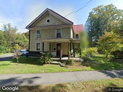
47 Triangle St Amherst, MA 01002
Amherst NeighborhoodEstimated Value: $527,398 - $630,000
6
Beds
3
Baths
2,630
Sq Ft
$223/Sq Ft
Est. Value
About This Home
This home is located at 47 Triangle St, Amherst, MA 01002 and is currently estimated at $586,100, approximately $222 per square foot. 47 Triangle St is a home located in Hampshire County with nearby schools including Wildwood Elementary School, Amherst Regional Middle School, and Amherst Regional High School.
Ownership History
Date
Name
Owned For
Owner Type
Purchase Details
Closed on
Jul 8, 2004
Sold by
Desherbinin Michael J
Bought by
Emmart Niall D and Emmart Sunitha K
Current Estimated Value
Home Financials for this Owner
Home Financials are based on the most recent Mortgage that was taken out on this home.
Original Mortgage
$250,000
Interest Rate
6.32%
Mortgage Type
Purchase Money Mortgage
Create a Home Valuation Report for This Property
The Home Valuation Report is an in-depth analysis detailing your home's value as well as a comparison with similar homes in the area
Home Values in the Area
Average Home Value in this Area
Purchase History
| Date | Buyer | Sale Price | Title Company |
|---|---|---|---|
| Emmart Niall D | $351,310 | -- |
Source: Public Records
Mortgage History
| Date | Status | Borrower | Loan Amount |
|---|---|---|---|
| Open | Desherbinin Michael J | $237,630 | |
| Closed | Emmart Niall D | $100,000 | |
| Closed | Desherbinin Michael J | $256,000 | |
| Closed | Desherbinin Michael J | $250,000 | |
| Previous Owner | Desherbinin Michael J | $230,000 |
Source: Public Records
Tax History Compared to Growth
Tax History
| Year | Tax Paid | Tax Assessment Tax Assessment Total Assessment is a certain percentage of the fair market value that is determined by local assessors to be the total taxable value of land and additions on the property. | Land | Improvement |
|---|---|---|---|---|
| 2025 | $67 | $371,700 | $202,600 | $169,100 |
| 2024 | $6,490 | $350,600 | $191,100 | $159,500 |
| 2023 | $6,241 | $310,500 | $173,700 | $136,800 |
| 2022 | $5,915 | $278,100 | $158,000 | $120,100 |
| 2021 | $8,460 | $387,700 | $146,400 | $241,300 |
| 2020 | $8,266 | $387,700 | $146,400 | $241,300 |
| 2019 | $8,007 | $367,300 | $146,400 | $220,900 |
| 2018 | $7,765 | $367,300 | $146,400 | $220,900 |
| 2017 | $7,811 | $357,800 | $139,400 | $218,400 |
| 2016 | $7,593 | $357,800 | $139,400 | $218,400 |
| 2015 | $6,579 | $320,300 | $139,400 | $180,900 |
Source: Public Records
Map
Nearby Homes
- 21 Sunrise Ave
- 14 Smith St
- 0 Red Gate Ln Unit 73348273
- 155 Amity St
- 60 Red Gate Ln
- 242 Lincoln Ave
- 30 Blue Hills Rd
- 232 N East St Unit 12
- 28 Brigham Ln
- 53 Amity Place
- 56 Memorial Dr
- 25 Greenleaves Dr Unit 520
- 26 Greenleaves Dr Unit 619
- 12 Chadwick Ct
- 33 Echo Hill Rd
- 101 Cherry Ln
- 12 Sutton Ct
- 78 Aubinwood Rd
- 171 Aubinwood Rd
- 252 West St Unit 16