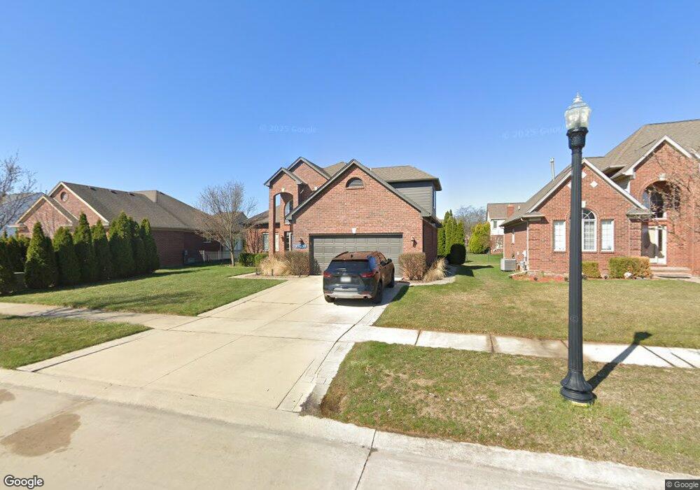
47083 Gloede Rd Macomb, MI 48044
Estimated Value: $414,161 - $496,000
3
Beds
3
Baths
1,910
Sq Ft
$243/Sq Ft
Est. Value
About This Home
This home is located at 47083 Gloede Rd, Macomb, MI 48044 and is currently estimated at $464,290, approximately $243 per square foot. 47083 Gloede Rd is a home located in Macomb County with nearby schools including Floyd Ebeling Elementary School, Bemis Junior High School, and Henry Ford II High School.
Ownership History
Date
Name
Owned For
Owner Type
Purchase Details
Closed on
Nov 27, 2013
Sold by
Hansen Bradley J and Mykietiuk Melissa A
Bought by
Hansen Bradley J and Hansen Melissa A
Current Estimated Value
Home Financials for this Owner
Home Financials are based on the most recent Mortgage that was taken out on this home.
Original Mortgage
$192,000
Outstanding Balance
$98,437
Interest Rate
4.1%
Mortgage Type
New Conventional
Estimated Equity
$365,853
Purchase Details
Closed on
Sep 16, 2009
Sold by
S E Michigan Development Llc
Bought by
Hansen Bradley J and Mykietiuk Melissa A
Purchase Details
Closed on
May 18, 2009
Sold by
Gloede Park Estate Llc
Bought by
S E Michigan Development Llc
Create a Home Valuation Report for This Property
The Home Valuation Report is an in-depth analysis detailing your home's value as well as a comparison with similar homes in the area
Home Values in the Area
Average Home Value in this Area
Purchase History
| Date | Buyer | Sale Price | Title Company |
|---|---|---|---|
| Hansen Bradley J | -- | Abstract Title Agency | |
| Hansen Bradley J | $205,000 | None Available | |
| S E Michigan Development Llc | -- | None Available |
Source: Public Records
Mortgage History
| Date | Status | Borrower | Loan Amount |
|---|---|---|---|
| Open | Hansen Bradley J | $192,000 |
Source: Public Records
Tax History Compared to Growth
Tax History
| Year | Tax Paid | Tax Assessment Tax Assessment Total Assessment is a certain percentage of the fair market value that is determined by local assessors to be the total taxable value of land and additions on the property. | Land | Improvement |
|---|---|---|---|---|
| 2025 | $4,737 | $205,700 | $0 | $0 |
| 2024 | $2,722 | $199,600 | $0 | $0 |
| 2023 | $2,578 | $182,400 | $0 | $0 |
| 2022 | $4,112 | $164,000 | $0 | $0 |
| 2021 | $3,701 | $154,500 | $0 | $0 |
| 2020 | $2,373 | $151,300 | $0 | $0 |
| 2019 | $3,238 | $140,300 | $0 | $0 |
| 2018 | $3,192 | $135,500 | $0 | $0 |
| 2017 | $3,150 | $130,710 | $32,500 | $98,210 |
| 2016 | $2,968 | $130,710 | $0 | $0 |
| 2015 | $2,933 | $121,360 | $0 | $0 |
| 2014 | $2,933 | $110,860 | $21,500 | $89,360 |
| 2013 | $5,643 | $110,860 | $0 | $0 |
Source: Public Records
Map
Nearby Homes
- 46966 Mckenna Dr
- 47340 Chrys Rd
- 16230 21 Mile Rd
- 47165 Susan Rd
- 46980 Country Ln Unit 8
- 16729 White Plains Dr
- 16282 Sassafras Ln
- 47687 Tilch Rd
- 16115 Nathan Dr
- 16170 Musket Dr
- 46421 Imperial Ln
- 15613 Valerie Dr
- 16498 Norfolk Dr Unit 320
- 46101 Allenton Dr
- 17115 Scarborough Dr
- 46969 Fox Run Dr
- 46257 Cavalier Dr
- 17609 21 Mile Rd
- 46721 Barbara Dr
- 17338 Tower Dr
- 47115 Gloede Rd
- 47051 Gloede Rd
- 47110 Liberty Bell Rd E
- 47147 Gloede Rd
- 47130 Liberty Bell Rd E
- 47090 Liberty Bell Rd E
- 47035 Gloede Rd
- 47150 Liberty Bell Rd E
- 47070 Liberty Bell Rd E
- 47179 Gloede Rd
- 47050 Liberty Bell Rd E
- 47170 Liberty Bell Rd E
- 47211 Gloede Rd
- 47030 Liberty Bell Rd E
- 47125 Liberty Bell Rd E
- 47105 Liberty Bell Rd E
- 47145 Liberty Bell Rd E
- 16367 Liberty Bell Rd N
- 47085 Liberty Bell Rd E
- 47243 Gloede Rd