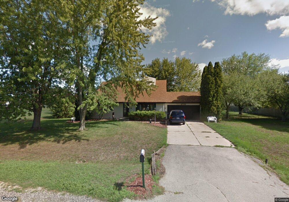
4738 Crown Point Rd Roscoe, IL 61073
Estimated Value: $191,000 - $281,000
3
Beds
2
Baths
1,064
Sq Ft
$230/Sq Ft
Est. Value
About This Home
This home is located at 4738 Crown Point Rd, Roscoe, IL 61073 and is currently estimated at $244,930, approximately $230 per square foot. 4738 Crown Point Rd is a home located in Winnebago County with nearby schools including Ledgewood Elementary School, Kinnikinnick School, and Stone Creek School.
Ownership History
Date
Name
Owned For
Owner Type
Purchase Details
Closed on
Mar 25, 2022
Sold by
Luther John L and Luther Joan B
Bought by
Neyer Neal F and Neyer Jane M
Current Estimated Value
Home Financials for this Owner
Home Financials are based on the most recent Mortgage that was taken out on this home.
Original Mortgage
$68,000
Outstanding Balance
$63,881
Interest Rate
4.42%
Mortgage Type
New Conventional
Estimated Equity
$181,049
Purchase Details
Closed on
Jan 11, 1994
Bought by
Luther John L and Luther Joan
Create a Home Valuation Report for This Property
The Home Valuation Report is an in-depth analysis detailing your home's value as well as a comparison with similar homes in the area
Home Values in the Area
Average Home Value in this Area
Purchase History
| Date | Buyer | Sale Price | Title Company |
|---|---|---|---|
| Neyer Neal F | $85,000 | None Listed On Document | |
| Luther John L | $50,900 | -- |
Source: Public Records
Mortgage History
| Date | Status | Borrower | Loan Amount |
|---|---|---|---|
| Open | Neyer Neal F | $68,000 |
Source: Public Records
Tax History
| Year | Tax Paid | Tax Assessment Tax Assessment Total Assessment is a certain percentage of the fair market value that is determined by local assessors to be the total taxable value of land and additions on the property. | Land | Improvement |
|---|---|---|---|---|
| 2024 | $5,108 | $61,936 | $12,654 | $49,282 |
| 2023 | $4,778 | $55,583 | $11,356 | $44,227 |
| 2022 | $4,585 | $50,812 | $10,381 | $40,431 |
| 2021 | $4,400 | $47,733 | $9,752 | $37,981 |
| 2020 | $4,330 | $45,999 | $9,398 | $36,601 |
| 2019 | $4,230 | $43,938 | $8,977 | $34,961 |
| 2018 | $4,016 | $42,220 | $8,626 | $33,594 |
| 2017 | $4,131 | $40,722 | $8,320 | $32,402 |
| 2016 | $3,968 | $40,069 | $8,187 | $31,882 |
| 2015 | $3,812 | $38,924 | $7,953 | $30,971 |
| 2014 | $3,511 | $38,432 | $7,852 | $30,580 |
Source: Public Records
Map
Nearby Homes
- 11748 Cedarbrook Rd
- 11578 Edgemere Terrace
- 9.41 Acres Bluestem Rd
- 4361 Pfister Ln
- 10458 Main St
- 5683 Oak Village Dr Unit 5683
- 11062 Chicory Ridge Way
- 10662 Chicory Ridge Way
- 10853 Lemon Grass Ln
- 0000 Joncey Dr
- 12227 Joncey Dr
- 410 Pine White #102-B Rd
- 664 Elberon Way
- 4753 Edenberry Ln
- 10138 Monarch Rd
- 10138 Monarch Rd Unit 4
- 638 Merrion Rd
- 11870 River Hills Pkwy Unit 29
- 13280 Huntington Chase
- 1245 Aldrin Rd
- 4782 Crown Point Rd
- 11541 Cedarbrook Rd
- 11515 Cedarbrook Rd
- 11569 Cedarbrook Rd
- 4794 Crown Point Rd
- 4794 Crown Point Cir
- 4830 Crown Point Rd
- 4745 Crown Point Rd
- 4727 Crown Point Rd
- 4763 Crown Point Rd
- 4719 Crown Point Rd
- 4779 Crown Point Rd
- 4802 Crown Point Cir
- 4818 Crown Point Rd
- 11463 Cedarbrook Rd
- 4803 Crown Point Rd
- 4670 Wild Deer Ct
- 11536 Cedarbrook Rd
- 11554 Cedarbrook Rd
- 4817 Rollingsford Ln