4755 Winghaven Dr Waterloo, IA 50701
Audubon NeighborhoodEstimated payment $2,886/month
Highlights
- Very Popular Property
- Laundry Room
- Ceiling Fan
- Deck
- Central Air
- Gas Fireplace
About This Home
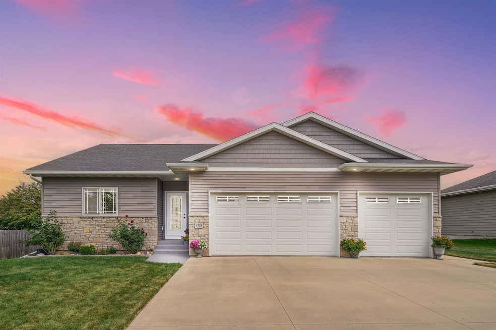
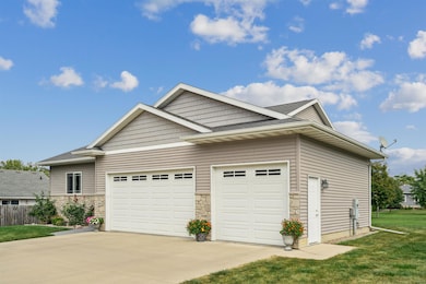
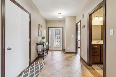
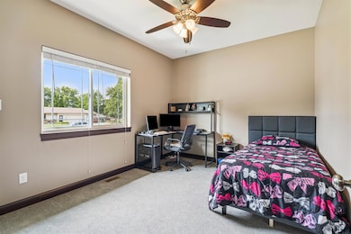
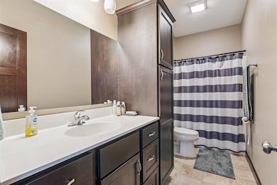
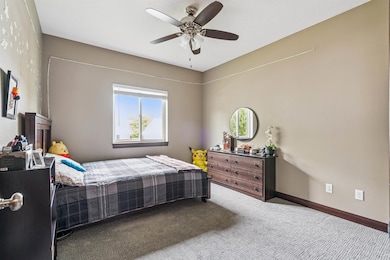
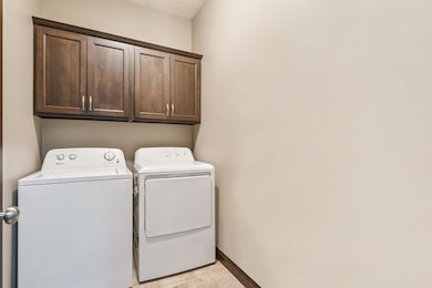
Welcome home! This 4-bedroom, 2-bath home with a 3-stall garage offers comfort, function, and a layout designed for everyday living. As you step inside, you’re greeted by a welcoming foyer with two bedrooms just off to the side and a convenient main-floor laundry room. Continue toward the back of the home, where you’ll find a cozy living room featuring a gas fireplace — the perfect spot to unwind. The open kitchen is equipped with newer appliances and flows seamlessly into the dining space, creating an inviting area for gatherings. Step right out to the deck and backyard to extend your entertaining outdoors. The primary suite is tucked off the living room and features a walk-in closet and private bath with a walk-in shower. Downstairs, you’ll find a spacious family room and an additional bedroom, with an unfinished area offering plenty of flexibility for storage, a workout zone, or future expansion. Located in a desirable, established Waterloo neighborhood, this home keeps you close to Highway 20 and 63, golf courses, trails, and the Lost Island Waterpark and Themepark. A home that’s truly ready for you to move right in and start making memories.
Home Details
Home Type
- Single Family
Est. Annual Taxes
- $6,898
Year Built
- Built in 2014
Lot Details
- 0.27 Acre Lot
- Lot Dimensions are 85x140
Parking
- 3 Car Garage
Home Design
- Shingle Roof
- Vinyl Siding
Interior Spaces
- 2,393 Sq Ft Home
- Ceiling Fan
- Gas Fireplace
- Partially Finished Basement
- Sump Pump
- Fire and Smoke Detector
Kitchen
- Built-In Oven
- Built-In Microwave
- Dishwasher
- Disposal
Bedrooms and Bathrooms
- 4 Bedrooms
- 2 Full Bathrooms
Laundry
- Laundry Room
- Laundry on main level
- Dryer
- Washer
Schools
- Orange Elementary School
- Hoover Intermediate
- West High School
Additional Features
- Deck
- Central Air
Community Details
- Klingaman Park Third Addition Subdivision
Listing and Financial Details
- Assessor Parcel Number 881307476040
Map
Home Values in the Area
Average Home Value in this Area
Tax History
| Year | Tax Paid | Tax Assessment Tax Assessment Total Assessment is a certain percentage of the fair market value that is determined by local assessors to be the total taxable value of land and additions on the property. | Land | Improvement |
|---|---|---|---|---|
| 2025 | $6,898 | $368,080 | $48,880 | $319,200 |
| 2024 | $6,898 | $328,180 | $48,880 | $279,300 |
| 2023 | $5,874 | $328,180 | $48,880 | $279,300 |
| 2022 | $5,718 | $276,360 | $48,880 | $227,480 |
| 2021 | $5,914 | $276,360 | $48,880 | $227,480 |
| 2020 | $5,814 | $269,700 | $36,130 | $233,570 |
| 2019 | $5,814 | $269,700 | $36,130 | $233,570 |
| 2018 | $612 | $269,700 | $36,130 | $233,570 |
| 2017 | $634 | $249,390 | $36,130 | $213,260 |
| 2016 | $622 | $249,390 | $36,130 | $213,260 |
| 2015 | $622 | $249,390 | $36,130 | $213,260 |
| 2014 | $752 | $32,510 | $32,510 | $0 |
Property History
| Date | Event | Price | List to Sale | Price per Sq Ft |
|---|---|---|---|---|
| 12/30/2025 12/30/25 | Price Changed | $445,000 | -0.7% | $186 / Sq Ft |
| 10/29/2025 10/29/25 | For Sale | $448,000 | -- | $187 / Sq Ft |
Purchase History
| Date | Type | Sale Price | Title Company |
|---|---|---|---|
| Warranty Deed | $260,500 | None Available | |
| Warranty Deed | $260,000 | None Available | |
| Warranty Deed | $37,000 | None Available |
About the Listing Agent
Hermina's Other Listings
Source: Northeast Iowa Regional Board of REALTORS®
MLS Number: NBR20255322
APN: 8813-07-476-040
- 4750 Winghaven Dr
- 1944 Kitty Hawk Dr
- 2108 Josie Ridge Unit RG
- 125 Sunbird Ct
- 135 Sunbird Ct
- 1553 Audubon Dr
- 2107 Cassi Ridge Unit RG
- 1464 Audubon Dr
- 1416 Partridge Ln
- 122 Goldcrest Ct
- 128 Goldcrest Ct
- 118 Aidin Way
- 2220 Sky Line Dr Unit 7
- 2327 Sky Line Dr
- Lot 11 Red Tail Dr
- Lot 2 Red Tail Dr
- Lot 1 Red Tail Dr
- Lot 15 Red Tail Dr
- Lot 16 Red Tail Dr
- 122 Kestrel Cir
- 1867 Pinehurst Ct
- 3855 Pineview Place
- 765-791 Russell Rd
- 733-747 Russell Rd
- 1105-1110 Kent Cir
- 425 Colby Rd
- 2787 Crestline Ave
- 402 Fast Ln
- 3322 Tropic Ln
- 1150 Home Park Blvd
- 3666 Ravenwood Cir
- 3714 Ravenwood Cir
- 301-313 Springfield Ave
- 1050 Flammang Dr
- 100 Tunis Cir
- 6025 Donegal Cir
- 1003 Bluegrass Cir
- 825 Bluegrass
- 1008-1024 Leavitt St
- 804 Hanna Blvd
