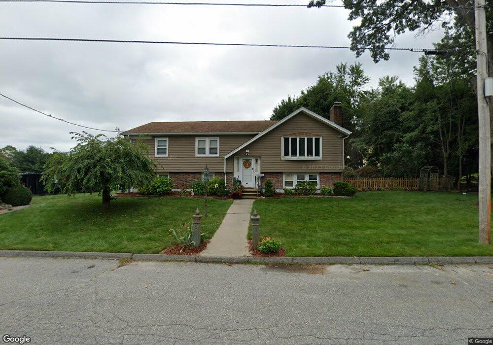
48 Hapgood Rd Worcester, MA 01605
Forest Grove NeighborhoodEstimated Value: $502,000 - $567,000
4
Beds
2
Baths
1,386
Sq Ft
$393/Sq Ft
Est. Value
About This Home
This home is located at 48 Hapgood Rd, Worcester, MA 01605 and is currently estimated at $544,395, approximately $392 per square foot. 48 Hapgood Rd is a home located in Worcester County with nearby schools including Nelson Place Elementary School, Jacob Hiatt Magnet School, and Chandler Magnet.
Create a Home Valuation Report for This Property
The Home Valuation Report is an in-depth analysis detailing your home's value as well as a comparison with similar homes in the area
Home Values in the Area
Average Home Value in this Area
Tax History
| Year | Tax Paid | Tax Assessment Tax Assessment Total Assessment is a certain percentage of the fair market value that is determined by local assessors to be the total taxable value of land and additions on the property. | Land | Improvement |
|---|---|---|---|---|
| 2025 | $6,964 | $528,000 | $123,700 | $404,300 |
| 2024 | $6,696 | $487,000 | $123,700 | $363,300 |
| 2023 | $6,261 | $436,600 | $106,500 | $330,100 |
| 2022 | $6,049 | $397,700 | $85,200 | $312,500 |
| 2021 | $5,454 | $335,000 | $68,200 | $266,800 |
| 2020 | $5,137 | $302,200 | $68,000 | $234,200 |
| 2019 | $5,384 | $299,100 | $65,600 | $233,500 |
| 2018 | $5,291 | $279,800 | $65,600 | $214,200 |
| 2017 | $5,034 | $261,900 | $65,600 | $196,300 |
| 2016 | $5,078 | $246,400 | $54,100 | $192,300 |
| 2015 | $4,945 | $246,400 | $54,100 | $192,300 |
| 2014 | $4,783 | $244,800 | $54,100 | $190,700 |
Source: Public Records
Map
Nearby Homes
Your Personal Tour Guide
Ask me questions while you tour the home.