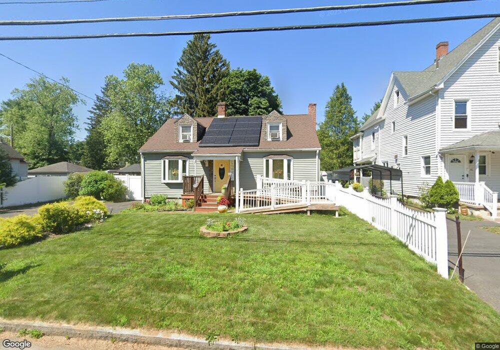
48 Merrill Rd Unit 1 Springfield, MA 01119
Boston Road NeighborhoodEstimated Value: $322,924 - $345,000
4
Beds
1
Bath
1,651
Sq Ft
$201/Sq Ft
Est. Value
About This Home
This home is located at 48 Merrill Rd Unit 1, Springfield, MA 01119 and is currently estimated at $332,481, approximately $201 per square foot. 48 Merrill Rd Unit 1 is a home located in Hampden County with nearby schools including Warner, M Marcus Kiley Middle, and Roger L. Putnam Vocational Technical Academy.
Ownership History
Date
Name
Owned For
Owner Type
Purchase Details
Closed on
May 6, 2021
Sold by
Moise Marjorie
Bought by
Bailey Maxine and Bailey Steve
Current Estimated Value
Home Financials for this Owner
Home Financials are based on the most recent Mortgage that was taken out on this home.
Original Mortgage
$242,525
Outstanding Balance
$219,788
Interest Rate
3.1%
Mortgage Type
FHA
Estimated Equity
$112,693
Create a Home Valuation Report for This Property
The Home Valuation Report is an in-depth analysis detailing your home's value as well as a comparison with similar homes in the area
Home Values in the Area
Average Home Value in this Area
Purchase History
| Date | Buyer | Sale Price | Title Company |
|---|---|---|---|
| Bailey Maxine | $246,999 | None Available |
Source: Public Records
Mortgage History
| Date | Status | Borrower | Loan Amount |
|---|---|---|---|
| Open | Bailey Maxine | $242,525 |
Source: Public Records
Tax History
| Year | Tax Paid | Tax Assessment Tax Assessment Total Assessment is a certain percentage of the fair market value that is determined by local assessors to be the total taxable value of land and additions on the property. | Land | Improvement |
|---|---|---|---|---|
| 2025 | $4,627 | $295,100 | $43,000 | $252,100 |
| 2024 | $4,304 | $268,000 | $40,200 | $227,800 |
| 2023 | $4,426 | $259,600 | $38,300 | $221,300 |
| 2022 | $4,076 | $216,600 | $38,300 | $178,300 |
| 2021 | $3,281 | $173,600 | $34,800 | $138,800 |
| 2020 | $3,117 | $159,600 | $34,800 | $124,800 |
| 2019 | $3,137 | $159,400 | $34,800 | $124,600 |
| 2018 | $2,758 | $152,200 | $34,800 | $117,400 |
| 2017 | $2,758 | $140,300 | $34,800 | $105,500 |
| 2016 | $2,786 | $141,700 | $34,800 | $106,900 |
| 2015 | $2,510 | $127,600 | $34,800 | $92,800 |
Source: Public Records
Map
Nearby Homes
- 48 Merrill Rd
- 44 Merrill Rd
- 60 Merrill Rd
- 59 Jamaica St
- 34 Merrill Rd
- 43 Merrill Rd
- 53 Merrill Rd
- 0 (ws) Jamaica St
- Lot: 58 Jamaica Street (Ws)
- 39 Merrill Rd
- 59 Merrill Rd
- 28 Merrill Rd
- 33 Merrill Rd
- 70 Merrill Rd
- 71 Jamaica St
- 29 Merrill Rd
- 24 Merrill Rd
- 48 Wrentham Rd Unit 50
- 48-50 Wrentham Rd
- 42 Wrentham Rd Unit 44
Your Personal Tour Guide
Ask me questions while you tour the home.