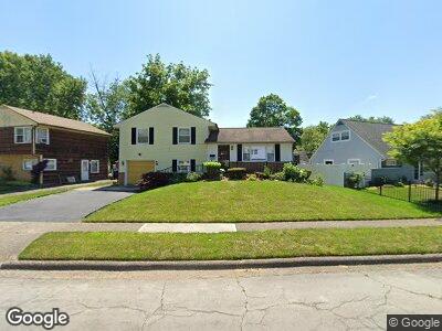
4825 Calvin Dr Columbus, OH 43227
Shady Lane NeighborhoodEstimated Value: $182,000 - $215,000
3
Beds
2
Baths
1,104
Sq Ft
$181/Sq Ft
Est. Value
About This Home
This home is located at 4825 Calvin Dr, Columbus, OH 43227 and is currently estimated at $199,697, approximately $180 per square foot. 4825 Calvin Dr is a home located in Franklin County with nearby schools including Shady Lane Elementary School, Sherwood Middle School, and Walnut Ridge High School.
Ownership History
Date
Name
Owned For
Owner Type
Purchase Details
Closed on
Nov 8, 1995
Sold by
Zook Arthur L
Bought by
Sarah L Whipple
Current Estimated Value
Home Financials for this Owner
Home Financials are based on the most recent Mortgage that was taken out on this home.
Original Mortgage
$77,300
Outstanding Balance
$4,284
Interest Rate
7.7%
Mortgage Type
New Conventional
Estimated Equity
$196,690
Purchase Details
Closed on
May 1, 1983
Create a Home Valuation Report for This Property
The Home Valuation Report is an in-depth analysis detailing your home's value as well as a comparison with similar homes in the area
Home Values in the Area
Average Home Value in this Area
Purchase History
| Date | Buyer | Sale Price | Title Company |
|---|---|---|---|
| Sarah L Whipple | $77,900 | -- | |
| -- | $45,000 | -- |
Source: Public Records
Mortgage History
| Date | Status | Borrower | Loan Amount |
|---|---|---|---|
| Open | Norris Michael L | $25,000 | |
| Closed | Whipple Sarah L | $13,000 | |
| Open | Sarah L Whipple | $77,300 |
Source: Public Records
Tax History Compared to Growth
Tax History
| Year | Tax Paid | Tax Assessment Tax Assessment Total Assessment is a certain percentage of the fair market value that is determined by local assessors to be the total taxable value of land and additions on the property. | Land | Improvement |
|---|---|---|---|---|
| 2024 | $2,300 | $61,040 | $17,290 | $43,750 |
| 2023 | $2,298 | $61,040 | $17,290 | $43,750 |
| 2022 | $1,155 | $31,020 | $6,480 | $24,540 |
| 2021 | $1,157 | $31,020 | $6,480 | $24,540 |
| 2020 | $1,159 | $31,020 | $6,480 | $24,540 |
| 2019 | $954 | $24,470 | $5,180 | $19,290 |
| 2018 | $982 | $24,470 | $5,180 | $19,290 |
| 2017 | $1,034 | $24,470 | $5,180 | $19,290 |
| 2016 | $1,116 | $25,590 | $5,640 | $19,950 |
| 2015 | $1,013 | $25,590 | $5,640 | $19,950 |
| 2014 | $1,015 | $25,590 | $5,640 | $19,950 |
| 2013 | $635 | $30,100 | $6,615 | $23,485 |
Source: Public Records
Map
Nearby Homes
- 4838 Calvin Dr
- 1494 Country Club Rd
- 4814 E Livingston Ave
- 1519 Country Club Rd
- 4685 E Livingston Ave
- 1308 Lancelot Rd
- 1477 Shady Lane Rd
- 1294 Lancelot Rd
- 1359 Gertrude Dr
- 4656 Dundee Ave
- 1660 Shady Lane Rd
- 4538 Grimsby Rd
- 5072 Teddy Dr
- 4502 Aragon Ave
- 4530 Amesbury Rd
- 4665 Healy Dr
- 1573 Baxter Dr
- 4620 Boynton Place
- 4467 Grimsby Rd
- 4991 Justin Rd
- 4825 Calvin Dr
- 4821 Calvin Dr
- 4831 Calvin Dr
- 4841 Calvin Dr
- 1497 Blaine Dr
- 1499 Blaine Dr
- 4818 Calvin Dr
- 4824 Calvin Dr
- 4849 Calvin Dr
- 4814 Calvin Dr
- 4830 Calvin Dr
- 4817 Calvin Dr
- 4828 Dickens Dr
- 1493 Blaine Dr
- 4812 Calvin Dr
- 4838 Dickens Dr
- 4836 Calvin Dr
- 4859 Calvin Dr
- 1456 Country Club Rd
- 4810 Calvin Dr