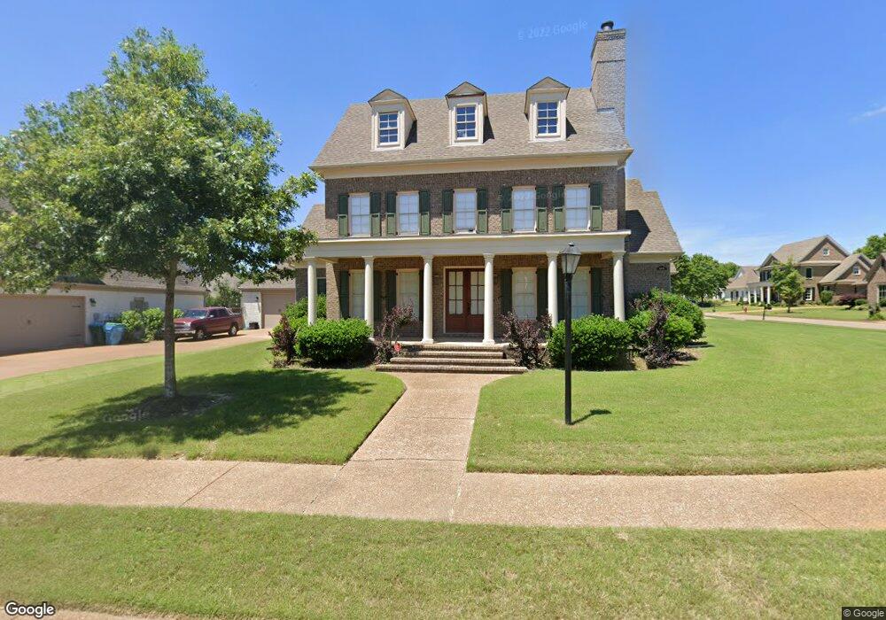
4871 Delbridge Ct E Olive Branch, MS 38654
Pleasant Hill NeighborhoodEstimated Value: $465,307 - $566,000
4
Beds
3
Baths
3,000
Sq Ft
$170/Sq Ft
Est. Value
About This Home
This home is located at 4871 Delbridge Ct E, Olive Branch, MS 38654 and is currently estimated at $508,827, approximately $169 per square foot. 4871 Delbridge Ct E is a home located in DeSoto County with nearby schools including Pleasant Hill Elementary School, DeSoto Central Middle School, and DeSoto Central High School.
Ownership History
Date
Name
Owned For
Owner Type
Purchase Details
Closed on
May 19, 2010
Sold by
Sycamore Bank
Bought by
Morgan Verlindama S
Current Estimated Value
Home Financials for this Owner
Home Financials are based on the most recent Mortgage that was taken out on this home.
Original Mortgage
$245,000
Interest Rate
5.02%
Mortgage Type
Future Advance Clause Open End Mortgage
Create a Home Valuation Report for This Property
The Home Valuation Report is an in-depth analysis detailing your home's value as well as a comparison with similar homes in the area
Home Values in the Area
Average Home Value in this Area
Purchase History
| Date | Buyer | Sale Price | Title Company |
|---|---|---|---|
| Morgan Verlindama S | -- | None Available |
Source: Public Records
Mortgage History
| Date | Status | Borrower | Loan Amount |
|---|---|---|---|
| Closed | Morgan Verlindama S | $245,000 |
Source: Public Records
Tax History
| Year | Tax Paid | Tax Assessment Tax Assessment Total Assessment is a certain percentage of the fair market value that is determined by local assessors to be the total taxable value of land and additions on the property. | Land | Improvement |
|---|---|---|---|---|
| 2025 | $2,219 | $26,667 | $4,600 | $22,067 |
| 2024 | $2,616 | $26,667 | $4,600 | $22,067 |
| 2023 | $2,616 | $26,667 | $0 | $0 |
| 2022 | $2,616 | $26,667 | $4,600 | $22,067 |
| 2021 | $2,616 | $26,667 | $4,600 | $22,067 |
| 2020 | $1,916 | $26,667 | $4,600 | $22,067 |
| 2019 | $1,916 | $26,667 | $4,600 | $22,067 |
| 2017 | $1,892 | $47,978 | $26,289 | $21,689 |
| 2016 | $2,086 | $28,217 | $4,600 | $23,617 |
| 2015 | $2,841 | $51,834 | $28,217 | $23,617 |
| 2014 | $2,086 | $28,217 | $0 | $0 |
| 2013 | $3,266 | $28,217 | $0 | $0 |
Source: Public Records
Map
Nearby Homes
- 4209 S Bolivar Trail
- 4223 S Bolivar Trail
- 4743 Bolivar Trail N
- 4285 S Bolivar Trail
- 4291 S Bolivar Trail
- 4338 S Bolivar Trail
- 4183 Robinson Crossing
- 5137 Meadow Pointe Dr
- 4435 Parish Row
- 4426 Macon Cove
- 5162 Kensley Ct
- 4245 Lundy Bend W
- 5518 Bunyan Hill Dr
- 3310 Forest Bend Dr
- 5035 Wethersfield Blvd
- 5085 Savannah Pkwy
- 4087 Jessica Dr
- 4481 Summers Place Dr
- 4703 W Dublin
- 5540 Pinetree Loop E
- 4853 Delbridge Ct E
- 4866 Delbridge Ct E
- 4140 Delbridge Ct N
- 4120 Delbridge Ct N
- 4840 Delbridge Ct E
- 26 Delbridge Ct
- 4156 Delbridge Ct N
- 4106 Delbridge Ct W
- 4106 Delbridge Ct N
- 4852 Delbridge Ct W
- 4878 Delbridge Ct E
- 4890 Delbridge Ct E
- 4890 Delbridge Ct
- 4827 Delbridge Ct E
- 4870 Delbridge Ct W
- 4830 Delbridge Ct W
- 4828 Delbridge Ct W
- 4090 Delbridge Ct N
- 4839 Delbridge Ct W
- 4875 Delbridge Ct W
Your Personal Tour Guide
Ask me questions while you tour the home.