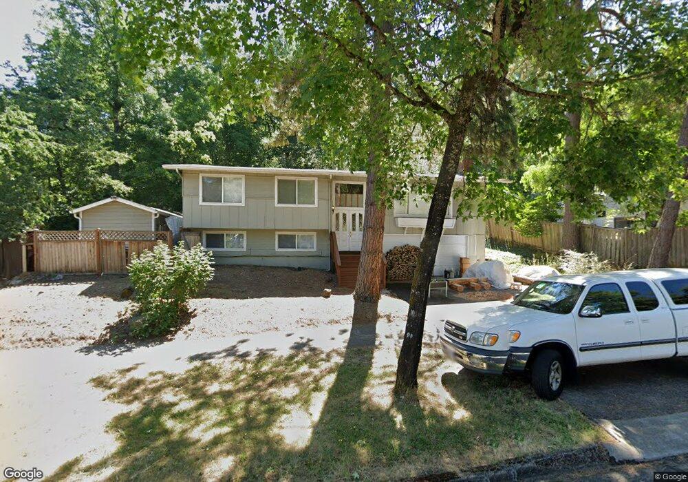
4881 Donald St Eugene, OR 97405
Southeast Eugene NeighborhoodEstimated Value: $533,000 - $564,000
4
Beds
2
Baths
1,868
Sq Ft
$291/Sq Ft
Est. Value
About This Home
This home is located at 4881 Donald St, Eugene, OR 97405 and is currently estimated at $542,947, approximately $290 per square foot. 4881 Donald St is a home located in Lane County with nearby schools including Edgewood Community Elementary School, Spencer Butte Middle School, and South Eugene High School.
Ownership History
Date
Name
Owned For
Owner Type
Purchase Details
Closed on
Aug 2, 2005
Sold by
Kestrel Co
Bought by
Morring David
Current Estimated Value
Home Financials for this Owner
Home Financials are based on the most recent Mortgage that was taken out on this home.
Original Mortgage
$212,000
Outstanding Balance
$108,532
Interest Rate
5.46%
Mortgage Type
Fannie Mae Freddie Mac
Estimated Equity
$434,415
Purchase Details
Closed on
Jan 19, 2005
Sold by
Blume Donald and Blume Elizabeth
Bought by
Kestrel Co
Create a Home Valuation Report for This Property
The Home Valuation Report is an in-depth analysis detailing your home's value as well as a comparison with similar homes in the area
Home Values in the Area
Average Home Value in this Area
Purchase History
| Date | Buyer | Sale Price | Title Company |
|---|---|---|---|
| Morring David | $265,000 | Evergreen Land Title Co | |
| Kestrel Co | $140,500 | -- |
Source: Public Records
Mortgage History
| Date | Status | Borrower | Loan Amount |
|---|---|---|---|
| Open | Morring David | $212,000 |
Source: Public Records
Tax History
| Year | Tax Paid | Tax Assessment Tax Assessment Total Assessment is a certain percentage of the fair market value that is determined by local assessors to be the total taxable value of land and additions on the property. | Land | Improvement |
|---|---|---|---|---|
| 2025 | $4,806 | $246,683 | -- | -- |
| 2024 | $4,747 | $239,499 | -- | -- |
| 2023 | $4,747 | $232,524 | $0 | $0 |
| 2022 | $4,447 | $225,752 | $0 | $0 |
| 2021 | $4,177 | $219,177 | $0 | $0 |
| 2020 | $4,191 | $212,794 | $0 | $0 |
| 2019 | $4,048 | $206,597 | $0 | $0 |
| 2018 | $3,810 | $194,738 | $0 | $0 |
| 2017 | $3,640 | $194,738 | $0 | $0 |
| 2016 | $3,549 | $189,066 | $0 | $0 |
| 2015 | $3,447 | $183,559 | $0 | $0 |
| 2014 | $3,378 | $178,213 | $0 | $0 |
Source: Public Records
Map
Nearby Homes
- 4734 Brookwood St
- 395 E 46th Ave
- 4845 Brookwood St
- 36 Westbrook Way
- 17 Westbrook Way
- 21 Westbrook Way
- 4295 Ferry St
- 4425 Hilyard St
- 278 Rockridge Ct
- 126 Treehill Loop Unit 126
- 143 Treehill Loop Unit 143
- 4023 Donald St Unit K
- 170 E 40th Ave
- 152 Treehill Loop Unit 152
- 151 Treehill Loop Unit 151
- 4680 W Hillside Dr
- 4429 Fox Hollow Rd Unit 3
- 4364 Fox Hollow Rd
- 434 E 39th Ave
- 4320 Fox Hollow Rd
- 4871 Donald St
- 4891 Donald St
- 4895 Donald St
- 4738 Brookwood St
- 4861 Donald St
- 4742 Brookwood St
- 4870 Donald St
- 4890 Donald St
- 4901 Donald St
- 4915 Donald St
- 4752 Brookwood St
- 4850 Donald St
- 4851 Donald St
- 4905 Donald St
- 4866 Donald St
- 365 E 49th Ave
- 4910 Donald St
- 4852 Donald St
- 4730 Brookwood St
- 4762 Brookwood St
Your Personal Tour Guide
Ask me questions while you tour the home.