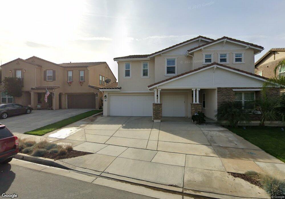
490 Citrus Union St Upland, CA 91784
Estimated Value: $1,141,810 - $1,247,000
3
Beds
3
Baths
3,356
Sq Ft
$355/Sq Ft
Est. Value
About This Home
This home is located at 490 Citrus Union St, Upland, CA 91784 and is currently estimated at $1,190,703, approximately $354 per square foot. 490 Citrus Union St is a home with nearby schools including Sierra Vista Elementary School, Pioneer Junior High School, and Upland High School.
Ownership History
Date
Name
Owned For
Owner Type
Purchase Details
Closed on
Apr 27, 2015
Sold by
Meritage Homes Of California Inc
Bought by
Campos Gilbert and Campos Audrey
Current Estimated Value
Home Financials for this Owner
Home Financials are based on the most recent Mortgage that was taken out on this home.
Original Mortgage
$587,010
Interest Rate
5.12%
Mortgage Type
Commercial
Create a Home Valuation Report for This Property
The Home Valuation Report is an in-depth analysis detailing your home's value as well as a comparison with similar homes in the area
Home Values in the Area
Average Home Value in this Area
Purchase History
| Date | Buyer | Sale Price | Title Company |
|---|---|---|---|
| Campos Gilbert | $839,000 | First American Title Company |
Source: Public Records
Mortgage History
| Date | Status | Borrower | Loan Amount |
|---|---|---|---|
| Previous Owner | Campos Gilbert | $587,010 |
Source: Public Records
Tax History
| Year | Tax Paid | Tax Assessment Tax Assessment Total Assessment is a certain percentage of the fair market value that is determined by local assessors to be the total taxable value of land and additions on the property. | Land | Improvement |
|---|---|---|---|---|
| 2025 | $10,860 | $992,716 | $349,220 | $643,496 |
| 2024 | $10,515 | $973,251 | $342,373 | $630,878 |
| 2023 | $10,359 | $954,168 | $335,660 | $618,508 |
| 2022 | $10,138 | $935,458 | $329,078 | $606,380 |
| 2021 | $10,131 | $917,115 | $322,625 | $594,490 |
| 2020 | $9,856 | $907,711 | $319,317 | $588,394 |
| 2019 | $9,822 | $889,913 | $313,056 | $576,857 |
| 2018 | $9,580 | $872,464 | $306,918 | $565,546 |
| 2017 | $9,304 | $855,357 | $300,900 | $554,457 |
| 2016 | $9,035 | $186,396 | $186,396 | $0 |
| 2015 | -- | $183,596 | $183,596 | $0 |
Source: Public Records
Map
Nearby Homes
- 1844 N 1st Ave
- 252 W 19th St
- 1238 Leggio Ln
- 256 W 18th St
- 1060 Pebble Beach Dr Unit 58
- 1267 Kendra Ln
- 1695 N Palm Ave
- 1767 Seth Loop W
- 141 W 21st St
- 1629 N Palm Ave
- 1842 Richards Place
- 2162 N Euclid Ave
- 612 W 17th St
- 779 Coral Tree Way
- 1409 Upland Hills Dr N Unit N
- 2205 N Euclid Ave
- 689 E Cumberland St
- 1742 N Albright Ave
- 655 Doreen Ct
- 635 W 16th St
- 482 Citrus Union St
- 512 Citrus Union St
- 518 Sunkist St
- 474 Citrus Union St
- 445 E Nicole Ct
- 1860 Sunkist St
- 1861 Sunkist St
- 460 Citrus Union St
- 435 E Nicole Ct
- 1864 Sunkist St
- 454 Citrus Union St
- 1867 Sunkist St
- 1868 Sunkist St
- 450 E Nicole Ct
- 425 E Nicole Ct
- 1866 Lemon House Ct
- 1852 N Christopher Ave
- 440 E Nicole Ct
- 1871 Sunkist St
- 1870 Sunkist St
Your Personal Tour Guide
Ask me questions while you tour the home.