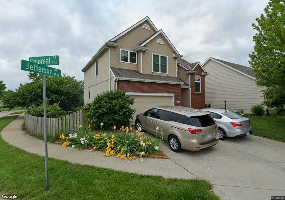
4901 Jefferson Way Lawrence, KS 66049
West Lawrence NeighborhoodEstimated Value: $367,000 - $402,000
3
Beds
3
Baths
2,532
Sq Ft
$154/Sq Ft
Est. Value
About This Home
This home is located at 4901 Jefferson Way, Lawrence, KS 66049 and is currently estimated at $389,334, approximately $153 per square foot. 4901 Jefferson Way is a home located in Douglas County with nearby schools including Langston Hughes Elementary School, Southwest Middle School, and Lawrence Free State High School.
Ownership History
Date
Name
Owned For
Owner Type
Purchase Details
Closed on
Apr 17, 2020
Sold by
Mayhew Jessica D and Magnew Jessica
Bought by
Mayhew Scott W
Current Estimated Value
Home Financials for this Owner
Home Financials are based on the most recent Mortgage that was taken out on this home.
Original Mortgage
$192,300
Outstanding Balance
$170,031
Interest Rate
3.3%
Mortgage Type
New Conventional
Estimated Equity
$219,303
Purchase Details
Closed on
Sep 13, 2015
Sold by
Larsen Jacob J and Larsen Jessica Mr
Bought by
Mayhew Scott and Mayhew Jessica
Home Financials for this Owner
Home Financials are based on the most recent Mortgage that was taken out on this home.
Original Mortgage
$201,400
Interest Rate
3.97%
Mortgage Type
New Conventional
Purchase Details
Closed on
Jan 15, 2009
Sold by
Rodriguez Alfred and Rodriguez Mary J
Bought by
Larsen Jacob J and Larsen Jessica M R
Home Financials for this Owner
Home Financials are based on the most recent Mortgage that was taken out on this home.
Original Mortgage
$190,950
Interest Rate
4.91%
Mortgage Type
Purchase Money Mortgage
Purchase Details
Closed on
Apr 7, 2006
Sold by
Roecker Michael D and Roecker Janet W
Bought by
Larsen Jacob J and Larsen Jessica M R
Home Financials for this Owner
Home Financials are based on the most recent Mortgage that was taken out on this home.
Original Mortgage
$195,700
Interest Rate
6.33%
Mortgage Type
Fannie Mae Freddie Mac
Purchase Details
Closed on
Feb 23, 2001
Sold by
Bland Mathis Lisa K and Bland Lisa Kaye
Bought by
Roecker Michael D and Roecker Janet W
Home Financials for this Owner
Home Financials are based on the most recent Mortgage that was taken out on this home.
Original Mortgage
$103,000
Interest Rate
7.13%
Purchase Details
Closed on
Feb 13, 2001
Sold by
Mathis Ronald D
Bought by
Bland Lisa Kaye
Home Financials for this Owner
Home Financials are based on the most recent Mortgage that was taken out on this home.
Original Mortgage
$103,000
Interest Rate
7.13%
Create a Home Valuation Report for This Property
The Home Valuation Report is an in-depth analysis detailing your home's value as well as a comparison with similar homes in the area
Home Values in the Area
Average Home Value in this Area
Purchase History
| Date | Buyer | Sale Price | Title Company |
|---|---|---|---|
| Mayhew Scott W | -- | None Available | |
| Mayhew Scott | -- | Capital Title Ins Company Lc | |
| Larsen Jacob J | -- | First American Title | |
| Larsen Jacob J | -- | Commerce Title | |
| Roecker Michael D | -- | First American Title | |
| Bland Lisa Kaye | -- | -- |
Source: Public Records
Mortgage History
| Date | Status | Borrower | Loan Amount |
|---|---|---|---|
| Open | Mayhew Scott W | $192,300 | |
| Closed | Mayhew Scott | $201,400 | |
| Previous Owner | Larsen Jacob J | $190,950 | |
| Previous Owner | Larsen Jacob J | $195,700 | |
| Previous Owner | Roecker Michael D | $103,000 | |
| Closed | Roecker Michael D | $20,000 |
Source: Public Records
Tax History Compared to Growth
Tax History
| Year | Tax Paid | Tax Assessment Tax Assessment Total Assessment is a certain percentage of the fair market value that is determined by local assessors to be the total taxable value of land and additions on the property. | Land | Improvement |
|---|---|---|---|---|
| 2025 | $5,053 | $40,756 | $9,200 | $31,556 |
| 2024 | $4,719 | $38,123 | $7,475 | $30,648 |
| 2023 | $4,873 | $37,904 | $7,475 | $30,429 |
| 2022 | $4,517 | $34,914 | $7,475 | $27,439 |
| 2021 | $3,858 | $28,911 | $6,334 | $22,577 |
| 2020 | $3,681 | $27,738 | $6,334 | $21,404 |
| 2019 | $3,464 | $26,151 | $6,334 | $19,817 |
| 2018 | $3,366 | $25,231 | $6,334 | $18,897 |
| 2017 | $3,348 | $24,817 | $6,334 | $18,483 |
| 2016 | $3,147 | $24,380 | $5,753 | $18,627 |
| 2015 | $3,163 | $24,495 | $5,753 | $18,742 |
| 2014 | $2,996 | $23,448 | $5,753 | $17,695 |
Source: Public Records
Map
Nearby Homes
- 5024 Cedar Grove Way
- 904 Moundridge Dr
- 5117 Harvard Rd
- 5204 Foxchase Dr
- 5204 Fox Chase Dr
- 1202 Little Knife
- 1300 Research Park Dr
- 5245 Overland Dr Unit A15
- 5245 Overland Dr Unit C12
- 5245 Overland Dr Unit D4
- 1017 Stoneridge Dr
- 1040 Stonecreek Dr
- 1315 Research Park Dr
- 1033 Stonecreek Dr
- 237 Landon Ct
- 1012 Wagon Wheel Rd
- 611 Eldridge St
- 4207 Timberline Ct
- 408 Vine Dr
- 1204 Chadwick Ct
- 4905 Jefferson Way
- 4900 Colonial Way
- 4904 Colonial Way
- 4909 Jefferson Way
- 908 Colonial Dr
- 912 Colonial Dr
- 4908 Colonial Way
- 4913 Jefferson Way
- 4900 Jefferson Way
- 4904 Jefferson Way
- 916 Colonial Dr
- 900 Colonial Dr
- 4908 Jefferson Way
- 4912 Colonial Way
- 920 Colonial Dr
- 4917 Jefferson Way
- 4912 Jefferson Way
- 4901 Colonial Way
- 4916 Colonial Way
- 924 Colonial Dr