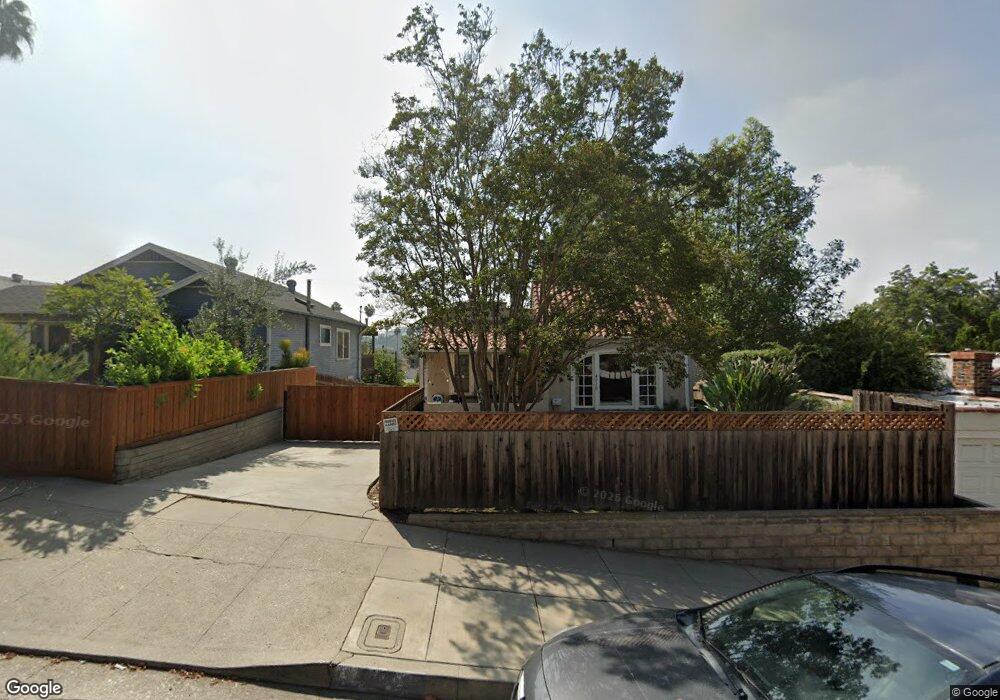
4910 Range View Ave Los Angeles, CA 90042
Estimated Value: $1,024,000 - $1,089,000
2
Beds
1
Bath
948
Sq Ft
$1,118/Sq Ft
Est. Value
About This Home
This home is located at 4910 Range View Ave, Los Angeles, CA 90042 and is currently estimated at $1,060,150, approximately $1,118 per square foot. 4910 Range View Ave is a home located in Los Angeles County with nearby schools including Buchanan Street Elementary, Benjamin Franklin High School, and Luther Burbank Middle School.
Ownership History
Date
Name
Owned For
Owner Type
Purchase Details
Closed on
Jul 27, 2006
Sold by
Morris Walter D and Doherty Kelly Lynn
Bought by
Occidental College
Current Estimated Value
Purchase Details
Closed on
Jun 19, 2003
Sold by
Chisholm Christine M and Minkey Living Trust
Bought by
Morris Walter D and Doherty Kelly Lynn
Home Financials for this Owner
Home Financials are based on the most recent Mortgage that was taken out on this home.
Original Mortgage
$263,200
Interest Rate
5.15%
Mortgage Type
Purchase Money Mortgage
Purchase Details
Closed on
Dec 8, 1994
Sold by
Minkey Mary P
Bought by
Minkey Mary P and The Minkey Living Trust
Create a Home Valuation Report for This Property
The Home Valuation Report is an in-depth analysis detailing your home's value as well as a comparison with similar homes in the area
Home Values in the Area
Average Home Value in this Area
Purchase History
| Date | Buyer | Sale Price | Title Company |
|---|---|---|---|
| Occidental College | $510,000 | None Available | |
| Morris Walter D | $329,000 | Ort | |
| Minkey Mary P | -- | -- |
Source: Public Records
Mortgage History
| Date | Status | Borrower | Loan Amount |
|---|---|---|---|
| Previous Owner | Morris Walter D | $263,200 | |
| Closed | Morris Walter D | $49,350 |
Source: Public Records
Tax History Compared to Growth
Tax History
| Year | Tax Paid | Tax Assessment Tax Assessment Total Assessment is a certain percentage of the fair market value that is determined by local assessors to be the total taxable value of land and additions on the property. | Land | Improvement |
|---|---|---|---|---|
| 2025 | $124 | $683,274 | $546,628 | $136,646 |
| 2024 | $124 | $669,877 | $535,910 | $133,967 |
| 2023 | $124 | $656,743 | $525,402 | $131,341 |
| 2022 | $120 | $643,866 | $515,100 | $128,766 |
| 2021 | $112 | $631,242 | $505,000 | $126,242 |
| 2019 | $111 | $612,521 | $490,022 | $122,499 |
| 2018 | $117 | $600,512 | $480,414 | $120,098 |
| 2016 | $114 | $540,000 | $431,600 | $108,400 |
| 2015 | $114 | $512,500 | $409,600 | $102,900 |
| 2014 | $124 | $495,000 | $395,600 | $99,400 |
Source: Public Records
Map
Nearby Homes
- 4925 Buchanan St
- 5117 Stratford Rd
- 4854 Buchanan St
- 1113 N Avenue 50
- 1336 Armadale Ave
- 5125 Buchanan St
- 1048 Dexter St
- 4666 York Blvd
- 1037 N Avenue 50
- 4707 Toland Way
- 4780 Hub St
- 1902 N Avenue 51
- 1607 Campus Rd
- 5252 Range View Ave
- 5055 Hub St
- 4654 Toland Way
- 1813 N Avenue 53
- 1915 N Avenue 52
- 5240 Barker Dr
- 1932 Phillips Way
- 4914 Range View Ave
- 4914 4914 1/2 Range View Ave
- 1522 North Avenue 49
- 1524 North Avenue 49
- 1512 North Avenue 49
- 4918 Range View Ave
- 1508 North Avenue 49
- 4922 Range View Ave
- 4909 Stratford Rd
- 4913 Stratford Rd
- 4917 Stratford Rd
- 4926 Range View Ave
- 4905 Stratford Rd
- 4901 Stratford Rd
- 4921 Stratford Rd
- 4923 Stratford Rd
- 4930 Range View Ave
- 4925 Stratford Rd
- 1515 North Avenue 49
- 1527 North Avenue 49