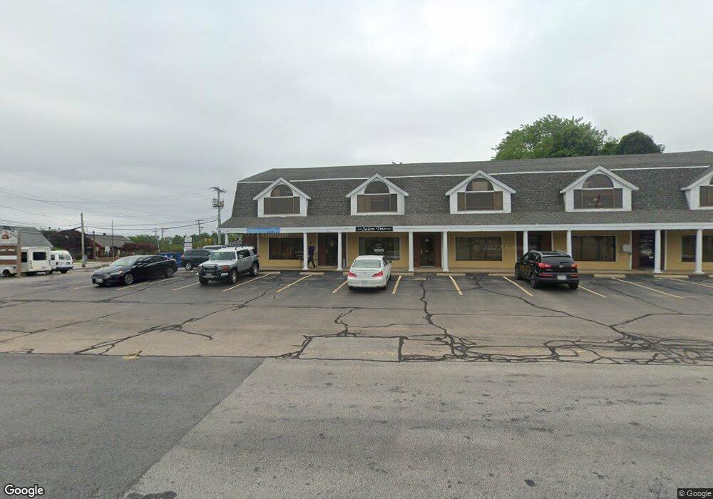
492 Metacom Ave Unit 3&4 Bristol, RI 02809
The Narrows NeighborhoodEstimated Value: $1,538,972
--
Bed
--
Bath
2,000
Sq Ft
$769/Sq Ft
Est. Value
About This Home
This home is located at 492 Metacom Ave Unit 3&4, Bristol, RI 02809 and is currently estimated at $1,538,972, approximately $769 per square foot. 492 Metacom Ave Unit 3&4 is a home located in Bristol County with nearby schools including Mt. Hope High School, Highlander Charter Middle and High School, and Our Lady of Mt. Carmel School.
Ownership History
Date
Name
Owned For
Owner Type
Purchase Details
Closed on
Dec 13, 2017
Sold by
Mho Realty Llc
Bought by
Shanna Realty Llc
Current Estimated Value
Purchase Details
Closed on
Apr 30, 2004
Sold by
Nelson Jeanne
Bought by
Mho Realty Llc
Home Financials for this Owner
Home Financials are based on the most recent Mortgage that was taken out on this home.
Original Mortgage
$525,000
Interest Rate
5.36%
Mortgage Type
Purchase Money Mortgage
Create a Home Valuation Report for This Property
The Home Valuation Report is an in-depth analysis detailing your home's value as well as a comparison with similar homes in the area
Home Values in the Area
Average Home Value in this Area
Purchase History
| Date | Buyer | Sale Price | Title Company |
|---|---|---|---|
| Shanna Realty Llc | -- | -- | |
| Mho Realty Llc | $695,000 | -- |
Source: Public Records
Mortgage History
| Date | Status | Borrower | Loan Amount |
|---|---|---|---|
| Previous Owner | Mho Realty Llc | $100,000 | |
| Previous Owner | Mho Realty Llc | $525,000 |
Source: Public Records
Tax History Compared to Growth
Tax History
| Year | Tax Paid | Tax Assessment Tax Assessment Total Assessment is a certain percentage of the fair market value that is determined by local assessors to be the total taxable value of land and additions on the property. | Land | Improvement |
|---|---|---|---|---|
| 2025 | $13,408 | $970,200 | $277,600 | $692,600 |
| 2024 | $13,408 | $970,200 | $277,600 | $692,600 |
| 2023 | $12,962 | $970,200 | $277,600 | $692,600 |
| 2022 | $12,613 | $970,200 | $277,600 | $692,600 |
| 2021 | $14,465 | $1,005,900 | $286,200 | $719,700 |
| 2020 | $14,153 | $1,005,900 | $286,200 | $719,700 |
| 2019 | $13,801 | $1,005,900 | $286,200 | $719,700 |
| 2018 | $11,312 | $735,500 | $258,900 | $476,600 |
| 2017 | $11,059 | $741,200 | $258,900 | $482,300 |
| 2016 | $10,948 | $741,200 | $258,900 | $482,300 |
| 2015 | $10,319 | $735,500 | $258,900 | $476,600 |
| 2014 | $9,649 | $738,790 | $234,800 | $503,990 |
Source: Public Records
Map
Nearby Homes
- 6 Scott Ln
- 6 Violet Ct
- 48 Narrows Rd
- 79 Hopeworth Ave
- 3 Chestnut St
- 0 Platt St Unit 1383816
- 214 Franklin St
- 2 Chilton St
- 2 Wilson St
- 22 Magnolia St
- 7 Knowlton Ct
- 3 Knowlton Ct
- 5 Knowlton Ct
- 107 Franklin St
- 413 High St
- 669 Metacom Ave Unit 17
- 17 Rock St
- 683 Metacom Ave Unit 79
- 1 Knowlton Ct
- 1220 Hope St
- 490 Metacom Ave
- 500 Metacom Ave
- 491 Metacom Ave
- 495 Metacom Ave
- 489 Metacom Ave
- 4 Fernwood Rd
- 497 Metacom Ave
- 6 Fernwood Rd
- 485 Metacom Ave
- 483 Metacom Ave
- 8 Fernwood Rd
- 456 Chestnut St
- 7 Rosedale Dr
- 10 Fernwood Rd
- 11 Annawamscutt Dr
- 481 Metacom Ave
- 9 Rosedale Dr
- 5 Redic Ct
- 1 Redic Ct
- 431 Chestnut St