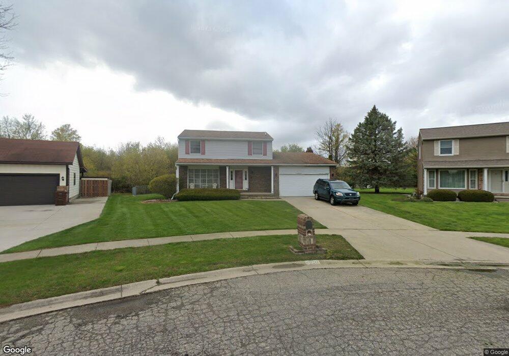
4920 Westbridge Cir Lansing, MI 48917
Estimated Value: $263,000 - $305,000
3
Beds
4
Baths
1,724
Sq Ft
$162/Sq Ft
Est. Value
About This Home
This home is located at 4920 Westbridge Cir, Lansing, MI 48917 and is currently estimated at $279,415, approximately $162 per square foot. 4920 Westbridge Cir is a home located in Eaton County with nearby schools including Waverly Senior High School, Greater Lansing Adventist School, and New Covenant Christian School.
Ownership History
Date
Name
Owned For
Owner Type
Purchase Details
Closed on
Jun 4, 2004
Sold by
Chapko Ronald P and Chapko Amella B
Bought by
Turner Carmen Y
Current Estimated Value
Home Financials for this Owner
Home Financials are based on the most recent Mortgage that was taken out on this home.
Original Mortgage
$177,354
Outstanding Balance
$87,046
Interest Rate
6.06%
Mortgage Type
FHA
Estimated Equity
$192,369
Create a Home Valuation Report for This Property
The Home Valuation Report is an in-depth analysis detailing your home's value as well as a comparison with similar homes in the area
Home Values in the Area
Average Home Value in this Area
Purchase History
| Date | Buyer | Sale Price | Title Company |
|---|---|---|---|
| Turner Carmen Y | $179,000 | Midstate Title |
Source: Public Records
Mortgage History
| Date | Status | Borrower | Loan Amount |
|---|---|---|---|
| Open | Turner Carmen Y | $177,354 |
Source: Public Records
Tax History Compared to Growth
Tax History
| Year | Tax Paid | Tax Assessment Tax Assessment Total Assessment is a certain percentage of the fair market value that is determined by local assessors to be the total taxable value of land and additions on the property. | Land | Improvement |
|---|---|---|---|---|
| 2025 | $4,292 | $120,500 | $0 | $0 |
| 2024 | $2,424 | $116,600 | $0 | $0 |
| 2023 | $2,330 | $106,400 | $0 | $0 |
| 2022 | $3,748 | $100,800 | $0 | $0 |
| 2021 | $3,624 | $93,500 | $0 | $0 |
| 2020 | $3,717 | $87,600 | $0 | $0 |
| 2019 | $3,693 | $82,604 | $0 | $0 |
| 2018 | $3,627 | $81,800 | $0 | $0 |
| 2017 | $3,541 | $79,900 | $0 | $0 |
| 2016 | -- | $77,300 | $0 | $0 |
| 2015 | -- | $75,200 | $0 | $0 |
| 2014 | -- | $73,600 | $0 | $0 |
| 2013 | -- | $72,500 | $0 | $0 |
Source: Public Records
Map
Nearby Homes
- 916 Westover Cir
- 1018 Pickton Dr
- 4616 W St Joe Hwy
- 1109 Boulder Ct Unit 46
- 4819 Moultrie Cir
- 1130 Vail Ct Unit 25
- 5525 W St Joe Hwy Unit A8
- 5535 W St Joe Hwy Unit B12
- 5535 W St Joe Hwy Unit B3
- 5538 W St Joe Hwy
- 210 Park Meadows Dr Unit 25
- 2517 W Michigan Ave
- 1212 Bennington Dr
- 918 Harvest Ln
- 5521 W Michigan Ave
- 612 S Dibble Blvd
- 929 Grenoble Dr Unit B
- 215 Winifred Ave Unit A & B
- 1005 Grenoble Dr Unit H
- 4220 Otis St
- 4916 Westbridge Cir
- 4919 Westbridge Cir
- 4912 Westbridge Cir
- 4915 Westbridge Cir
- 736 Westhaven Blvd
- 802 Westhaven Blvd
- 726 Westhaven Blvd
- 5008 Southwick Cir
- 5014 Southwick Cir
- 814 Westhaven Blvd
- 5004 Southwick Cir
- 820 Westhaven Blvd
- 712 Westhaven Blvd
- 5022 Southwick Cir
- 4902 Westhaven Blvd
- 4812 Westvale Cir
- 5001 Southwick Cir
- 745 Westhaven Blvd
- 700 Westhaven Blvd
- 5030 Southwick Cir