Estimated Value: $230,000 - $309,000
Studio
1
Bath
1,215
Sq Ft
$212/Sq Ft
Est. Value
About This Home
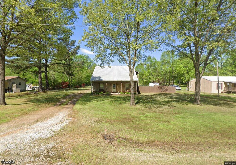
This home is located at 495 Ecology Loop, Eads, TN 38028 and is currently estimated at $257,910, approximately $212 per square foot. 495 Ecology Loop is a home located in Fayette County with nearby schools including Oakland Elementary School, West Junior High School, and Fayette Ware Comprehensive High School.
Ownership History
Date
Name
Owned For
Owner Type
Purchase Details
Closed on
Apr 14, 2011
Sold by
Harpel Bruce
Bought by
Chambers William E and Chambers Pamela L
Current Estimated Value
Purchase Details
Closed on
Apr 13, 2011
Sold by
Wall Karen
Bought by
Harpel Bruce
Purchase Details
Closed on
Aug 19, 2003
Sold by
Harpel Violet E
Bought by
Harpel David A
Purchase Details
Closed on
Nov 20, 1992
Bought by
Harpel David A
Purchase Details
Closed on
Jun 5, 1992
Bought by
Hopkins Ronald E and Sisco Della L
Purchase Details
Closed on
Jan 1, 1985
Bought by
Thornton Wesley
Create a Home Valuation Report for This Property
The Home Valuation Report is an in-depth analysis detailing your home's value as well as a comparison with similar homes in the area
Purchase History
| Date | Buyer | Sale Price | Title Company |
|---|---|---|---|
| Chambers William E | $12,000 | -- | |
| Harpel Bruce | -- | -- | |
| Harpel Bruce | -- | -- | |
| Harpel David A | -- | -- | |
| Harpel David A | $21,000 | -- | |
| Hopkins Ronald E | $18,000 | -- | |
| Thornton Wesley | $3,200 | -- |
Source: Public Records
Tax History
| Year | Tax Paid | Tax Assessment Tax Assessment Total Assessment is a certain percentage of the fair market value that is determined by local assessors to be the total taxable value of land and additions on the property. | Land | Improvement |
|---|---|---|---|---|
| 2025 | $504 | $52,525 | $6,500 | $46,025 |
| 2024 | $504 | $39,050 | $6,250 | $32,800 |
| 2023 | $504 | $39,050 | $0 | $0 |
| 2022 | $504 | $39,050 | $6,250 | $32,800 |
| 2021 | $504 | $39,050 | $6,250 | $32,800 |
| 2020 | $522 | $39,050 | $6,250 | $32,800 |
| 2019 | $522 | $34,600 | $6,250 | $28,350 |
| 2018 | $522 | $34,600 | $6,250 | $28,350 |
| 2017 | $522 | $34,600 | $6,250 | $28,350 |
| 2016 | $528 | $32,875 | $6,250 | $26,625 |
| 2015 | $528 | $32,875 | $6,250 | $26,625 |
| 2014 | $528 | $32,875 | $6,250 | $26,625 |
Source: Public Records
Map
Nearby Homes
- 245 Ecology Loop
- 390 Rolling Acres Dr
- 2000 U S Highway 64
- 0 Bell Grove Rd Unit 10211043
- 0 Bell Grove Rd Unit 23176368
- 0 Bell Grove Rd Unit 10211044
- 225 Bibury Ln
- 260 Bibury Ln
- 110 Fair Meadows Ln
- 1575-1105 Bell Grove Rd
- 285 Bibury Ln
- 400 Cypress Village Ln
- 410 Cypress Village Ln
- 435 Cypress Village Ln
- 430 Cypress Village Ln
- 335 Bibury Ln
- 365 Bibury Ln
- 230 Oak Haven Cir
- 340 Oak Haven Cir
- 270 Oak Haven Cir
- 525 Ecology Loop
- 475 Ecology Loop
- 455 Ecology Loop
- 435 Ecology Loop
- 250 Randy Rd
- 450 Ecology Loop
- 542 Ecology Loop
- 500 Ecology Loop
- 595 Ecology Loop
- 540 Ecology Loop
- 120 Randy Rd
- 195 Randy Rd
- 145 Randy Rd
- 265 Randy Rd
- 635 Ecology Loop
- 305 Randy Rd
- 275 Ecology Loop
- 640 Ecology Loop
- 320 Ecology Loop Unit 260
- 30 Randy Rd
Your Personal Tour Guide
Ask me questions while you tour the home.