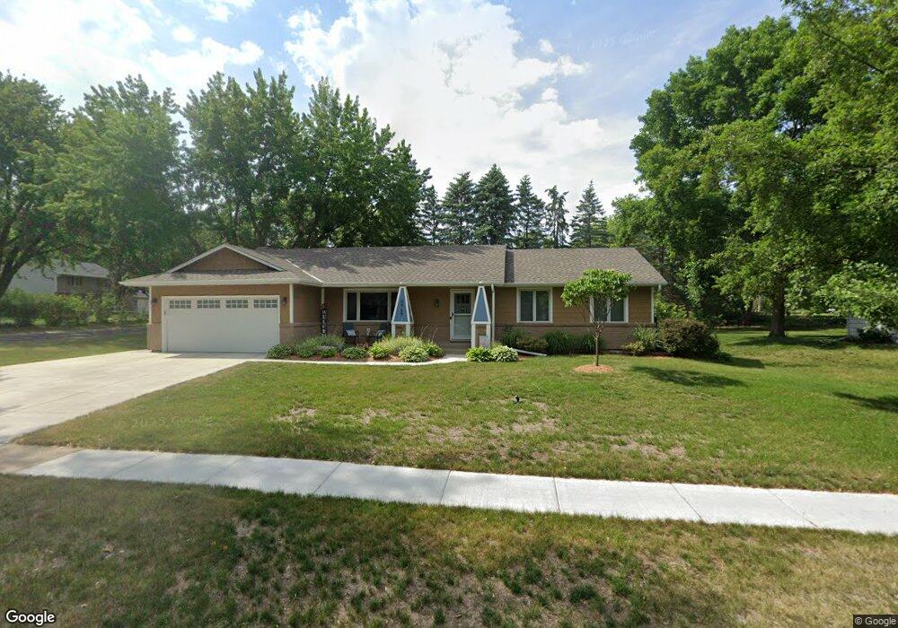
4967 142nd Path W Saint Paul, MN 55124
Estimated Value: $427,000 - $452,000
3
Beds
3
Baths
1,495
Sq Ft
$294/Sq Ft
Est. Value
About This Home
This home is located at 4967 142nd Path W, Saint Paul, MN 55124 and is currently estimated at $438,792, approximately $293 per square foot. 4967 142nd Path W is a home located in Dakota County with nearby schools including Diamond Path Elementary School of International Studies, Scott Highlands Middle School, and Eastview Senior High School.
Ownership History
Date
Name
Owned For
Owner Type
Purchase Details
Closed on
Aug 29, 2005
Sold by
Wassmund Keith D and Wassmund Linda C
Bought by
Wassmund Steven G and Wassmund Erin K
Current Estimated Value
Create a Home Valuation Report for This Property
The Home Valuation Report is an in-depth analysis detailing your home's value as well as a comparison with similar homes in the area
Home Values in the Area
Average Home Value in this Area
Purchase History
| Date | Buyer | Sale Price | Title Company |
|---|---|---|---|
| Wassmund Steven G | $275,000 | -- |
Source: Public Records
Tax History Compared to Growth
Tax History
| Year | Tax Paid | Tax Assessment Tax Assessment Total Assessment is a certain percentage of the fair market value that is determined by local assessors to be the total taxable value of land and additions on the property. | Land | Improvement |
|---|---|---|---|---|
| 2024 | $4,374 | $375,000 | $89,500 | $285,500 |
| 2023 | $4,374 | $387,200 | $89,700 | $297,500 |
| 2022 | $3,816 | $387,200 | $89,400 | $297,800 |
| 2021 | $3,680 | $333,000 | $77,800 | $255,200 |
| 2020 | $3,630 | $315,400 | $74,100 | $241,300 |
| 2019 | $3,278 | $302,700 | $70,500 | $232,200 |
| 2018 | $3,206 | $287,200 | $67,200 | $220,000 |
| 2017 | $3,166 | $270,100 | $64,000 | $206,100 |
| 2016 | $3,136 | $254,500 | $60,900 | $193,600 |
| 2015 | $2,857 | $234,933 | $56,169 | $178,764 |
| 2014 | -- | $215,095 | $53,518 | $161,577 |
| 2013 | -- | $195,257 | $48,700 | $146,557 |
Source: Public Records
Map
Nearby Homes
- 13877 Elkhart Rd
- 13937 Ember Ct
- 14387 Embassy Way
- 14162 Dearborn Path
- 5357 Upper 147th St W
- 5167 148th St W
- 14220 Davenport Path
- 14554 Denver Ct
- 5657 144th St W
- 14527 Eureka Ct
- 22367 Denmark Ct
- 4176 143rd St W
- 14797 Lower Endicott Way
- 14757 Excelsior Ln Unit 105
- 14742 Endicott Way
- 14720 Excelsior Ln Unit 28
- 13169 Diamond Path
- 13641 Everton Ave
- 13573 Everton Ave
- 5099 151st St W
- 4945 142nd Path W
- 14050 Dunbar Ct
- 4989 142nd Path W
- 4929 142nd Path W
- 4966 142nd Path W
- 14040 Dunbar Ct
- 4982 142nd Path W
- 4943 142nd St W
- 4927 142nd Path W
- 14061 Dunbar Ct
- 5001 142nd Path W
- 4998 142nd Path W
- 14049 Dunbar Ct
- 14024 Dunbar Ct
- 14039 Dunbar Ct
- 4930 142nd Path W
- 14133 Drexel Ct
- 4931 142nd St W
- 5008 142nd Path W
- 5005 142nd Path W