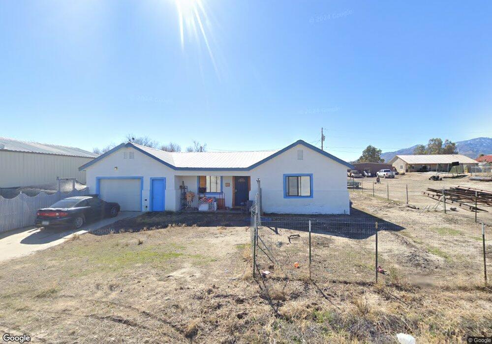
497 W Frying Pan Rd Safford, AZ 85546
Estimated Value: $273,119 - $307,000
--
Bed
--
Bath
1,426
Sq Ft
$199/Sq Ft
Est. Value
About This Home
This home is located at 497 W Frying Pan Rd, Safford, AZ 85546 and is currently estimated at $284,280, approximately $199 per square foot. 497 W Frying Pan Rd is a home with nearby schools including Dorothy Stinson School, Ruth Powell Elementary School, and Lafe Nelson School.
Ownership History
Date
Name
Owned For
Owner Type
Purchase Details
Closed on
Jun 30, 2017
Sold by
Morse David R
Bought by
Gerlach Jasmin
Current Estimated Value
Home Financials for this Owner
Home Financials are based on the most recent Mortgage that was taken out on this home.
Original Mortgage
$85,000
Outstanding Balance
$70,737
Interest Rate
3.95%
Mortgage Type
New Conventional
Estimated Equity
$213,543
Purchase Details
Closed on
Feb 21, 2007
Sold by
Off Rose T
Bought by
Morse David G and Morse Ruth E
Create a Home Valuation Report for This Property
The Home Valuation Report is an in-depth analysis detailing your home's value as well as a comparison with similar homes in the area
Home Values in the Area
Average Home Value in this Area
Purchase History
| Date | Buyer | Sale Price | Title Company |
|---|---|---|---|
| Gerlach Jasmin | $110,000 | Stewart Title Safford | |
| Morse David G | $61,500 | Safford Title Agency |
Source: Public Records
Mortgage History
| Date | Status | Borrower | Loan Amount |
|---|---|---|---|
| Open | Gerlach Jasmin | $85,000 |
Source: Public Records
Tax History Compared to Growth
Tax History
| Year | Tax Paid | Tax Assessment Tax Assessment Total Assessment is a certain percentage of the fair market value that is determined by local assessors to be the total taxable value of land and additions on the property. | Land | Improvement |
|---|---|---|---|---|
| 2026 | $999 | -- | -- | -- |
| 2025 | $999 | $16,336 | $717 | $15,619 |
| 2024 | $1,029 | $15,134 | $717 | $14,417 |
| 2023 | $1,029 | $13,210 | $701 | $12,509 |
| 2022 | $1,007 | $11,859 | $779 | $11,080 |
| 2021 | $1,097 | $0 | $0 | $0 |
| 2020 | $1,054 | $0 | $0 | $0 |
| 2019 | $1,100 | $0 | $0 | $0 |
| 2018 | $1,037 | $0 | $0 | $0 |
| 2017 | $982 | $0 | $0 | $0 |
| 2016 | $1,093 | $0 | $0 | $0 |
| 2015 | $1,015 | $0 | $0 | $0 |
Source: Public Records
Map
Nearby Homes
- 0000 W Doggie Dr Unit 163
- TBA W Doggie Dr
- 000 S Branding Iron Rd Unit 38
- 0 Us Hwy 191 -- Unit 13 6846235
- 0 Us Hwy 191 Unit 13 22509576
- 6850 S Us Highway 191
- TBD #5 Tbd Hwy 191 Unit 5
- 7577 S Pommel St
- 0 Lariat Way Unit 22994149
- 7910 U S 191
- tbd Pommel St Unit B
- TBD Quartz Ridge
- 8420 S Ute Cir
- 8495 Navajo Dr
- 0.23ac Yavapai Dr Unit 272
- 8583 S Thunderbird Dr
- 8615 S Thunderbird Dr
- 8656 Yavapai Dr
- 1601 E 68th Place
- 8944 S Thomas Place
- 493 W Frying Pan Rd
- 533 W Frying Pan Rd
- 514 W Roadrunner St
- 500 W Roadrunner St
- 440 W Frying Pan Dr
- 548 W Roadrunner St
- 600 W Roadrunner St
- 549 W Roadrunner St
- 574 W Frying Pan Dr
- 626 W Roadrunner St
- 639 W Frying Pan Dr
- 552 W Doggie Dr
- 629 W Roadrunner St
- 584 W Doggie Dr
- 401 W Roadrunner St
- 645 W Roadrunner St
- 664 W Roadrunner St
- 681 W Frying Pan Rd
- 681 W Frying Pan Dr
- 606 W Doggie Dr