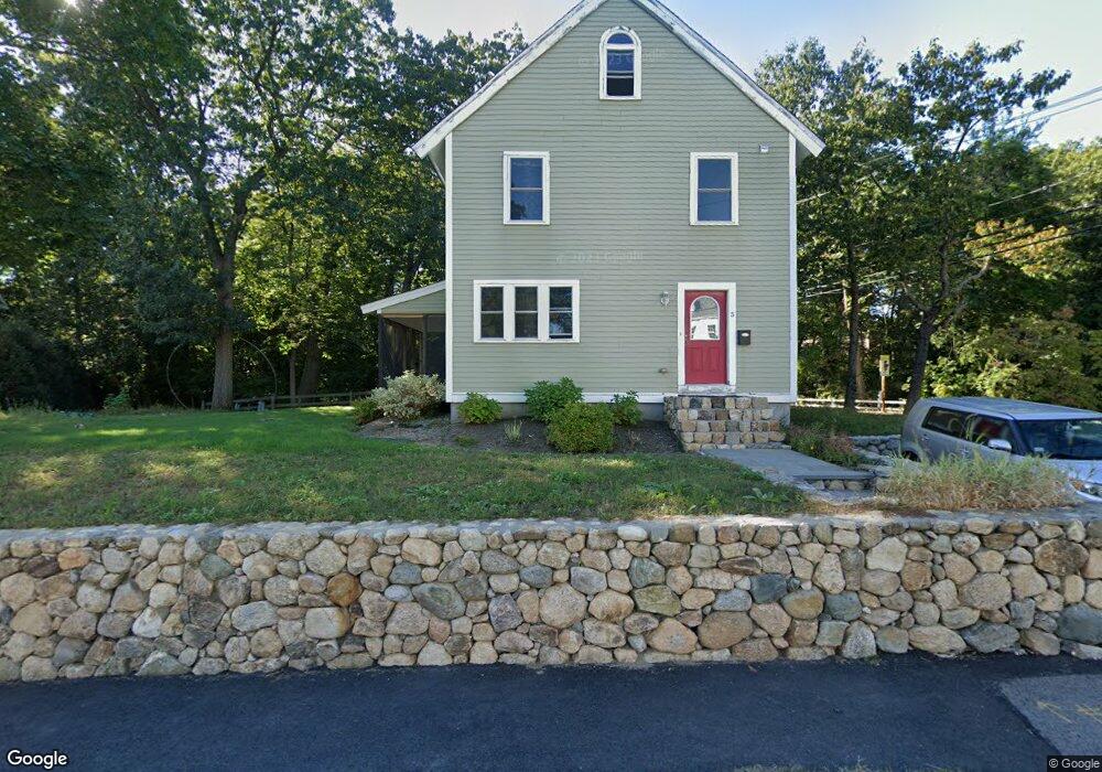
5 Bancroft St Needham, MA 02492
Estimated Value: $1,265,000 - $1,442,505
--
Bed
--
Bath
672
Sq Ft
$2,059/Sq Ft
Est. Value
About This Home
This home is located at 5 Bancroft St, Needham, MA 02492 and is currently estimated at $1,383,376, approximately $2,058 per square foot. 5 Bancroft St is a home with nearby schools including Mitchell Elementary School, High Rock Middle School, and Pollard Middle School.
Ownership History
Date
Name
Owned For
Owner Type
Purchase Details
Closed on
Jun 30, 2010
Sold by
Habitat Humanity Great
Bought by
Fernandez Manuel A and Fernandez Yocayra
Current Estimated Value
Home Financials for this Owner
Home Financials are based on the most recent Mortgage that was taken out on this home.
Original Mortgage
$150,000
Outstanding Balance
$100,471
Interest Rate
4.88%
Mortgage Type
Purchase Money Mortgage
Estimated Equity
$1,282,905
Create a Home Valuation Report for This Property
The Home Valuation Report is an in-depth analysis detailing your home's value as well as a comparison with similar homes in the area
Home Values in the Area
Average Home Value in this Area
Purchase History
| Date | Buyer | Sale Price | Title Company |
|---|---|---|---|
| Fernandez Manuel A | $150,000 | -- | |
| Fernandez Manuel A | $150,000 | -- |
Source: Public Records
Mortgage History
| Date | Status | Borrower | Loan Amount |
|---|---|---|---|
| Open | Fernandez Manuel A | $150,000 | |
| Closed | Fernandez Manuel A | $150,000 |
Source: Public Records
Tax History Compared to Growth
Tax History
| Year | Tax Paid | Tax Assessment Tax Assessment Total Assessment is a certain percentage of the fair market value that is determined by local assessors to be the total taxable value of land and additions on the property. | Land | Improvement |
|---|---|---|---|---|
| 2025 | $11,683 | $1,102,200 | $814,800 | $287,400 |
| 2024 | $1,878 | $150,000 | $150,000 | $0 |
| 2023 | $1,956 | $150,000 | $150,000 | $0 |
| 2022 | $2,006 | $150,000 | $150,000 | $0 |
| 2021 | $1,955 | $150,000 | $150,000 | $0 |
| 2020 | $1,874 | $150,000 | $150,000 | $0 |
| 2019 | $1,859 | $150,000 | $150,000 | $0 |
| 2018 | $1,782 | $150,000 | $150,000 | $0 |
| 2017 | $1,784 | $150,000 | $150,000 | $0 |
| 2016 | $1,731 | $150,000 | $150,000 | $0 |
| 2015 | $1,694 | $150,000 | $150,000 | $0 |
| 2014 | $1,746 | $150,000 | $150,000 | $0 |
Source: Public Records
Map
Nearby Homes
- 190 Brookline St
- 332 Hillcrest Rd
- 62 Washington Ave
- 23 Cheney St
- 556 Webster St
- 8 Wilshire Park
- 40 Otis St Unit L
- 42 Otis St Unit R
- 26 Pinewood Rd
- 9 Jayne Rd
- 701 Greendale Ave
- 143 Hunting Rd
- 39 Mark Lee Rd
- 247 Broad Meadow Rd
- 154 Warren St
- 36 Davenport Rd
- 445 Hillside Ave
- 100 Rosemary Way Unit 129
- 100 Rosemary Way Unit 324
- 3 Crescent Rd
- 157 Brookline St
- 15 Bancroft St
- 4 Bancroft St
- 8 Bancroft St
- 12 Bancroft St
- 2 Bancroft St
- 151 Brookline St
- 176 Brookline St
- 21 Bancroft St
- 22 Bancroft St
- 242 Washington Ave
- 142 Brookline St
- 145 Brookline St
- 216 Washington Ave
- 139 Brookline St
- 136 Brookline St
- 33 Bancroft St
- 30 Bancroft St
- 260 Washington Ave
- 133 Brookline St