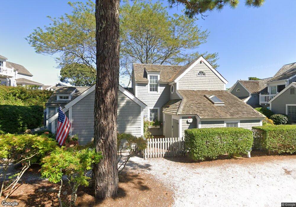
5 Flying Cloud Cir Mashpee, MA 02649
New Seabury-Popponesset Island NeighborhoodEstimated Value: $848,000 - $1,005,000
2
Beds
2
Baths
993
Sq Ft
$902/Sq Ft
Est. Value
About This Home
This home is located at 5 Flying Cloud Cir, Mashpee, MA 02649 and is currently estimated at $896,179, approximately $902 per square foot. 5 Flying Cloud Cir is a home located in Barnstable County with nearby schools including Kenneth C. Coombs School, Quashnet School, and Mashpee Middle School.
Ownership History
Date
Name
Owned For
Owner Type
Purchase Details
Closed on
Sep 22, 2021
Sold by
Doolittle Peter C and Doolittle Steffany P
Bought by
Riseberg Douglas T and Riseberg Robyn S
Current Estimated Value
Home Financials for this Owner
Home Financials are based on the most recent Mortgage that was taken out on this home.
Original Mortgage
$505,778
Outstanding Balance
$460,220
Interest Rate
2.8%
Mortgage Type
Purchase Money Mortgage
Estimated Equity
$435,959
Purchase Details
Closed on
Apr 7, 2016
Sold by
Anthony Richard A and Anthony Krista E
Bought by
Doolittle Peter C
Purchase Details
Closed on
Oct 15, 2010
Sold by
Smith Peter W and Smith Deborah R
Bought by
Anthony Frank S
Home Financials for this Owner
Home Financials are based on the most recent Mortgage that was taken out on this home.
Original Mortgage
$318,750
Interest Rate
4.36%
Mortgage Type
Purchase Money Mortgage
Purchase Details
Closed on
Mar 22, 2002
Sold by
Miles Ft
Bought by
Jlv Rt
Create a Home Valuation Report for This Property
The Home Valuation Report is an in-depth analysis detailing your home's value as well as a comparison with similar homes in the area
Home Values in the Area
Average Home Value in this Area
Purchase History
| Date | Buyer | Sale Price | Title Company |
|---|---|---|---|
| Riseberg Douglas T | $632,222 | None Available | |
| Doolittle Peter C | $387,500 | -- | |
| Anthony Frank S | $430,000 | -- | |
| Jlv Rt | $280,000 | -- |
Source: Public Records
Mortgage History
| Date | Status | Borrower | Loan Amount |
|---|---|---|---|
| Open | Riseberg Douglas T | $505,778 | |
| Previous Owner | Anthony Frank S | $318,750 |
Source: Public Records
Tax History
| Year | Tax Paid | Tax Assessment Tax Assessment Total Assessment is a certain percentage of the fair market value that is determined by local assessors to be the total taxable value of land and additions on the property. | Land | Improvement |
|---|---|---|---|---|
| 2025 | $5,142 | $776,700 | $0 | $776,700 |
| 2024 | $4,815 | $748,800 | $0 | $748,800 |
| 2023 | $4,432 | $632,300 | $0 | $632,300 |
| 2022 | $4,049 | $495,600 | $0 | $495,600 |
| 2021 | $3,886 | $428,400 | $0 | $428,400 |
| 2020 | $4,043 | $444,800 | $0 | $444,800 |
| 2019 | $3,871 | $427,700 | $0 | $427,700 |
| 2018 | $3,604 | $404,000 | $0 | $404,000 |
| 2017 | $3,606 | $392,400 | $0 | $392,400 |
| 2016 | $3,529 | $381,900 | $0 | $381,900 |
| 2015 | $3,315 | $363,900 | $0 | $363,900 |
| 2014 | $3,414 | $363,600 | $0 | $363,600 |
Source: Public Records
Map
Nearby Homes
- 15 Brant Rock Rd Unit 765
- 21 Milestone Way Unit 620
- 33 Landmark Ave
- 6 Hammock Pond Rd
- 6 Hammock Pond Rd Unit 6
- 11 Milestone Way Unit 624
- 3 Hyannis Point Rd Unit 790
- 3 Hyannis Point Rd
- 25 Milestone Way Unit 25
- 25 Milestone Way
- 46 Greensward Cir
- 101 Greensward Rd
- 251 Shore Dr Unit D2
- 251 Shore Dr Unit D2
- 16 Slice Way
- 7 Blue Fin
- 42 Fells Pond Rd
- 22 Mid Iron Way Unit 7511
- 97 Walton Heath Way
- 37 The Hunt Cir
- 7 Flying Cloud Cir
- 5 Flying Cloud Cir Unit 714
- 7 Flying Cloud Cir Unit 7
- 7 Flying Cloud Cir Unit 713
- 38 Landmark Ave
- 3 Flying Cloud Cir
- 38 Landmark Ave Unit 38
- 16 Barneys Ave
- 48 Landmark Ave
- 46 Landmark Ave
- 12 Barneys Ave
- 12 Barneys Ave Unit 12
- 12 Barneys Ave Unit 703
- 10 Barneys Ave
- 2 Flying Cloud Cir
- 2 Flying Cloud Cir Unit 701
- 6 Colemans Way
- 8 Barneys Ave
- 3 Milestone Way
- 2 Milestone Way
Your Personal Tour Guide
Ask me questions while you tour the home.