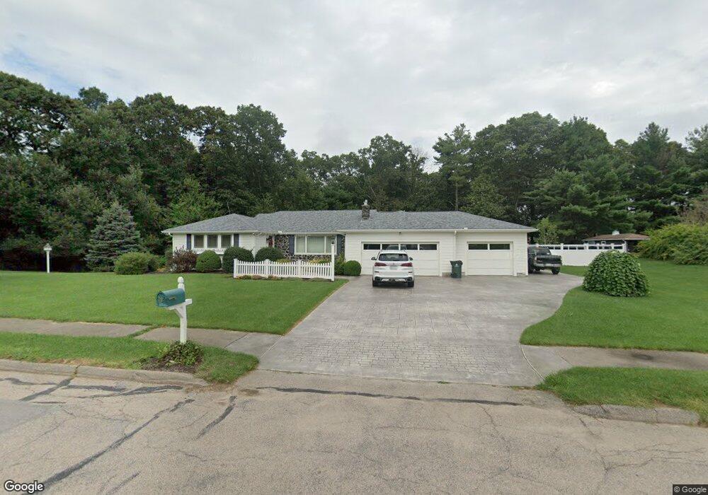
5 Tam o Shanter Rd Franklin, MA 02038
Estimated Value: $773,970 - $872,000
3
Beds
3
Baths
2,263
Sq Ft
$359/Sq Ft
Est. Value
About This Home
This home is located at 5 Tam o Shanter Rd, Franklin, MA 02038 and is currently estimated at $812,993, approximately $359 per square foot. 5 Tam o Shanter Rd is a home located in Norfolk County with nearby schools including Remington Middle School and Franklin High School.
Ownership History
Date
Name
Owned For
Owner Type
Purchase Details
Closed on
Dec 16, 2005
Sold by
Curran Ann K and Curran Lucille
Bought by
Evans Joseph G and Evans Julie A
Current Estimated Value
Home Financials for this Owner
Home Financials are based on the most recent Mortgage that was taken out on this home.
Original Mortgage
$277,500
Interest Rate
6.34%
Mortgage Type
Purchase Money Mortgage
Purchase Details
Closed on
Nov 30, 1993
Sold by
Blethen Harold C and Blethen Judith H
Bought by
Curran John and Curran Lucille M
Create a Home Valuation Report for This Property
The Home Valuation Report is an in-depth analysis detailing your home's value as well as a comparison with similar homes in the area
Home Values in the Area
Average Home Value in this Area
Purchase History
| Date | Buyer | Sale Price | Title Company |
|---|---|---|---|
| Evans Joseph G | $432,500 | -- | |
| Curran John | $185,000 | -- |
Source: Public Records
Mortgage History
| Date | Status | Borrower | Loan Amount |
|---|---|---|---|
| Open | Curran John | $351,355 | |
| Closed | Evans Joseph G | $277,500 |
Source: Public Records
Tax History Compared to Growth
Tax History
| Year | Tax Paid | Tax Assessment Tax Assessment Total Assessment is a certain percentage of the fair market value that is determined by local assessors to be the total taxable value of land and additions on the property. | Land | Improvement |
|---|---|---|---|---|
| 2025 | $7,819 | $672,900 | $335,000 | $337,900 |
| 2024 | $7,787 | $660,500 | $335,000 | $325,500 |
| 2023 | $7,042 | $559,800 | $285,600 | $274,200 |
| 2022 | $6,858 | $488,100 | $224,800 | $263,300 |
| 2021 | $6,702 | $457,500 | $252,500 | $205,000 |
| 2020 | $5,922 | $408,100 | $242,200 | $165,900 |
| 2019 | $5,722 | $390,300 | $231,800 | $158,500 |
| 2018 | $5,352 | $365,300 | $223,500 | $141,800 |
| 2017 | $5,086 | $348,800 | $207,000 | $141,800 |
| 2016 | $5,030 | $346,900 | $221,800 | $125,100 |
| 2015 | $4,983 | $335,800 | $210,700 | $125,100 |
| 2014 | $4,478 | $309,900 | $184,800 | $125,100 |
Source: Public Records
Map
Nearby Homes
- 50 Reed Fulton Ave Unit Lot 61
- 11 Elliot Mills Unit 11
- 570 Franklin St
- 12 Waites Crossing Way
- 1 Uncas Ave
- 70 Uncas Ave
- 64 Uncas Ave
- 82 Uncas Ave Unit 1
- 67 Milliken Ave Unit 22
- 159 E Central St
- 40 Cross St
- 55 Lawrence Dr Unit 55
- 45 Joshua Rd
- 90 E Central St Unit 103
- 90 E Central St Unit 106
- 90 E Central St Unit 304
- 90 E Central St Unit 202
- 90 E Central St Unit 105
- 90 E Central St Unit 301
- 29 Lawrence Dr
- 7 Tam o Shanter Rd
- 60 Country Club Dr
- 2 Tam o Shanter Rd
- 1 Tam o Shanter Rd
- 205 Jordan Rd
- 4 Tam o Shanter Rd
- 215 Jordan Rd
- 72 Country Club Dr
- 57 Country Club Dr
- 45 Country Club Dr
- 2 Burning Tree Rd
- 206 Jordan Rd
- 69 Country Club Dr
- 4 Burning Tree Rd
- 208 Jordan Rd
- 691 E Central St
- 691 E Central St Unit 1
- 33 Country Club Dr
- 204 Jordan Rd
- 6 Burning Tree Rd