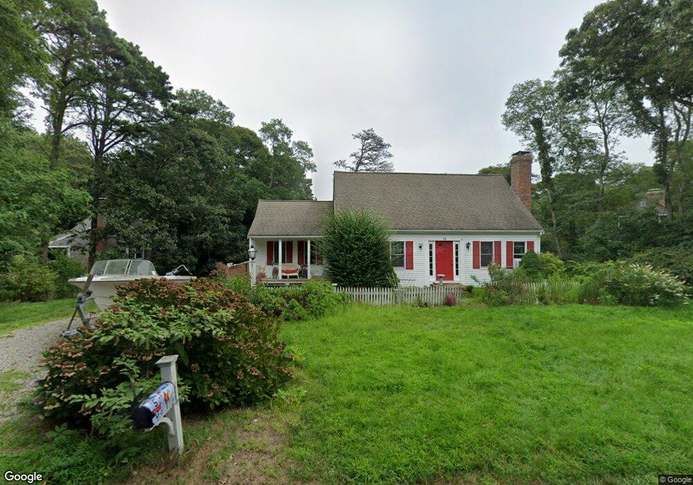
50 Briggs Field Rd Eastham, MA 02642
Estimated Value: $739,000 - $983,000
4
Beds
2
Baths
1,801
Sq Ft
$487/Sq Ft
Est. Value
About This Home
This home is located at 50 Briggs Field Rd, Eastham, MA 02642 and is currently estimated at $877,089, approximately $487 per square foot. 50 Briggs Field Rd is a home located in Barnstable County with nearby schools including Eastham Elementary School, Nauset Regional Middle School, and Nauset Regional High School.
Ownership History
Date
Name
Owned For
Owner Type
Purchase Details
Closed on
Oct 23, 1998
Sold by
Salt Winds Inc
Bought by
Bonzek Florentine G
Current Estimated Value
Purchase Details
Closed on
Aug 15, 1997
Sold by
Arrowood Rt
Bought by
Salt Winds Inc
Create a Home Valuation Report for This Property
The Home Valuation Report is an in-depth analysis detailing your home's value as well as a comparison with similar homes in the area
Home Values in the Area
Average Home Value in this Area
Purchase History
We collect this data history from publicly available records. To have your information removed, we recommend requesting removal directly through your county’s website.
| Date | Buyer | Sale Price | Title Company |
|---|---|---|---|
| Bonzek Florentine G | $210,000 | -- | |
| Salt Winds Inc | $41,000 | -- |
Source: Public Records
Mortgage History
We collect this data history from publicly available records. To have your information removed, we recommend requesting removal directly through your county’s website.
| Date | Status | Borrower | Loan Amount |
|---|---|---|---|
| Open | Salt Winds Inc | $75,000 | |
| Closed | Salt Winds Inc | $100,000 | |
| Closed | Salt Winds Inc | $50,000 |
Source: Public Records
Tax History
| Year | Tax Paid | Tax Assessment Tax Assessment Total Assessment is a certain percentage of the fair market value that is determined by local assessors to be the total taxable value of land and additions on the property. | Land | Improvement |
|---|---|---|---|---|
| 2025 | $6,139 | $796,300 | $263,500 | $532,800 |
| 2024 | $5,311 | $757,600 | $294,200 | $463,400 |
| 2023 | $4,893 | $675,800 | $272,400 | $403,400 |
| 2022 | $4,553 | $530,700 | $243,200 | $287,500 |
| 2021 | $4,457 | $485,500 | $221,100 | $264,400 |
| 2020 | $4,125 | $473,000 | $225,700 | $247,300 |
| 2019 | $3,813 | $462,200 | $219,100 | $243,100 |
| 2018 | $3,747 | $448,800 | $212,700 | $236,100 |
| 2017 | $3,497 | $442,700 | $208,500 | $234,200 |
| 2016 | $3,061 | $411,400 | $181,300 | $230,100 |
| 2015 | $2,868 | $403,900 | $177,800 | $226,100 |
Source: Public Records
Map
Nearby Homes
- 15 Runway Ln
- 80 Runway Ln
- 10 Field Rd
- 90 Whitney Rd
- 5 Anderson Ln
- 1065 Great Pond Rd
- 65 Whitney Rd
- 90 Rolling Ln
- 5 Weir Rd
- 20 Oak Rd
- 82 Old Orchard Rd
- 300 Brackett Rd
- 600 Kingsbury Beach Rd
- 295 Shurtleff Rd
- 3315 State Hwy
- 10 Alston Ct
- 80 Chipman St
- 1690 Herring Brook Rd
- 155 Sea Gull Ln
- 535 School House Rd
- 40 Briggs Field Rd
- 55 Briggs Field Rd
- 70 Briggs Field Rd
- 65 Briggs Field Rd
- 130 Circle Dr
- 0 Briggs Field Rd
- 35 Briggs Field Rd
- 30 Briggs Field Rd
- 145 Edgewood Rd
- 140 Circle Dr
- 80 Briggs Field Rd
- 125 Edgewood Rd
- 175 Edgewood Rd
- 150 Circle Dr
- 75 Briggs Field Rd
- 85 Briggs Field Rd
- 20 Briggs Field Rd
- 125 Circle Dr
- 95 Edgewood Rd
- 95 Edgewood Rd Unit A & B
Your Personal Tour Guide
Ask me questions while you tour the home.