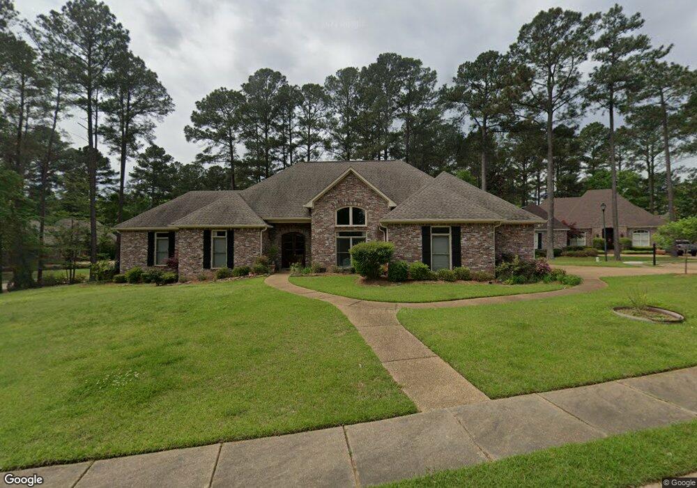
501 Silverstone Dr Madison, MS 39110
Estimated Value: $560,503 - $611,000
5
Beds
4
Baths
4,129
Sq Ft
$141/Sq Ft
Est. Value
About This Home
This home is located at 501 Silverstone Dr, Madison, MS 39110 and is currently estimated at $580,876, approximately $140 per square foot. 501 Silverstone Dr is a home located in Madison County with nearby schools including Madison Avenue Upper Elementary School, Madison Avenue Elementary, and Madison Middle School.
Ownership History
Date
Name
Owned For
Owner Type
Purchase Details
Closed on
Oct 21, 2005
Sold by
Patel Dinesh D and Patel Gomti D
Bought by
Dinesh D Patel Living Trust and Gomti Patel Living Trust
Current Estimated Value
Purchase Details
Closed on
Dec 30, 2004
Sold by
Woodland Homes And Development Inc
Bought by
Patel Dinesh D and Patel Gomti
Home Financials for this Owner
Home Financials are based on the most recent Mortgage that was taken out on this home.
Original Mortgage
$300,000
Interest Rate
4.75%
Mortgage Type
Adjustable Rate Mortgage/ARM
Create a Home Valuation Report for This Property
The Home Valuation Report is an in-depth analysis detailing your home's value as well as a comparison with similar homes in the area
Home Values in the Area
Average Home Value in this Area
Purchase History
| Date | Buyer | Sale Price | Title Company |
|---|---|---|---|
| Dinesh D Patel Living Trust | -- | None Available | |
| Patel Dinesh D | -- | None Available |
Source: Public Records
Mortgage History
| Date | Status | Borrower | Loan Amount |
|---|---|---|---|
| Previous Owner | Patel Dinesh D | $300,000 |
Source: Public Records
Tax History
| Year | Tax Paid | Tax Assessment Tax Assessment Total Assessment is a certain percentage of the fair market value that is determined by local assessors to be the total taxable value of land and additions on the property. | Land | Improvement |
|---|---|---|---|---|
| 2025 | $3,409 | $38,268 | $0 | $0 |
| 2024 | $3,409 | $38,268 | $0 | $0 |
| 2023 | $3,409 | $38,268 | $0 | $0 |
| 2022 | $3,409 | $38,268 | $0 | $0 |
| 2021 | $3,409 | $36,755 | $0 | $0 |
| 2020 | $3,409 | $36,755 | $0 | $0 |
| 2019 | $3,409 | $36,755 | $0 | $0 |
| 2018 | $3,409 | $36,755 | $0 | $0 |
| 2017 | $3,339 | $36,150 | $0 | $0 |
| 2016 | $3,339 | $36,150 | $0 | $0 |
| 2015 | -- | $35,650 | $0 | $0 |
| 2014 | $3,854 | $35,650 | $0 | $0 |
Source: Public Records
Map
Nearby Homes
- 812 Norwich Dr
- 204 Breezy Hill Dr
- 401 Kingsbridge Rd
- 101 Honey Locust Ct
- 180 Wright's Mill Dr
- 124 Trace Cove Dr
- 171 Cavanaugh Dr
- 108 Frenchmans Cay
- 147 Overlook Pointe Dr
- 550 Post Rd Unit 708
- 550 Post Rd Unit 803
- 550 Post Rd Unit 205
- 550 Post Rd Unit 121
- 550 Post Rd Unit 607
- 550 Post Rd Unit 1002
- 489 Cheyenne Ln
- 111 Hawks Nest Bluff
- 133 Overlook Pointe Dr
- 135 Winter Teal Place
- 112 Winter Teal Place
- 505 Silverstone Dr
- 508 Silverstone Dr
- 504 Silverstone Dr
- 112 Wrights Mill Dr
- 116 Wrights Mill Dr
- 512 Silverstone Dr
- 509 Silverstone Dr
- 120 Wrights Mill Dr
- 108 Wrights Mill Dr
- 513 Silverstone Dr
- 135 Wrights Mill Dr
- 200 Kingsbridge Rd
- 516 Silverstone Dr
- 600 Silverstone Dr
- 204 Kingsbridge Rd
- 601 Silverstone Dr
- 300 Kingsbridge Rd
- 421 Ashbourn Ct
- 813 Norwich Dr
- 134 Wrights Mill Dr Unit 134
Your Personal Tour Guide
Ask me questions while you tour the home.