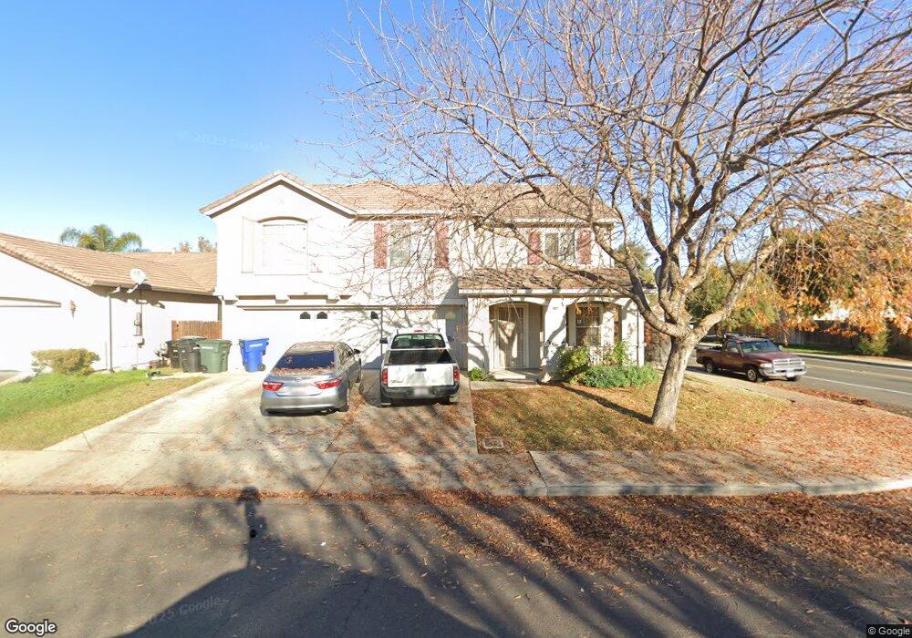
502 Osprey Dr Patterson, CA 95363
Estimated Value: $485,000 - $561,000
5
Beds
3
Baths
2,946
Sq Ft
$181/Sq Ft
Est. Value
About This Home
This home is located at 502 Osprey Dr, Patterson, CA 95363 and is currently estimated at $532,725, approximately $180 per square foot. 502 Osprey Dr is a home located in Stanislaus County with nearby schools including Northmead Elementary School, Creekside Middle School, and Patterson High School.
Ownership History
Date
Name
Owned For
Owner Type
Purchase Details
Closed on
Apr 16, 2020
Sold by
Obeid Mohamed Mobel
Bought by
Obeid Mohamed M and Obeid Lutfah Hamood
Current Estimated Value
Purchase Details
Closed on
Feb 4, 2002
Sold by
Alaniz Albert M and Alaniz Betty V
Bought by
Alaniz Albert M and Alaniz Betty V
Purchase Details
Closed on
Jan 22, 2001
Sold by
Kb Home North Bay Inc
Bought by
Obeid Mohamed Mokbel
Home Financials for this Owner
Home Financials are based on the most recent Mortgage that was taken out on this home.
Original Mortgage
$208,250
Outstanding Balance
$76,837
Interest Rate
7.54%
Mortgage Type
Stand Alone First
Estimated Equity
$455,888
Create a Home Valuation Report for This Property
The Home Valuation Report is an in-depth analysis detailing your home's value as well as a comparison with similar homes in the area
Home Values in the Area
Average Home Value in this Area
Purchase History
| Date | Buyer | Sale Price | Title Company |
|---|---|---|---|
| Obeid Mohamed M | -- | None Available | |
| Alaniz Albert M | -- | -- | |
| Obeid Mohamed Mokbel | $222,500 | First American Title Co |
Source: Public Records
Mortgage History
| Date | Status | Borrower | Loan Amount |
|---|---|---|---|
| Open | Obeid Mohamed Mokbel | $208,250 |
Source: Public Records
Tax History
| Year | Tax Paid | Tax Assessment Tax Assessment Total Assessment is a certain percentage of the fair market value that is determined by local assessors to be the total taxable value of land and additions on the property. | Land | Improvement |
|---|---|---|---|---|
| 2025 | $4,046 | $334,495 | $82,864 | $251,631 |
| 2024 | $4,656 | $327,938 | $81,240 | $246,698 |
| 2023 | $4,572 | $321,509 | $79,648 | $241,861 |
| 2022 | $4,307 | $315,206 | $78,087 | $237,119 |
| 2021 | $4,274 | $309,026 | $76,556 | $232,470 |
| 2020 | $4,254 | $305,859 | $75,772 | $230,087 |
| 2019 | $4,198 | $299,863 | $74,287 | $225,576 |
| 2018 | $4,010 | $293,984 | $72,831 | $221,153 |
| 2017 | $3,956 | $288,220 | $71,403 | $216,817 |
| 2016 | $3,861 | $282,569 | $70,003 | $212,566 |
| 2015 | $3,812 | $278,326 | $68,952 | $209,374 |
| 2014 | $3,727 | $272,875 | $67,602 | $205,273 |
Source: Public Records
Map
Nearby Homes
- 408 Peregrine Dr
- 216 Barros St
- 1314 Sutter Creek Ct
- 432 Meadow Creek Dr
- 445 M St
- 1407 Dylan Creek Dr
- 1419 Nubian St
- 312 Roxanne Dr
- 1459 Mesa Creek Dr
- 1129 Imperial Lily Dr
- 158 Charbray Ct
- 701 N 3rd St
- 126 Jersey Ln
- 612 Beck Creek Ln
- 15707 S 9th St
- 849 Miraggio Dr
- 855 Toyon Ln
- 140 Ivy Ave Unit A5
- 140 Ivy Ave Unit 39
- 1265 Fawn Lily Dr
- 506 Osprey Dr
- 503 Roadrunner Dr
- 507 Roadrunner Dr
- 510 Osprey Dr
- 454 Osprey Dr
- 501 Osprey Dr
- 511 Roadrunner Dr
- 461 Roadrunner Dr
- 505 Osprey Dr
- 514 Osprey Dr
- 450 Osprey Dr
- 509 Osprey Dr
- 453 Osprey Dr
- 515 Roadrunner Dr
- 457 Roadrunner Dr
- 513 Osprey Dr
- 449 Osprey Dr
- 518 Osprey Dr
- 500 Peregrine Dr
- 446 Osprey Dr
Your Personal Tour Guide
Ask me questions while you tour the home.