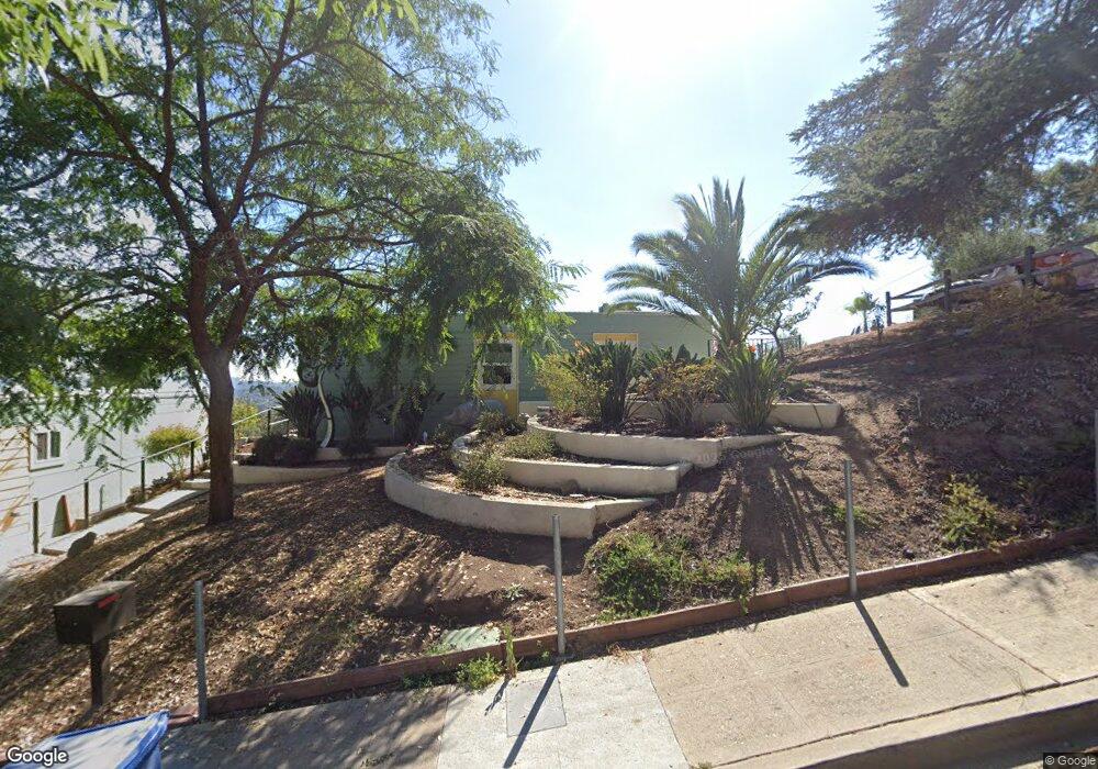
5026 Eaton St Los Angeles, CA 90042
Eagle Rock NeighborhoodEstimated Value: $945,000 - $1,316,000
2
Beds
2
Baths
1,174
Sq Ft
$970/Sq Ft
Est. Value
About This Home
This home is located at 5026 Eaton St, Los Angeles, CA 90042 and is currently estimated at $1,138,842, approximately $970 per square foot. 5026 Eaton St is a home located in Los Angeles County with nearby schools including Buchanan Street Elementary, Benjamin Franklin High School, and Luther Burbank Middle School.
Ownership History
Date
Name
Owned For
Owner Type
Purchase Details
Closed on
Sep 6, 2025
Sold by
Michael And Lucille Arson Living Trust and Arson Lucille Patricia
Bought by
Rose Marcelle
Current Estimated Value
Purchase Details
Closed on
Jun 15, 1999
Sold by
Arson Michael
Bought by
Arson Michael Louis and Arson Lucille Patricia
Purchase Details
Closed on
Aug 6, 1997
Sold by
Downey S & L Assn Fa
Bought by
Arson Michael and Arson Lucille
Home Financials for this Owner
Home Financials are based on the most recent Mortgage that was taken out on this home.
Original Mortgage
$90,000
Interest Rate
7.45%
Purchase Details
Closed on
Feb 19, 1997
Sold by
Dalessandro Robert
Bought by
Downey S & L Assn
Create a Home Valuation Report for This Property
The Home Valuation Report is an in-depth analysis detailing your home's value as well as a comparison with similar homes in the area
Home Values in the Area
Average Home Value in this Area
Purchase History
| Date | Buyer | Sale Price | Title Company |
|---|---|---|---|
| Rose Marcelle | -- | None Listed On Document | |
| Arson Michael Louis | -- | -- | |
| Arson Michael | $100,000 | Lawyers Title Company | |
| Downey S & L Assn | $108,228 | Continental Lawyers Title Co |
Source: Public Records
Mortgage History
| Date | Status | Borrower | Loan Amount |
|---|---|---|---|
| Previous Owner | Arson Michael | $90,000 |
Source: Public Records
Tax History Compared to Growth
Tax History
| Year | Tax Paid | Tax Assessment Tax Assessment Total Assessment is a certain percentage of the fair market value that is determined by local assessors to be the total taxable value of land and additions on the property. | Land | Improvement |
|---|---|---|---|---|
| 2025 | $2,772 | $213,913 | $127,722 | $86,191 |
| 2024 | $2,772 | $209,719 | $125,218 | $84,501 |
| 2023 | $2,722 | $205,608 | $122,763 | $82,845 |
| 2022 | $2,600 | $201,577 | $120,356 | $81,221 |
| 2021 | $2,564 | $197,626 | $117,997 | $79,629 |
| 2019 | $2,491 | $191,767 | $114,499 | $77,268 |
| 2018 | $2,451 | $188,007 | $112,254 | $75,753 |
| 2016 | $1,771 | $134,865 | $107,896 | $26,969 |
| 2015 | $1,747 | $132,840 | $106,276 | $26,564 |
| 2014 | $1,765 | $130,239 | $104,195 | $26,044 |
Source: Public Records
Map
Nearby Homes
- 1902 N Avenue 51
- 1915 N Avenue 52
- 5117 Stratford Rd
- 1932 Phillips Way
- 1942 Phillips Way
- 5240 Barker Dr
- 1938 Phillips Way
- 1632 Oak Grove Dr
- 1813 N Avenue 53
- 5318 Raber St
- 5252 Range View Ave
- 1813 N Avenue 55
- 1584 Oak Grove Place
- 1333 Wildwood Dr
- 4631 4637 Loleta Place
- 4925 Buchanan St
- 5125 Buchanan St
- 1113 N Avenue 50
- 5413 Meridian St
- 4854 Buchanan St
- 5010 Eaton St
- 5027 Eaton St
- 5025 Coringa Dr
- 5031 Coringa Dr
- 5031 Eaton St
- 5006 Eaton St
- 5034 Eaton St
- 1836 North Avenue 50
- 5051 Coringa Dr
- 5051 1/2 Coringa Dr
- 5035 Eaton St
- 5000 Eaton St
- 5023 Coringa Dr
- 5042 Eaton St
- 5027 Coringa Dr
- 5041 Coringa Dr
- 5023 5023 Coringa Dr Dr
- 5043 Eaton St
- 5013 Coringa Dr
- 1846 North Avenue 50