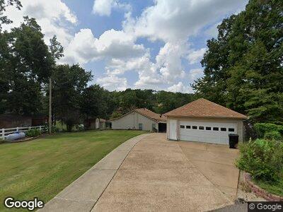
5026 Koko Cove Hernando, MS 38632
Lake Cormorant NeighborhoodEstimated Value: $267,000 - $384,000
3
Beds
--
Bath
2,651
Sq Ft
$114/Sq Ft
Est. Value
About This Home
This home is located at 5026 Koko Cove, Hernando, MS 38632 and is currently estimated at $301,552, approximately $113 per square foot. 5026 Koko Cove is a home located in DeSoto County with nearby schools including Lake Cormorant Elementary School, Horn Lake Intermediate School, and Horn Lake Middle School.
Ownership History
Date
Name
Owned For
Owner Type
Purchase Details
Closed on
Jun 30, 2015
Sold by
Shackleford Hubert L and Shackleford Barbara M
Bought by
Rhoades Joseph T and Rhoades Jessica D
Current Estimated Value
Home Financials for this Owner
Home Financials are based on the most recent Mortgage that was taken out on this home.
Original Mortgage
$215,916
Interest Rate
4.09%
Mortgage Type
FHA
Purchase Details
Closed on
Jul 28, 2009
Sold by
Patrick Robert F and Patrick Evelyn Joy
Bought by
Shackleford Hubert L and Shackleford Barbara M
Create a Home Valuation Report for This Property
The Home Valuation Report is an in-depth analysis detailing your home's value as well as a comparison with similar homes in the area
Home Values in the Area
Average Home Value in this Area
Purchase History
| Date | Buyer | Sale Price | Title Company |
|---|---|---|---|
| Rhoades Joseph T | -- | Shaw Title | |
| Shackleford Hubert L | -- | None Available |
Source: Public Records
Mortgage History
| Date | Status | Borrower | Loan Amount |
|---|---|---|---|
| Open | Rhoades Joseph T | $12,446 | |
| Previous Owner | Rhoades Joseph T | $215,916 |
Source: Public Records
Tax History Compared to Growth
Tax History
| Year | Tax Paid | Tax Assessment Tax Assessment Total Assessment is a certain percentage of the fair market value that is determined by local assessors to be the total taxable value of land and additions on the property. | Land | Improvement |
|---|---|---|---|---|
| 2024 | $921 | $12,217 | $1,000 | $11,217 |
| 2023 | $921 | $12,217 | $0 | $0 |
| 2022 | $921 | $12,217 | $1,000 | $11,217 |
| 2021 | $921 | $12,217 | $1,000 | $11,217 |
| 2020 | $849 | $11,491 | $0 | $0 |
| 2019 | $849 | $11,491 | $1,000 | $10,491 |
| 2017 | $810 | $21,046 | $11,023 | $10,023 |
| 2016 | $810 | $11,023 | $1,000 | $10,023 |
| 2015 | $1,110 | $21,046 | $11,023 | $10,023 |
| 2014 | $355 | $11,023 | $0 | $0 |
| 2013 | $360 | $11,023 | $0 | $0 |
Source: Public Records
Map
Nearby Homes
- 12 Boka Cove
- 0 E Williams Unit 4076067
- 0 E Williams Unit 4076066
- 4577 Bluff Rd
- 3806 Bluff Rd
- 3211 Snow Downs Ridge
- 3222 High Rd
- 11423 High Rd
- 3310 Monans Rill Cove
- 3336 Monans Rill Cove
- 10883 Loch Venarcher Cove
- LOT 265-266 Glen Gyle Rd
- 3670 Glen Artney Cove
- 0 W Glen Gyle Rd Unit 4105213
- 3620 Councils Ford Cove
- 11319 Wren Dr
- 10825 Ben Vorlich's Head
- 9640 Barbee Rd
- 11455 First Hickory Cove
- 2830 Elm Dr
- 5026 Koko Cove
- 5026 Koko Cove
- 5026 Koko Cove
- 5009 Koko Reef Dr
- 5039 Koko Cove
- 5039 Koko Reef Dr
- 5071 Koko Reef Dr
- 4997 Koko Reef Dr
- 4952 Layson Cove
- 0 Koko Reef Unit 2248812
- 0 Koko Reef Unit 2246222
- 0 Koko Reef Unit 2275720
- 5121 Koko Reef Dr
- 4930 Layson Cove
- 5030 Koko Reef Dr
- 5108 Hilo Dr
- 4838 Hawaii Cove
- 5100 Hilo Dr
- 4850 Hawaii Cove
- 5136 Hilo Dr