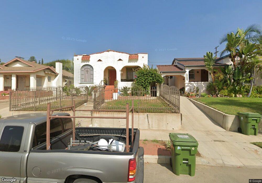
5031 Range View Ave Los Angeles, CA 90042
Eagle Rock NeighborhoodEstimated Value: $1,093,642 - $1,343,000
3
Beds
1
Bath
1,302
Sq Ft
$937/Sq Ft
Est. Value
About This Home
This home is located at 5031 Range View Ave, Los Angeles, CA 90042 and is currently estimated at $1,219,661, approximately $936 per square foot. 5031 Range View Ave is a home located in Los Angeles County with nearby schools including Buchanan Street Elementary, Benjamin Franklin High School, and Luther Burbank Middle School.
Ownership History
Date
Name
Owned For
Owner Type
Purchase Details
Closed on
Sep 6, 2025
Sold by
Gazard-Longoria Doris N and Longoria Manuel
Bought by
Manuel And Doris Longoria Family Trust and Longoria
Current Estimated Value
Purchase Details
Closed on
Sep 23, 2010
Sold by
Longoria Manuel
Bought by
Longoria Manuel and Gazard Longoria Doris N
Home Financials for this Owner
Home Financials are based on the most recent Mortgage that was taken out on this home.
Original Mortgage
$37,000
Interest Rate
4.35%
Mortgage Type
New Conventional
Purchase Details
Closed on
Nov 1, 1993
Sold by
Blair Virginia L
Bought by
Longoria Manuel
Home Financials for this Owner
Home Financials are based on the most recent Mortgage that was taken out on this home.
Original Mortgage
$125,600
Interest Rate
7.09%
Create a Home Valuation Report for This Property
The Home Valuation Report is an in-depth analysis detailing your home's value as well as a comparison with similar homes in the area
Home Values in the Area
Average Home Value in this Area
Purchase History
| Date | Buyer | Sale Price | Title Company |
|---|---|---|---|
| Manuel And Doris Longoria Family Trust | -- | None Listed On Document | |
| Longoria Manuel | -- | North American Title | |
| Longoria Manuel | $157,000 | California Counties Title Co |
Source: Public Records
Mortgage History
| Date | Status | Borrower | Loan Amount |
|---|---|---|---|
| Previous Owner | Longoria Manuel | $37,000 | |
| Previous Owner | Longoria Manuel | $125,600 |
Source: Public Records
Tax History Compared to Growth
Tax History
| Year | Tax Paid | Tax Assessment Tax Assessment Total Assessment is a certain percentage of the fair market value that is determined by local assessors to be the total taxable value of land and additions on the property. | Land | Improvement |
|---|---|---|---|---|
| 2025 | $3,284 | $266,816 | $172,331 | $94,485 |
| 2024 | $3,284 | $261,585 | $168,952 | $92,633 |
| 2023 | $3,222 | $256,457 | $165,640 | $90,817 |
| 2022 | $3,073 | $251,430 | $162,393 | $89,037 |
| 2021 | $3,029 | $246,501 | $159,209 | $87,292 |
| 2019 | $2,938 | $239,191 | $154,488 | $84,703 |
| 2018 | $2,873 | $234,502 | $151,459 | $83,043 |
| 2016 | $2,732 | $225,398 | $145,579 | $79,819 |
| 2015 | $2,692 | $222,014 | $143,393 | $78,621 |
| 2014 | $2,707 | $217,666 | $140,585 | $77,081 |
Source: Public Records
Map
Nearby Homes
- 5117 Stratford Rd
- 5252 Range View Ave
- 1902 N Avenue 51
- 4925 Buchanan St
- 5125 Buchanan St
- 1813 N Avenue 53
- 5240 Barker Dr
- 1113 N Avenue 50
- 1932 Phillips Way
- 1915 N Avenue 52
- 4854 Buchanan St
- 1942 Phillips Way
- 1938 Phillips Way
- 1048 Dexter St
- 5318 Raber St
- 1813 N Avenue 55
- 1037 N Avenue 50
- 5413 Meridian St
- 5055 Hub St
- 1336 Armadale Ave
- 5029 Range View Ave
- 5037 Range View Ave
- 5025 Range View Ave
- 5041 Range View Ave
- 5021 Range View Ave
- 5045 Range View Ave
- 5034 Almaden Dr
- 5030 Almaden Dr
- 5038 Almaden Dr
- 5042 Almaden Dr
- 5026 Almaden Dr
- 5017 Range View Ave
- 5049 Range View Ave
- 5046 Almaden Dr
- 5022 Almaden Dr
- 5024 Range View Ave
- 5022 Range View Ave
- 5028 Range View Ave
- 5016 Range View Ave
- 5032 Range View Ave