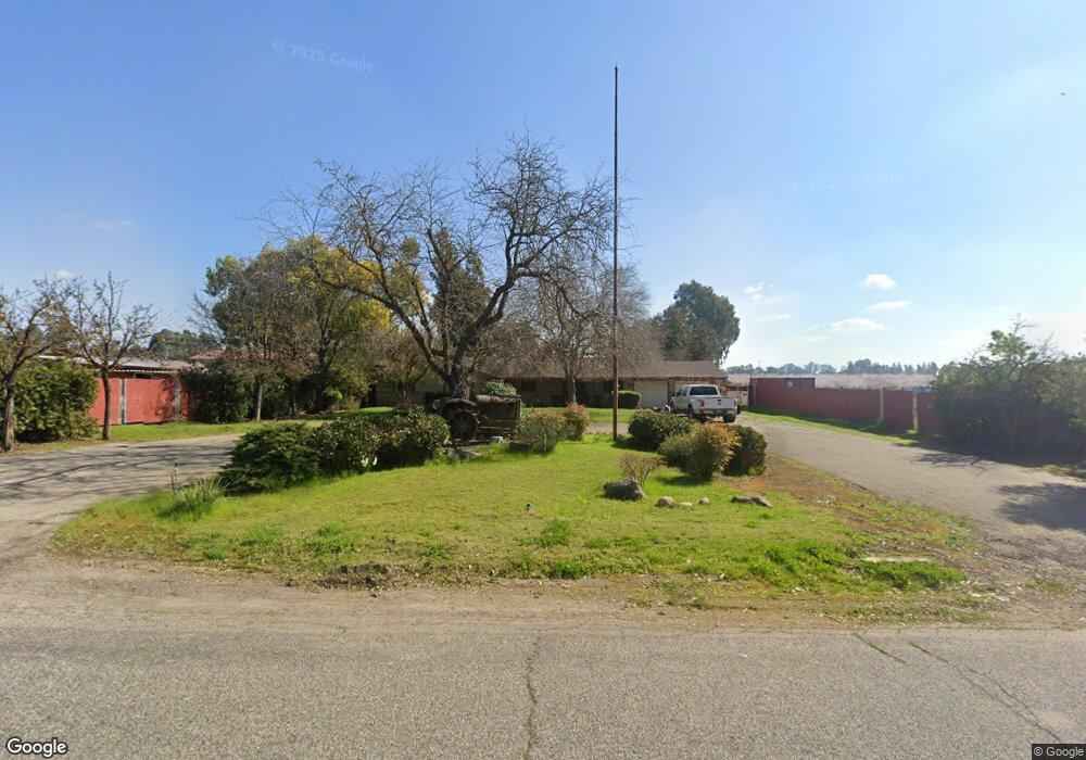
5036 Amber Ave Clovis, CA 93619
Estimated Value: $682,572 - $853,000
3
Beds
2
Baths
1,711
Sq Ft
$462/Sq Ft
Est. Value
About This Home
This home is located at 5036 Amber Ave, Clovis, CA 93619 and is currently estimated at $790,191, approximately $461 per square foot. 5036 Amber Ave is a home located in Fresno County with nearby schools including Cedarwood Elementary School, Clark Intermediate School, and Clovis High School.
Ownership History
Date
Name
Owned For
Owner Type
Purchase Details
Closed on
Sep 12, 2022
Sold by
Blevins Daniel M and Flores Patricia A
Bought by
Daniel M Blevins And Patricia A Flores Revoca and Blevins
Current Estimated Value
Purchase Details
Closed on
Jun 15, 1999
Sold by
Gallagher William A
Bought by
Blevins Daniel M and Flores Patty
Home Financials for this Owner
Home Financials are based on the most recent Mortgage that was taken out on this home.
Original Mortgage
$165,200
Interest Rate
7.05%
Create a Home Valuation Report for This Property
The Home Valuation Report is an in-depth analysis detailing your home's value as well as a comparison with similar homes in the area
Purchase History
| Date | Buyer | Sale Price | Title Company |
|---|---|---|---|
| Daniel M Blevins And Patricia A Flores Revoca | -- | None Listed On Document | |
| Blevins Daniel M | $206,500 | Chicago Title Co |
Source: Public Records
Mortgage History
| Date | Status | Borrower | Loan Amount |
|---|---|---|---|
| Previous Owner | Blevins Daniel M | $165,200 | |
| Closed | Blevins Daniel M | $20,650 |
Source: Public Records
Tax History
| Year | Tax Paid | Tax Assessment Tax Assessment Total Assessment is a certain percentage of the fair market value that is determined by local assessors to be the total taxable value of land and additions on the property. | Land | Improvement |
|---|---|---|---|---|
| 2025 | $3,734 | $323,707 | $133,243 | $190,464 |
| 2023 | $3,589 | $311,139 | $128,070 | $183,069 |
| 2022 | $3,540 | $305,039 | $125,559 | $179,480 |
| 2021 | $3,439 | $299,059 | $123,098 | $175,961 |
| 2020 | $3,425 | $295,993 | $121,836 | $174,157 |
| 2019 | $3,356 | $290,191 | $119,448 | $170,743 |
| 2018 | $3,281 | $284,502 | $117,106 | $167,396 |
| 2017 | $3,224 | $278,924 | $114,810 | $164,114 |
| 2016 | $3,113 | $273,456 | $112,559 | $160,897 |
| 2015 | $3,064 | $269,350 | $110,869 | $158,481 |
| 2014 | $3,006 | $264,075 | $108,698 | $155,377 |
Source: Public Records
Map
Nearby Homes
- 11078 Sawtooth Peak Way
- 4769 N Emerald Peak Dr
- 4674 N Arrow Ridge Way
- 4626 N Arrow Ridge Way
- 10588 E Fieldstone Ave
- 10952 E Promontory Way
- 10595 E San Felipe Ave
- 4249 N Waterside Dr
- 4199 N Quail Crossing
- 4133 N Morro Bay
- 4588 N Mccall Ave
- 6090 Amber Ave
- 12000 E Shaw Ave
- 6345 N Bethel Ave
- 3520 N Bethel Ave
- 3215 Lourdes Ave
- 11236 E Herndon Ave
- 3301 La Mirada Ave
- 2468 Montana Ave
- 4245 Fairmont Ave
- 5090 Amber Ave
- 5037 Amber Ave
- 5037 Amber Ave
- 11094 E Greenbury Way
- 11082 E Greenbury Way
- 11070 E Greenbury Way
- 5089 Amber Ave
- 11087 E Greenbury Way
- 11058 E Greenbury Way
- 11081 E Greenbury Way
- 5151 Amber Ave
- 11046 E Greenbury Way
- 11069 E Greenbury Way
- 5152 Amber Ave
- 11090 Sawtooth Peak Way
- 11034 E Greenbury Way
- 11057 E Greenbury Way
- 11045 E Greenbury Way
- 11022 E Greenbury Way
- 11066 Sawtooth Peak Way
Your Personal Tour Guide
Ask me questions while you tour the home.