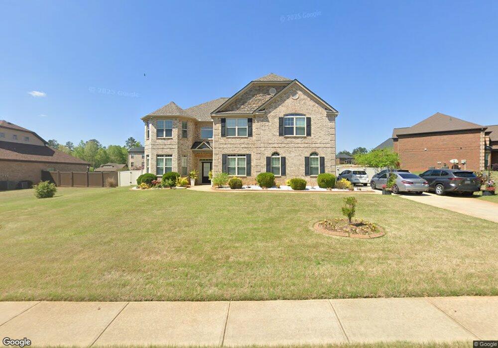
505 Aerial Ave Stockbridge, GA 30281
Estimated Value: $533,414 - $585,000
5
Beds
4
Baths
4,764
Sq Ft
$116/Sq Ft
Est. Value
About This Home
This home is located at 505 Aerial Ave, Stockbridge, GA 30281 and is currently estimated at $552,854, approximately $116 per square foot. 505 Aerial Ave is a home with nearby schools including Woodland Elementary School, Woodland Middle School, and Woodland High School.
Ownership History
Date
Name
Owned For
Owner Type
Purchase Details
Closed on
Jan 21, 2014
Sold by
Jefferson Homes Inc
Bought by
Tran Thanh Phong Nguyen and Le Nguyen Ngoc Thuy
Current Estimated Value
Home Financials for this Owner
Home Financials are based on the most recent Mortgage that was taken out on this home.
Original Mortgage
$205,900
Outstanding Balance
$156,156
Interest Rate
4.51%
Mortgage Type
New Conventional
Estimated Equity
$396,698
Create a Home Valuation Report for This Property
The Home Valuation Report is an in-depth analysis detailing your home's value as well as a comparison with similar homes in the area
Home Values in the Area
Average Home Value in this Area
Purchase History
| Date | Buyer | Sale Price | Title Company |
|---|---|---|---|
| Tran Thanh Phong Nguyen | $274,602 | -- |
Source: Public Records
Mortgage History
| Date | Status | Borrower | Loan Amount |
|---|---|---|---|
| Open | Tran Thanh Phong Nguyen | $205,900 |
Source: Public Records
Tax History Compared to Growth
Tax History
| Year | Tax Paid | Tax Assessment Tax Assessment Total Assessment is a certain percentage of the fair market value that is determined by local assessors to be the total taxable value of land and additions on the property. | Land | Improvement |
|---|---|---|---|---|
| 2025 | $6,846 | $225,600 | $20,000 | $205,600 |
| 2024 | $6,846 | $206,320 | $20,000 | $186,320 |
| 2023 | $5,967 | $205,800 | $16,000 | $189,800 |
| 2022 | $5,476 | $163,640 | $16,000 | $147,640 |
| 2021 | $5,088 | $147,240 | $16,000 | $131,240 |
| 2020 | $4,990 | $143,080 | $14,000 | $129,080 |
| 2019 | $4,877 | $138,320 | $12,000 | $126,320 |
| 2018 | $4,717 | $131,520 | $12,000 | $119,520 |
| 2016 | $4,524 | $123,360 | $12,000 | $111,360 |
| 2015 | $4,384 | $109,841 | $9,117 | $100,724 |
| 2014 | $2,830 | $69,720 | $10,000 | $59,720 |
Source: Public Records
Map
Nearby Homes
- 116 Way Point Dr
- 405 Tatum Terrace
- 100 Kim Trail
- 825 Bufflehead Ct
- 1493 Harlequin Way
- 1548 Harlequin Way
- 1009 Moseley Rd
- 1001 Moseley Rd
- 242 Summerford Place
- 551 Hood Rd
- 0 W Hemphill Rd Unit 10295429
- 0 W Hemphill Rd Unit 10536232
- 2581 Union Church Rd SW
- 278 Sound Cir
- 286 Sound Cir
- 120 Montgomery Dr
- 104 Montgomery Dr
- 544 Highway 138 E
- 468 Highway 138 E
- 164 Mckenzie Ct
- 454 Aerial Ave Unit 73
- 125 Way Point Dr
- 517 Aerial Ave
- 404 Tatum Terrace
- 400 Tatum Terrace
- 521 Aerial Ave
- 504 Aerial Ave
- 133 Way Point Dr
- 508 Aerial Ave
- 512 Aerial Ave
- 120 Waypoint Dr Unit LOT 46
- 124 Way Point Dr
- 516 Aerial Ave Unit LOT 21
- 516 Aerial Ave
- 120 Way Point Dr Unit 46
- 128 Way Point Dr
- 116 Waypoint Dr Unit LOT 45
- 132 Waypoint Dr Unit LOT 49
- 116 Way Point Dr Unit 45
- 520 Aerial Ave Unit LOT 20