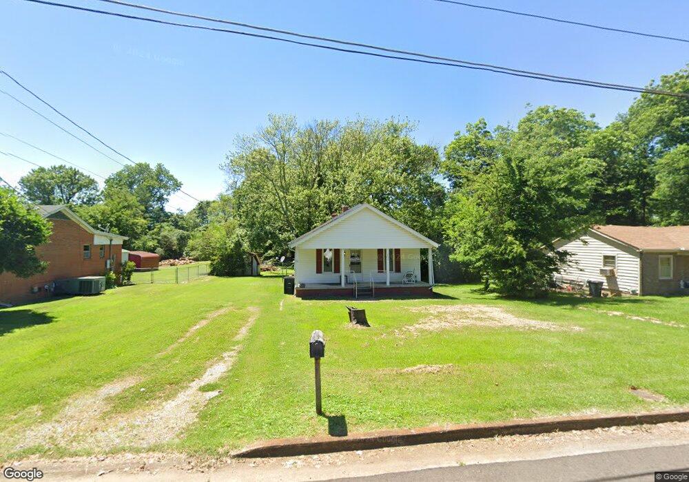
507 S 7th St Union City, TN 38261
Estimated Value: $75,095 - $108,000
--
Bed
1
Bath
960
Sq Ft
$95/Sq Ft
Est. Value
About This Home
This home is located at 507 S 7th St, Union City, TN 38261 and is currently estimated at $91,274, approximately $95 per square foot. 507 S 7th St is a home located in Obion County with nearby schools including Union City Elementary School, Union City Middle School, and Union City High School.
Ownership History
Date
Name
Owned For
Owner Type
Purchase Details
Closed on
Jan 6, 2015
Sold by
Mickens Robert Ray
Bought by
Mink Larry and Mink Cheryl
Current Estimated Value
Purchase Details
Closed on
Jun 3, 2011
Sold by
Mickens Wanda Kay
Bought by
Mickens Robert Ray
Purchase Details
Closed on
Sep 28, 1995
Bought by
Ray Mickens Robert
Purchase Details
Closed on
Jun 28, 1991
Bought by
Rice Stephen Lee and Rice Lynda L
Purchase Details
Closed on
Aug 17, 1989
Bought by
Hopkins Steve A and Hopkins Mitzi J
Purchase Details
Closed on
Jan 1, 1984
Bought by
Craig Rozanne
Purchase Details
Closed on
Nov 30, 1977
Create a Home Valuation Report for This Property
The Home Valuation Report is an in-depth analysis detailing your home's value as well as a comparison with similar homes in the area
Home Values in the Area
Average Home Value in this Area
Purchase History
| Date | Buyer | Sale Price | Title Company |
|---|---|---|---|
| Mink Larry | $27,000 | -- | |
| Mickens Robert Ray | -- | -- | |
| Ray Mickens Robert | $25,323 | -- | |
| Rice Stephen Lee | $21,000 | -- | |
| Hopkins Steve A | $17,500 | -- | |
| Craig Rozanne | -- | -- | |
| -- | -- | -- |
Source: Public Records
Tax History Compared to Growth
Tax History
| Year | Tax Paid | Tax Assessment Tax Assessment Total Assessment is a certain percentage of the fair market value that is determined by local assessors to be the total taxable value of land and additions on the property. | Land | Improvement |
|---|---|---|---|---|
| 2025 | -- | $14,825 | $0 | $0 |
| 2024 | -- | $14,275 | $2,750 | $11,525 |
| 2023 | $400 | $14,275 | $2,750 | $11,525 |
| 2022 | $148 | $9,250 | $2,750 | $6,500 |
| 2021 | $145 | $9,250 | $2,750 | $6,500 |
| 2020 | $148 | $9,250 | $2,750 | $6,500 |
| 2019 | $344 | $9,250 | $2,750 | $6,500 |
| 2018 | $342 | $9,250 | $2,750 | $6,500 |
| 2017 | $342 | $9,000 | $2,750 | $6,250 |
| 2016 | $342 | $9,000 | $2,750 | $6,250 |
| 2015 | $341 | $9,000 | $2,750 | $6,250 |
| 2014 | $341 | $9,000 | $2,750 | $6,250 |
Source: Public Records
Map
Nearby Homes
- 605 S 5th St
- 616 S 3rd St
- 422-426 430 W Jackson St
- 1129 S 4th St
- 610 Perkins St
- 0 Vaden St
- 501 N 1st St
- 901 S Home St
- 633 E Jackson St
- 803 E Main St
- 817 Exchange St
- 724 E Martin Luther King
- 922 N Division St
- 210 Graham St
- 713 Nelson St
- 803 Nelson St
- 1009 E Cheatham St
- 0 S Miles Ave Unit 41030
- 1319 Honeysuckle Dr
- 2703 Salem Dr