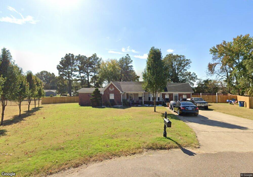
507 W Robin Cove Covington, TN 38019
Estimated Value: $143,000 - $254,670
--
Bed
2
Baths
1,844
Sq Ft
$99/Sq Ft
Est. Value
About This Home
This home is located at 507 W Robin Cove, Covington, TN 38019 and is currently estimated at $183,418, approximately $99 per square foot. 507 W Robin Cove is a home located in Tipton County with nearby schools including Crestview Elementary School, Crestview Middle School, and Covington High School.
Ownership History
Date
Name
Owned For
Owner Type
Purchase Details
Closed on
Sep 22, 2017
Sold by
Mason Teresa Henderson Jennie
Bought by
Mason Teresa Etvir and Henderson Jennie
Current Estimated Value
Purchase Details
Closed on
Aug 8, 1997
Sold by
Coulston R L & Sons Inc
Bought by
Teresa Mason
Purchase Details
Closed on
Oct 2, 1996
Bought by
Coulston R L & Sons Inc
Purchase Details
Closed on
Dec 28, 1989
Bought by
Hall Jack S and Hall Jean T
Purchase Details
Closed on
May 13, 1983
Bought by
Baskin S J
Create a Home Valuation Report for This Property
The Home Valuation Report is an in-depth analysis detailing your home's value as well as a comparison with similar homes in the area
Home Values in the Area
Average Home Value in this Area
Purchase History
| Date | Buyer | Sale Price | Title Company |
|---|---|---|---|
| Mason Teresa Etvir | -- | -- | |
| Smith John | -- | -- | |
| Teresa Mason | $72,000 | -- | |
| Coulston R L & Sons Inc | $16,000 | -- | |
| Hall Jack S | -- | -- | |
| Baskin S J | -- | -- |
Source: Public Records
Tax History Compared to Growth
Tax History
| Year | Tax Paid | Tax Assessment Tax Assessment Total Assessment is a certain percentage of the fair market value that is determined by local assessors to be the total taxable value of land and additions on the property. | Land | Improvement |
|---|---|---|---|---|
| 2024 | $1,166 | $46,025 | $4,250 | $41,775 |
| 2023 | $1,166 | $46,025 | $4,250 | $41,775 |
| 2022 | $1,055 | $32,175 | $3,125 | $29,050 |
| 2021 | $1,056 | $32,175 | $3,125 | $29,050 |
| 2020 | $1,055 | $32,175 | $3,125 | $29,050 |
| 2019 | $1,110 | $29,600 | $3,125 | $26,475 |
| 2018 | $948 | $29,600 | $3,125 | $26,475 |
| 2017 | $948 | $25,300 | $3,125 | $22,175 |
| 2016 | $948 | $25,300 | $3,125 | $22,175 |
| 2015 | $948 | $25,300 | $3,125 | $22,175 |
| 2014 | $948 | $25,306 | $0 | $0 |
Source: Public Records
Map
Nearby Homes
- 1517 Michael St
- 1186 U S 51
- 0 U S 51 S
- 0 Hwy 51
- LOT 2 Oil Mill Rd
- 1728 Oil Mill Rd
- 004 Oil Mill Rd
- 1 Oil Mill Rd
- 845 Antioch Hwy 51 Rd
- 000 Davis St
- 902 Hatchie Ave
- 900 Peete St
- 117 E Ripley Ave
- 325 Baxter Ave Unit 327
- 320 N Maple St
- 406 E Pleasant Ave
- 0 N Munford St Unit 10156264
- 0 N Munford St Unit 10156263
- 107 W Pleasant Ave
- 212 S Tipton St
- 518 W Robin Cove
- 520 Wortham Rd
- 1519 Cardinal Dr
- 512 Wortham Rd
- 1513 Cardinal Dr
- 510 W Robin Cove
- 506 Wortham Rd
- 502 W Robin Cove
- 500 Wortham Rd
- 1609 Cardinal Dr
- 207 Dove Cove W
- 1706 Cardinal Dr
- 1506 Cardinal Dr
- 1518 Cardinal Dr
- 1512 Cardinal Dr
- 203 Dove Cove W
- 410 Wortham Rd
- 424 E Robin Cir
- 211 Dove Cove W
- 108 W Dove Cove