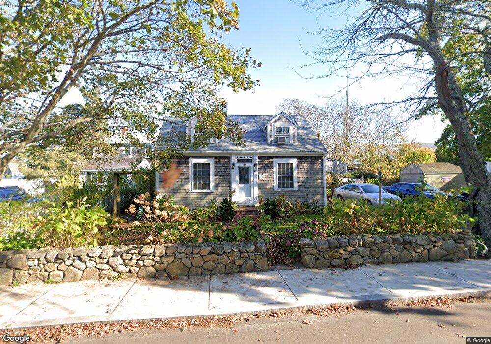
51 Robinson Rd Edgartown, MA 02539
Edgartown NeighborhoodEstimated Value: $1,644,000 - $1,743,000
2
Beds
2
Baths
1,386
Sq Ft
$1,212/Sq Ft
Est. Value
About This Home
This home is located at 51 Robinson Rd, Edgartown, MA 02539 and is currently estimated at $1,679,272, approximately $1,211 per square foot. 51 Robinson Rd is a home located in Dukes County with nearby schools including Edgartown Elementary School and Martha's Vineyard Regional High School.
Ownership History
Date
Name
Owned For
Owner Type
Purchase Details
Closed on
Jan 11, 1989
Bought by
Case Ralph C and Case Kathleen N
Current Estimated Value
Create a Home Valuation Report for This Property
The Home Valuation Report is an in-depth analysis detailing your home's value as well as a comparison with similar homes in the area
Home Values in the Area
Average Home Value in this Area
Purchase History
| Date | Buyer | Sale Price | Title Company |
|---|---|---|---|
| Case Ralph C | -- | -- |
Source: Public Records
Mortgage History
| Date | Status | Borrower | Loan Amount |
|---|---|---|---|
| Open | Case Ralph C | $33,543 | |
| Closed | Case Ralph C | $49,280 | |
| Open | Case Ralph C | $163,000 |
Source: Public Records
Tax History
| Year | Tax Paid | Tax Assessment Tax Assessment Total Assessment is a certain percentage of the fair market value that is determined by local assessors to be the total taxable value of land and additions on the property. | Land | Improvement |
|---|---|---|---|---|
| 2025 | $2,629 | $992,100 | $482,300 | $509,800 |
| 2024 | $2,354 | $923,200 | $482,300 | $440,900 |
| 2023 | $2,301 | $913,000 | $497,600 | $415,400 |
| 2022 | $2,303 | $760,000 | $497,600 | $262,400 |
| 2021 | $2,206 | $672,500 | $429,200 | $243,300 |
| 2020 | $2,094 | $625,000 | $394,400 | $230,600 |
| 2019 | $2,374 | $613,400 | $382,800 | $230,600 |
| 2018 | $1,978 | $511,000 | $343,500 | $167,500 |
| 2017 | $1,935 | $545,100 | $366,400 | $178,700 |
| 2016 | $1,780 | $491,800 | $332,100 | $159,700 |
| 2015 | $1,585 | $456,700 | $290,700 | $166,000 |
Source: Public Records
Map
Nearby Homes
- 23 Pinehurst Rd
- 99 Cooke St
- 38 Pinehurst Rd
- 43 Peases Point Way S
- 32 Norton Orchard Rd
- 10 Peases Point Way N
- 69 School St
- 5 Louis Field Rd Unit 121.3
- 5 Louis Field Rd
- 52 S Summer St
- 44 Plantingfield Way Unit 2
- 44 Plantingfield Way
- 35 Mariners Way
- 23 Beetle Swamp Rd
- 68 N Water St
- 90 Schoolhouse Rd
- 14 Trapps Pond Rd
- 43C Dark Woods Rd
- 19 Kitts Field Cir
- 114 N Water St
- 50 W Tisbury Rd
- 47 Robinson Rd
- 44 W Tisbury Rd
- 52 Robinson Rd
- 58 W Tisbury Rd
- 45 W Tisbury Rd
- 51 W Tisbury Rd
- 51 Edgartown - West Tisbury Rd
- 43 W Tisbury Rd
- 39 Edgartown - West Tisbury Rd
- 39 W Tisbury Rd
- 49 W Tisbury Rd
- 52 and 56 Robinson Rd
- 37 W Tisbury Rd
- 60 W Tisbury Rd
- 56 Robinson Rd
- 10 Pine Tree Ln
- 12 Pine Tree Ln
- 12 Pine Tree Ln Unit 3B
- 10 Pine Tree Ln Unit 3A
Your Personal Tour Guide
Ask me questions while you tour the home.