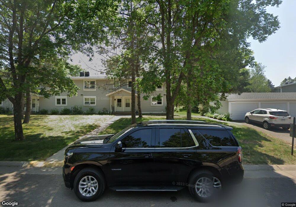
510 Selfridge Dr Unit 58D Duluth, MN 55811
Kenwood NeighborhoodEstimated Value: $235,000 - $239,000
3
Beds
2
Baths
1,152
Sq Ft
$206/Sq Ft
Est. Value
About This Home
This home is located at 510 Selfridge Dr Unit 58D, Duluth, MN 55811 and is currently estimated at $237,436, approximately $206 per square foot. 510 Selfridge Dr Unit 58D is a home located in St. Louis County with nearby schools including Lowell Elementary School, Lincoln Park Middle School, and Denfeld High School.
Ownership History
Date
Name
Owned For
Owner Type
Purchase Details
Closed on
Jul 31, 2001
Sold by
Mold Margaret V
Bought by
Lunde Dale L and Lunde Marcia J
Current Estimated Value
Home Financials for this Owner
Home Financials are based on the most recent Mortgage that was taken out on this home.
Original Mortgage
$71,000
Interest Rate
7.15%
Create a Home Valuation Report for This Property
The Home Valuation Report is an in-depth analysis detailing your home's value as well as a comparison with similar homes in the area
Home Values in the Area
Average Home Value in this Area
Purchase History
| Date | Buyer | Sale Price | Title Company |
|---|---|---|---|
| Lunde Dale L | $89,000 | -- |
Source: Public Records
Mortgage History
| Date | Status | Borrower | Loan Amount |
|---|---|---|---|
| Previous Owner | Lunde Dale L | $71,000 |
Source: Public Records
Tax History Compared to Growth
Tax History
| Year | Tax Paid | Tax Assessment Tax Assessment Total Assessment is a certain percentage of the fair market value that is determined by local assessors to be the total taxable value of land and additions on the property. | Land | Improvement |
|---|---|---|---|---|
| 2024 | $3,126 | $227,000 | $22,000 | $205,000 |
| 2023 | $3,126 | $208,100 | $22,000 | $186,100 |
| 2022 | $2,288 | $176,300 | $21,300 | $155,000 |
| 2021 | $2,068 | $137,900 | $20,500 | $117,400 |
| 2020 | $1,900 | $137,900 | $20,500 | $117,400 |
| 2019 | $1,738 | $125,200 | $18,400 | $106,800 |
| 2018 | $1,622 | $116,100 | $18,000 | $98,100 |
| 2017 | $1,610 | $116,100 | $18,000 | $98,100 |
| 2016 | $1,572 | $0 | $0 | $0 |
| 2015 | $1,500 | $95,400 | $15,100 | $80,300 |
| 2014 | $1,500 | $95,400 | $15,100 | $80,300 |
Source: Public Records
Map
Nearby Homes
- 802 Hamilton Dr Unit 34D
- 341 Madison Ave Unit 12B
- 1802 Rice Lake Rd
- 1804 Rice Lake Rd
- 332 Hickory St
- 110 W Toledo St
- 205 Bluff's Ridge Ct
- 323 Plum St
- 1917 Stanford Ave
- 1426 Cliff Ave
- 48 E Buffalo St
- XXX N Basswood Ave
- 206 E Gilead St
- 324 Wildwood Dr
- 1229 W Arrowhead Rd
- 311 W Rainbow St
- 1919 Middle Ln
- 111 E Myrtle St
- 908 E Skyline Pkwy
- 1950 Middle Ln
- 512 Selfridge Dr
- 502 Madison Ave Unit 59A
- 514 Selfridge Dr Unit 58B
- 504 Madison Ave Unit 59B
- 506 Madison Ave
- 509 Selfridge Dr Unit 44A
- 509 Selfridge Dr Unit 1
- 508 Madison Ave Unit 59D
- 511 Selfridge Dr Unit 44B
- 516 Selfridge Dr Unit 58A
- 531 Selfridge Dr Unit 42D
- 513 Selfridge Dr Unit 44C
- 529 Selfridge Dr Unit 42C
- 515 Selfridge Dr
- 801 Hamilton Dr Unit 60A
- 805 Hamilton Dr
- 527 Selfridge Dr Unit 42B
- 807 Hamilton Dr Unit 60D
- 803 Hamilton Dr
- 525 Selfridge Dr Unit 42A