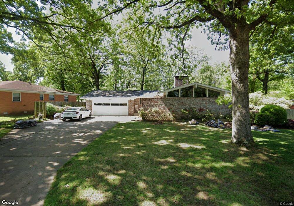
511 E Devon Ave Sherwood, AR 72120
Estimated Value: $182,000 - $203,000
Studio
2
Baths
1,433
Sq Ft
$132/Sq Ft
Est. Value
About This Home
This home is located at 511 E Devon Ave, Sherwood, AR 72120 and is currently estimated at $188,786, approximately $131 per square foot. 511 E Devon Ave is a home located in Pulaski County with nearby schools including Sherwood Elementary School, Sylvan Hills Middle School, and Sylvan Hills High School.
Ownership History
Date
Name
Owned For
Owner Type
Purchase Details
Closed on
Aug 15, 2000
Sold by
Wenzel Heinz K W and Wenzel Eleonora
Bought by
Dickerson Jay T and Dickerson Tina M
Current Estimated Value
Home Financials for this Owner
Home Financials are based on the most recent Mortgage that was taken out on this home.
Original Mortgage
$110,800
Outstanding Balance
$40,175
Interest Rate
8.22%
Mortgage Type
FHA
Estimated Equity
$148,611
Create a Home Valuation Report for This Property
The Home Valuation Report is an in-depth analysis detailing your home's value as well as a comparison with similar homes in the area
Home Values in the Area
Average Home Value in this Area
Purchase History
| Date | Buyer | Sale Price | Title Company |
|---|---|---|---|
| Dickerson Jay T | $111,000 | American Abstract & Title Co |
Source: Public Records
Mortgage History
| Date | Status | Borrower | Loan Amount |
|---|---|---|---|
| Open | Dickerson Jay T | $110,800 |
Source: Public Records
Tax History
| Year | Tax Paid | Tax Assessment Tax Assessment Total Assessment is a certain percentage of the fair market value that is determined by local assessors to be the total taxable value of land and additions on the property. | Land | Improvement |
|---|---|---|---|---|
| 2025 | $1,537 | $33,283 | $6,200 | $27,083 |
| 2024 | $1,409 | $33,283 | $6,200 | $27,083 |
| 2023 | $1,409 | $33,283 | $6,200 | $27,083 |
| 2022 | $1,516 | $33,283 | $6,200 | $27,083 |
| 2021 | $1,403 | $24,580 | $4,800 | $19,780 |
| 2020 | $1,022 | $24,580 | $4,800 | $19,780 |
| 2019 | $1,022 | $24,580 | $4,800 | $19,780 |
| 2018 | $1,047 | $24,580 | $4,800 | $19,780 |
| 2017 | $1,046 | $24,580 | $4,800 | $19,780 |
| 2016 | $1,076 | $25,160 | $4,400 | $20,760 |
| 2015 | $996 | $24,663 | $4,400 | $20,263 |
| 2014 | $996 | $22,603 | $4,400 | $18,203 |
Source: Public Records
Map
Nearby Homes
- 715 Coulter Rd
- 304 Verona Ave
- 511 Wildwood Ave
- 307 S Claremont Ave
- 308 S Longfield Ave
- 304 S Longfield Ave
- 1205 Dyson Dr
- 305 Glenora Ave
- 105 Glenora Ave
- 1505 Hawkwood Rd
- 30 Campden Hill Rd
- 1503 Hawkwood Rd
- 10 Campden Hill Rd
- 1106 Abercorn Place
- 926 Karla Cir
- 1 Sherwood - Multi Package Properties Dr
- 1224 Cornflower Ln
- 200 Fork River Rd
- 101 Red River Dr
- 5916 N Hills Blvd
Your Personal Tour Guide
Ask me questions while you tour the home.