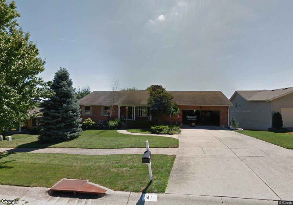
511 Leo Dr Hamilton, OH 45013
Estimated Value: $283,000 - $367,000
3
Beds
3
Baths
1,458
Sq Ft
$219/Sq Ft
Est. Value
About This Home
This home is located at 511 Leo Dr, Hamilton, OH 45013 and is currently estimated at $319,212, approximately $218 per square foot. 511 Leo Dr is a home located in Butler County with nearby schools including Bridgeport Elementary School, Wilson Middle School, and Hamilton High School Main Campus.
Ownership History
Date
Name
Owned For
Owner Type
Purchase Details
Closed on
Oct 12, 2006
Sold by
Richardson Marian K and Billings Marian K
Bought by
Billings Richard D and Billings Marian K
Current Estimated Value
Purchase Details
Closed on
Jul 3, 2000
Sold by
Schneider Lawrence N and Schneider Opha M
Bought by
Richardson Paul B and Richardson Marian K
Home Financials for this Owner
Home Financials are based on the most recent Mortgage that was taken out on this home.
Original Mortgage
$38,500
Interest Rate
8.64%
Mortgage Type
Purchase Money Mortgage
Create a Home Valuation Report for This Property
The Home Valuation Report is an in-depth analysis detailing your home's value as well as a comparison with similar homes in the area
Home Values in the Area
Average Home Value in this Area
Purchase History
| Date | Buyer | Sale Price | Title Company |
|---|---|---|---|
| Billings Richard D | -- | Attorney | |
| Richardson Paul B | $158,500 | Midland Title Security Inc |
Source: Public Records
Mortgage History
| Date | Status | Borrower | Loan Amount |
|---|---|---|---|
| Previous Owner | Richardson Paul B | $38,500 |
Source: Public Records
Tax History
| Year | Tax Paid | Tax Assessment Tax Assessment Total Assessment is a certain percentage of the fair market value that is determined by local assessors to be the total taxable value of land and additions on the property. | Land | Improvement |
|---|---|---|---|---|
| 2025 | $3,680 | $96,690 | $11,340 | $85,350 |
| 2024 | $3,680 | $96,690 | $11,340 | $85,350 |
| 2023 | $3,676 | $96,690 | $11,340 | $85,350 |
| 2022 | $2,944 | $67,160 | $11,340 | $55,820 |
| 2021 | $2,539 | $64,810 | $11,340 | $53,470 |
| 2020 | $2,645 | $64,810 | $11,340 | $53,470 |
| 2019 | $4,398 | $60,070 | $11,350 | $48,720 |
| 2018 | $2,386 | $60,070 | $11,350 | $48,720 |
| 2017 | $2,406 | $60,070 | $11,350 | $48,720 |
| 2016 | $2,240 | $54,280 | $11,350 | $42,930 |
| 2015 | $2,228 | $54,280 | $11,350 | $42,930 |
| 2014 | $2,015 | $54,280 | $11,350 | $42,930 |
| 2013 | $2,015 | $52,610 | $10,830 | $41,780 |
Source: Public Records
Map
Nearby Homes
- 850 NW Washington Blvd
- 1319 Peregrine Way
- 1325 Peregrine Way
- 1331 Peregrine Way
- 124 Gregory Ln
- 1460 Lawrence Ave
- 548 Shultz Dr
- 1365 Taft Place
- 1401 Park Ave
- 900 N Lawn Ave
- 177 Thomas Blvd
- 1420 Alexander Dr
- 146 Winston Dr
- 1210 Stephanie Dr
- 1210 Stephanie Dr Unit 3
- 1192 Deerfield Cir Unit 35
- 46 Lexington Dr
- 1263 Park Ave
- 938 N F St
- 3 Amanda Ct
Your Personal Tour Guide
Ask me questions while you tour the home.