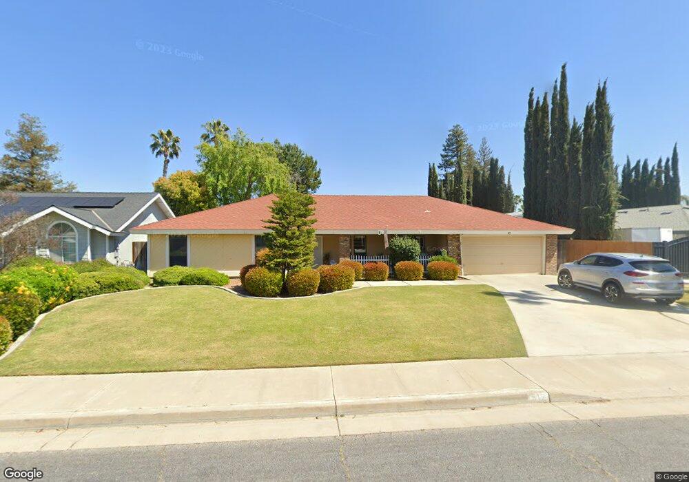
512 Marylhurst St Bakersfield, CA 93314
Estimated Value: $404,000 - $463,000
3
Beds
2
Baths
1,600
Sq Ft
$263/Sq Ft
Est. Value
About This Home
This home is located at 512 Marylhurst St, Bakersfield, CA 93314 and is currently estimated at $421,125, approximately $263 per square foot. 512 Marylhurst St is a home located in Kern County with nearby schools including Del Rio Elementary School, Rosedale Middle School, and Liberty High School.
Ownership History
Date
Name
Owned For
Owner Type
Purchase Details
Closed on
Aug 27, 2007
Sold by
Havener Terry L and Havener Carolyn D
Bought by
Havener Terry L and Havener Carolyn D
Current Estimated Value
Purchase Details
Closed on
Jul 29, 2003
Sold by
Havener Terry L and Havener Carolyn D
Bought by
Havener Terry L and Havener Carolyn D
Home Financials for this Owner
Home Financials are based on the most recent Mortgage that was taken out on this home.
Original Mortgage
$63,000
Interest Rate
5.17%
Mortgage Type
Purchase Money Mortgage
Purchase Details
Closed on
May 24, 1994
Sold by
Havener Terry L and Havener Carolyn D
Bought by
Havener Terry L and Havener Carolyn D
Create a Home Valuation Report for This Property
The Home Valuation Report is an in-depth analysis detailing your home's value as well as a comparison with similar homes in the area
Home Values in the Area
Average Home Value in this Area
Purchase History
| Date | Buyer | Sale Price | Title Company |
|---|---|---|---|
| Havener Terry L | -- | None Available | |
| Havener Terry L | -- | Chicago Title | |
| Havener Terry L | -- | Chicago Title | |
| Havener Terry L | -- | -- |
Source: Public Records
Mortgage History
| Date | Status | Borrower | Loan Amount |
|---|---|---|---|
| Closed | Havener Terry L | $63,000 |
Source: Public Records
Tax History Compared to Growth
Tax History
| Year | Tax Paid | Tax Assessment Tax Assessment Total Assessment is a certain percentage of the fair market value that is determined by local assessors to be the total taxable value of land and additions on the property. | Land | Improvement |
|---|---|---|---|---|
| 2025 | $2,705 | $210,996 | $63,111 | $147,885 |
| 2024 | $2,642 | $206,860 | $61,874 | $144,986 |
| 2023 | $2,642 | $202,805 | $60,661 | $142,144 |
| 2022 | $2,591 | $198,829 | $59,472 | $139,357 |
| 2021 | $2,476 | $194,931 | $58,306 | $136,625 |
| 2020 | $2,421 | $192,934 | $57,709 | $135,225 |
| 2019 | $2,373 | $192,934 | $57,709 | $135,225 |
| 2018 | $2,313 | $185,444 | $55,469 | $129,975 |
| 2017 | $2,273 | $181,809 | $54,382 | $127,427 |
| 2016 | $2,132 | $178,245 | $53,316 | $124,929 |
| 2015 | $2,096 | $175,569 | $52,516 | $123,053 |
| 2014 | $2,048 | $172,131 | $51,488 | $120,643 |
Source: Public Records
Map
Nearby Homes
- 501 Reed St
- 15829 Cole Brook Ct
- 13408 Frenchglen Ave
- 13301 Birkenfeld Ave
- 13900 San Lazaro Ave
- 601 Las Arenas Ct
- 14004 San Lazaro Ave
- 13506 Morocco Ave
- 201 El Paso Rd
- 306 Portola Ct
- 13904 Las Entradas
- 14008 Las Entradas
- 12811 Woodson Bridge Dr
- 12411 Riverfront Park Dr
- 14016 Las Entradas
- 14308 San Jose Ave
- 12512 Cheswolde Dr
- 12608 Fallstaff Ln
- 304 Calle Lechuga
- 508 Marylhurst St
- 600 Marylhurst St
- 517 Reed St
- 601 Reed St
- 513 Reed St
- 504 Marylhurst St
- 604 Marylhurst St
- 605 Reed St
- 513 Marylhurst St
- 509 Reed St
- 601 Marylhurst St
- 509 Marylhurst St
- 605 Marylhurst St
- 500 Marylhurst St
- 608 Marylhurst St
- 609 Reed St
- 505 Reed St
- 505 Marylhurst St
- 609 Marylhurst St
- 613 Reed St