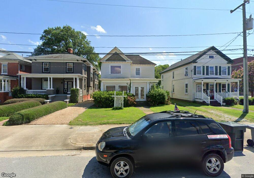
514 Settlers Landing Rd Hampton, VA 23669
Victoria Boulevard Historic District NeighborhoodEstimated Value: $184,000 - $257,000
3
Beds
2
Baths
1,572
Sq Ft
$136/Sq Ft
Est. Value
About This Home
This home is located at 514 Settlers Landing Rd, Hampton, VA 23669 and is currently estimated at $214,183, approximately $136 per square foot. 514 Settlers Landing Rd is a home located in Hampton City with nearby schools including Mary S. Peake Elementary School, C. Alton Lindsay Middle School, and Phoebus High School.
Ownership History
Date
Name
Owned For
Owner Type
Purchase Details
Closed on
Apr 9, 2025
Sold by
Mccarthy Robert and Mccarthy Paulette
Bought by
514Rpnaj Llc
Current Estimated Value
Purchase Details
Closed on
Apr 14, 2023
Sold by
Fortuna Frank W
Bought by
Mccarthy Robert and Mccarthy Paulette
Purchase Details
Closed on
May 30, 2022
Sold by
Fore Richard Daniel
Bought by
Fore Richard Daniel and Fortuna Frank W
Purchase Details
Closed on
Jan 28, 2003
Sold by
Hampton Redev And Housing
Bought by
Fore Richard
Create a Home Valuation Report for This Property
The Home Valuation Report is an in-depth analysis detailing your home's value as well as a comparison with similar homes in the area
Home Values in the Area
Average Home Value in this Area
Purchase History
| Date | Buyer | Sale Price | Title Company |
|---|---|---|---|
| 514Rpnaj Llc | -- | None Listed On Document | |
| Mccarthy Robert | $145,000 | Chicago Title | |
| Fore Richard Daniel | -- | Bentley Maryanna G | |
| Fore Richard | $50,000 | -- |
Source: Public Records
Tax History Compared to Growth
Tax History
| Year | Tax Paid | Tax Assessment Tax Assessment Total Assessment is a certain percentage of the fair market value that is determined by local assessors to be the total taxable value of land and additions on the property. | Land | Improvement |
|---|---|---|---|---|
| 2025 | $2,050 | $143,100 | $68,500 | $74,600 |
| 2024 | $1,850 | $160,900 | $62,500 | $98,400 |
| 2023 | $1,866 | $160,900 | $59,900 | $101,000 |
| 2022 | $1,899 | $160,900 | $59,900 | $101,000 |
| 2021 | $2,286 | $160,900 | $59,900 | $101,000 |
| 2020 | $1,867 | $150,600 | $53,500 | $97,100 |
| 2019 | $1,867 | $150,600 | $53,500 | $97,100 |
| 2018 | $2,263 | $150,600 | $53,500 | $97,100 |
| 2017 | $2,263 | $0 | $0 | $0 |
| 2016 | $2,263 | $150,600 | $0 | $0 |
| 2015 | $2,263 | $0 | $0 | $0 |
| 2014 | $2,384 | $159,700 | $56,500 | $103,200 |
Source: Public Records
Map
Nearby Homes
- 217 S Armistead Ave
- 144 Meredith St
- 130 Meredith St
- 256 Lee St
- 116 Linden Ave
- 241 Newport News Ave
- 243 Newport News Ave
- 497 Bridge St
- 400 Lee St
- 410 Chapel St
- 4408 Victoria Blvd
- 408 Newport News Ave
- 430 Newport News Ave
- 363 W Queen St
- 429 Lee St
- 373 W Queen St
- 381 W Queen St
- 358 Lincoln St
- 35 Miles Cary Mews
- 30 Maplewood St
- 512 Settlers Landing Rd
- 516 Settlers Landing Rd
- 510 Settlers Landing Rd
- 518 Settlers Landing Rd
- 522 Settlers Landing Rd
- 500 Settlers Landing Rd
- 519 Settlers Landing Rd
- 524 Settlers Landing Rd
- 340 Old Hampton Ln
- 526 Settlers Landing Rd
- 37 S Armistead Ave
- 199 W Queen St
- 128 Whiting St
- 132 Whiting St
- 209 S Armistead Ave
- 551 Settlers Landing Rd
- 134 Whiting St
- 136 Whiting St
- 213 S Armistead Ave
- 530 Settlers Landing Rd