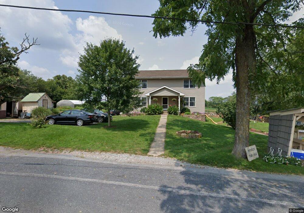
5140 Main Rd Union Bridge, MD 21791
Estimated Value: $421,000 - $533,084
Studio
2
Baths
2,560
Sq Ft
$180/Sq Ft
Est. Value
About This Home
This home is located at 5140 Main Rd, Union Bridge, MD 21791 and is currently estimated at $461,021, approximately $180 per square foot. 5140 Main Rd is a home located in Carroll County with nearby schools including Elmer A. Wolfe Elementary School, Northwest Middle School, and Francis Scott Key High School.
Ownership History
Date
Name
Owned For
Owner Type
Purchase Details
Closed on
Sep 14, 2004
Sold by
Mortgage Champion
Bought by
Hoover Marvin S and Hoover Marlene F
Current Estimated Value
Purchase Details
Closed on
May 4, 2004
Sold by
Pfoutz Todd Wayne
Bought by
Mortgage Champion
Purchase Details
Closed on
Jan 21, 1998
Sold by
Pfoutz Todd Wayne
Bought by
Pfoutz Todd Wayne and Pocock Susan K
Create a Home Valuation Report for This Property
The Home Valuation Report is an in-depth analysis detailing your home's value as well as a comparison with similar homes in the area
Purchase History
We collect this data history from publicly available records. To have your information removed, we recommend requesting removal directly through your county’s website.
| Date | Buyer | Sale Price | Title Company |
|---|---|---|---|
| Hoover Marvin S | $159,600 | -- | |
| Mortgage Champion | $150,831 | -- | |
| Pfoutz Todd Wayne | -- | -- |
Source: Public Records
Tax History
| Year | Tax Paid | Tax Assessment Tax Assessment Total Assessment is a certain percentage of the fair market value that is determined by local assessors to be the total taxable value of land and additions on the property. | Land | Improvement |
|---|---|---|---|---|
| 2025 | $4,279 | $376,767 | $0 | $0 |
| 2024 | $3,936 | $346,133 | $0 | $0 |
| 2023 | $3,593 | $315,500 | $124,100 | $191,400 |
| 2022 | $3,562 | $312,733 | $0 | $0 |
| 2021 | $7,245 | $309,967 | $0 | $0 |
| 2020 | $3,531 | $307,200 | $124,100 | $183,100 |
| 2019 | $3,494 | $303,933 | $0 | $0 |
| 2018 | $3,427 | $300,667 | $0 | $0 |
| 2017 | $3,390 | $297,400 | $0 | $0 |
| 2016 | -- | $297,400 | $0 | $0 |
| 2015 | -- | $170,900 | $0 | $0 |
| 2014 | -- | $170,900 | $0 | $0 |
Source: Public Records
Map
Nearby Homes
- 110 N Main St
- 14 Whyte St
- 302 E Thomas St
- 57B Hoff Rd
- 6245 Middleburg Rd
- 12763 Bunker Hill Rd
- 285 Stem Rd
- 0 Stem Rd
- 0 Crouse Mill
- 3875 Bark Hill Rd
- 837 Francis Scott Key Hwy
- 118 S Clear Ridge Rd
- 2051 Stover Rd
- 1309 Trevanion Rd
- 800 Trevanion Rd
- 12734 Woodsboro Pike
- 1935 Trevanion Rd
- 2175 Trevanion Rd
- 0 Muth Rd
- 7220 Middleburg Rd
- 5070 Main Rd
- 5170 Main Rd
- 125 Bucher John Rd
- 115 Bucher John Rd
- 112 Bucher John Rd
- 196 Bucher John Rd
- 208 Bucher John Rd
- 186 Bucher John Rd
- 188 Bucher John Rd
- 210 Bucher John Rd
- 235 Bucher John Rd
- 245 Bucher John Rd
- 249 Bucher John Rd
- 255 Bucher John Rd
- 246 Bucher John Rd
- 195 Union Bridge Rd
- 252 Bucher John Rd
- 260 Bucher John Rd
- 220 Bucher John Rd
- 309 Bucher John Rd
Your Personal Tour Guide
Ask me questions while you tour the home.