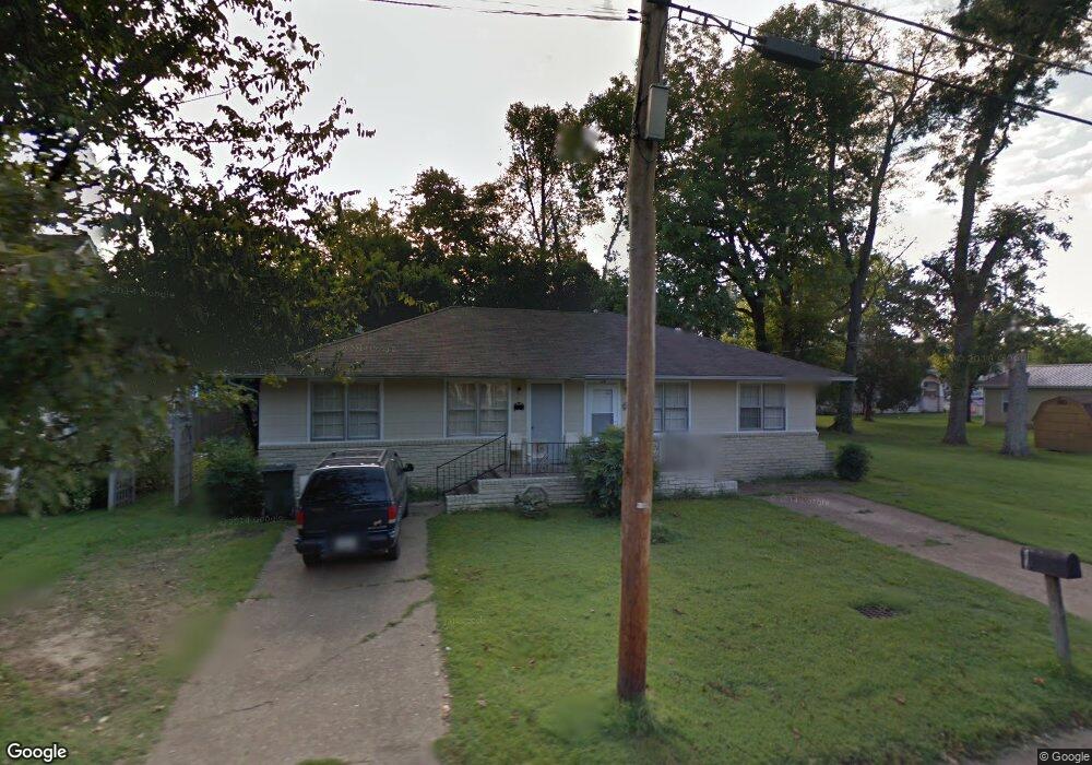
515 N Division St Unit 517 Union City, TN 38261
Estimated Value: $74,000 - $105,000
--
Bed
2
Baths
1,836
Sq Ft
$45/Sq Ft
Est. Value
About This Home
This home is located at 515 N Division St Unit 517, Union City, TN 38261 and is currently estimated at $83,326, approximately $45 per square foot. 515 N Division St Unit 517 is a home located in Obion County with nearby schools including Union City Elementary School, Union City Middle School, and Union City High School.
Ownership History
Date
Name
Owned For
Owner Type
Purchase Details
Closed on
Feb 27, 2006
Bought by
Adams Ralph E
Current Estimated Value
Purchase Details
Closed on
May 17, 2000
Sold by
Williams Ronnie H
Bought by
Gumpfer Cornelius A
Purchase Details
Closed on
Mar 24, 1997
Sold by
Clem Adams
Bought by
Williams Ronnie H
Purchase Details
Closed on
Sep 14, 1994
Bought by
Adams Clem
Purchase Details
Closed on
Jan 1, 1955
Bought by
Adams Mary Lucille
Create a Home Valuation Report for This Property
The Home Valuation Report is an in-depth analysis detailing your home's value as well as a comparison with similar homes in the area
Home Values in the Area
Average Home Value in this Area
Purchase History
| Date | Buyer | Sale Price | Title Company |
|---|---|---|---|
| Adams Ralph E | $30,000 | -- | |
| Gumpfer Cornelius A | $54,800 | -- | |
| Williams Ronnie H | $47,500 | -- | |
| Adams Clem | $40,000 | -- | |
| Adams Mary Lucille | -- | -- |
Source: Public Records
Tax History Compared to Growth
Tax History
| Year | Tax Paid | Tax Assessment Tax Assessment Total Assessment is a certain percentage of the fair market value that is determined by local assessors to be the total taxable value of land and additions on the property. | Land | Improvement |
|---|---|---|---|---|
| 2025 | -- | $22,440 | $0 | $0 |
| 2024 | -- | $22,440 | $2,800 | $19,640 |
| 2023 | $629 | $22,440 | $2,800 | $19,640 |
| 2022 | $214 | $13,360 | $2,000 | $11,360 |
| 2021 | $210 | $13,360 | $2,000 | $11,360 |
| 2020 | $214 | $13,360 | $2,000 | $11,360 |
| 2019 | $494 | $13,360 | $2,000 | $11,360 |
| 2018 | $492 | $13,280 | $2,000 | $11,280 |
| 2017 | $535 | $14,040 | $2,000 | $12,040 |
| 2016 | $535 | $14,040 | $2,000 | $12,040 |
| 2015 | $532 | $14,040 | $2,000 | $12,040 |
| 2014 | $532 | $14,040 | $2,000 | $12,040 |
Source: Public Records
Map
Nearby Homes
- 501 N 1st St
- 922 N Division St
- 724 E Martin Luther King
- 803 E Main St
- 1009 E Cheatham St
- 817 Exchange St
- 610 Perkins St
- 616 S 3rd St
- 605 S 5th St
- 841 Mosswood Dr
- 0 Mosswood Dr Unit RRA45928
- 0 Mosswood Dr Unit 44704
- 1414 Forest Dr
- 901 S Home St
- 903 Sherwood Dr
- 633 E Jackson St
- 422-426 430 W Jackson St
- 1129 S 4th St
- 1449 Forest Dr
- 0 S Miles Ave Unit 41030
- 519 N Division St
- 404 E College St
- 410 E College St
- 415 E Palmer St
- 514 N Division St
- 506 N Division St
- 601 N Division St
- 510 N Division St
- 504 N Division St
- 412 E Palmer St
- 605 N Division St
- 516 N Ury St
- 604 N Division St
- 418 E Palmer St
- 231 E Palmer
- 304 E College St
- 506 N Ury St
- 417 N Division St
- 420 E Palmer St
- 611 N Division St Unit 613