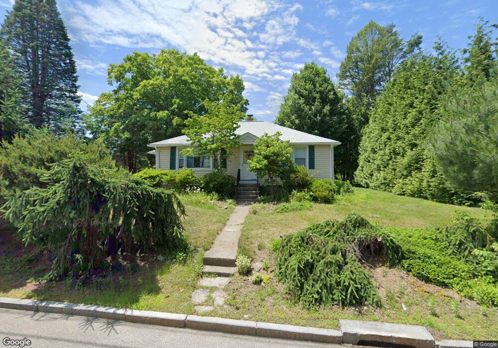
518 Massasoit Rd Worcester, MA 01604
Broadmeadow Brook NeighborhoodEstimated Value: $354,000 - $388,264
2
Beds
1
Bath
1,008
Sq Ft
$362/Sq Ft
Est. Value
About This Home
This home is located at 518 Massasoit Rd, Worcester, MA 01604 and is currently estimated at $365,066, approximately $362 per square foot. 518 Massasoit Rd is a home located in Worcester County with nearby schools including Jacob Hiatt Magnet School, Chandler Magnet, and Rice Square Elementary School.
Ownership History
Date
Name
Owned For
Owner Type
Purchase Details
Closed on
Sep 7, 2001
Sold by
Shyllberg Robert W
Bought by
Tormey Gail E
Current Estimated Value
Home Financials for this Owner
Home Financials are based on the most recent Mortgage that was taken out on this home.
Original Mortgage
$61,600
Outstanding Balance
$24,126
Interest Rate
7.05%
Mortgage Type
Purchase Money Mortgage
Estimated Equity
$340,940
Create a Home Valuation Report for This Property
The Home Valuation Report is an in-depth analysis detailing your home's value as well as a comparison with similar homes in the area
Home Values in the Area
Average Home Value in this Area
Purchase History
| Date | Buyer | Sale Price | Title Company |
|---|---|---|---|
| Tormey Gail E | $77,000 | -- |
Source: Public Records
Mortgage History
| Date | Status | Borrower | Loan Amount |
|---|---|---|---|
| Open | Tormey Gail E | $61,600 |
Source: Public Records
Tax History Compared to Growth
Tax History
| Year | Tax Paid | Tax Assessment Tax Assessment Total Assessment is a certain percentage of the fair market value that is determined by local assessors to be the total taxable value of land and additions on the property. | Land | Improvement |
|---|---|---|---|---|
| 2025 | $4,230 | $320,700 | $119,000 | $201,700 |
| 2024 | $4,159 | $302,500 | $119,000 | $183,500 |
| 2023 | $3,999 | $278,900 | $103,500 | $175,400 |
| 2022 | $3,527 | $231,900 | $82,800 | $149,100 |
| 2021 | $3,363 | $206,600 | $66,200 | $140,400 |
| 2020 | $3,245 | $190,900 | $66,200 | $124,700 |
| 2019 | $3,051 | $169,500 | $59,700 | $109,800 |
| 2018 | $2,973 | $157,200 | $59,700 | $97,500 |
| 2017 | $2,993 | $155,700 | $59,700 | $96,000 |
| 2016 | $2,883 | $139,900 | $44,500 | $95,400 |
| 2015 | $2,808 | $139,900 | $44,500 | $95,400 |
| 2014 | $2,734 | $139,900 | $44,500 | $95,400 |
Source: Public Records
Map
Nearby Homes
- 330 Millbury Ave
- 1 Broadmeadow Ave
- 1 Pineland Ave
- 232 Weatherstone Dr
- 76 Weatherstone Dr
- 11 Westview Ave
- 21 Epping St
- 12 Irene Ct
- 12 Alstead Path
- 2 Diane St
- 54 Park Hill Rd
- 4 Crest Ave
- 86 Wheelock Ave
- 266 Massasoit Rd
- 7 Lorraine Rd
- 3 Stidsen Way
- 10 Gensell Ave
- 46 Vincent Cir
- 330 Sunderland Rd Unit 78
- 330 Sunderland Rd Unit 87
- 512 Massasoit Rd
- 519 Massasoit Rd
- 515 Massasoit Rd
- 521 Massasoit Rd
- 525 Massasoit Rd
- 530 Massasoit Rd
- 511 Massasoit Rd
- 533 Massasoit Rd
- 506 Massasoit Rd
- 505 Massasoit Rd
- 502 Massasoit Rd
- 535 Massasoit Rd
- 500 Massasoit Rd
- 496 Massasoit Rd
- 489 Massasoit Rd
- 492 Massasoit Rd
- 539 Massasoit Rd
- 490 Massasoit Rd
- 488 Massasoit Rd
- 483 Massasoit Rd