N
Seller's Agent in 2014
Nancy Carter
Dennis Haniford's Cascade Realty
Estimated Value: $448,000 - $687,000
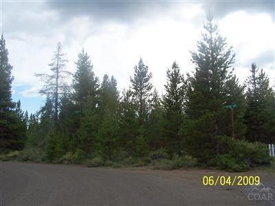
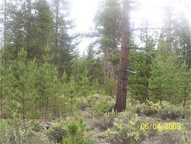
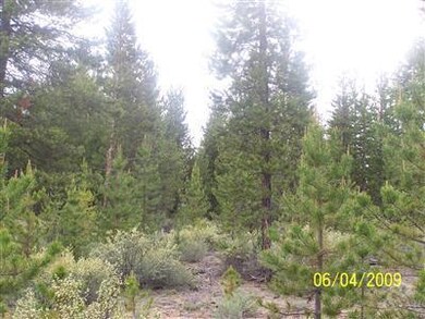
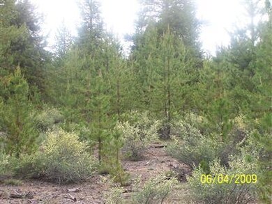
Private treed 5+/- Acres located west of LaPine in an area of similar size parcels. Borders private timberland on the west side.
Last Agent to Sell the Property
Nancy Carter
Dennis Haniford's Cascade Realty License #790600221 Listed on: 11/23/2013
Last Buyer's Agent
Jean Hamilton
Apex Real Estate Company License #920400048
| Date | Buyer | Sale Price | Title Company |
|---|---|---|---|
| Byrd Brandon Lee | $65,000 | Amerititle | |
| Patoine Michael J | -- | Amerititle |
| Date | Event | Price | List to Sale | Price per Sq Ft |
|---|---|---|---|---|
| 04/17/2014 04/17/14 | Sold | $65,000 | -62.9% | -- |
| 04/05/2014 04/05/14 | Pending | -- | -- | -- |
| 06/04/2009 06/04/09 | For Sale | $175,000 | -- | -- |
| Year | Tax Paid | Tax Assessment Tax Assessment Total Assessment is a certain percentage of the fair market value that is determined by local assessors to be the total taxable value of land and additions on the property. | Land | Improvement |
|---|---|---|---|---|
| 2025 | $3,064 | $217,370 | -- | -- |
| 2024 | $2,937 | $211,040 | -- | -- |
| 2023 | $2,872 | $204,900 | $0 | $0 |
| 2022 | $2,975 | $193,150 | $0 | $0 |
| 2021 | $2,993 | $187,530 | $0 | $0 |
| 2020 | $2,836 | $187,530 | $0 | $0 |
| 2019 | $2,757 | $182,070 | $0 | $0 |
| 2018 | $2,679 | $176,770 | $0 | $0 |
| 2017 | $2,609 | $171,630 | $0 | $0 |
| 2016 | $2,486 | $166,640 | $0 | $0 |
| 2015 | $719 | $44,880 | $0 | $0 |
| 2014 | $308 | $23,970 | $0 | $0 |
N
Seller's Agent in 2014
Nancy Carter
Dennis Haniford's Cascade Realty
J
Buyer's Agent in 2014
Jean Hamilton
Apex Real Estate Company
Source: Oregon Datashare
MLS Number: 2905335
APN: 141685
Disclaimer: Certain information contained herein is derived from information provided by parties other than Homes.com. All information provided is deemed reliable, but is not guaranteed to be accurate and should be independently verified.
![]() © 2026 Oregon Datashare (KCAR | MLSCO | SOMLS). All rights reserved. The data relating to real estate for sale on this web site comes in part from the Internet Data Exchange Program of the Oregon Datashare. Real estate listings held by IDX Brokerage firms other than Ten-X are marked with the Internet Data Exchange logo or the Internet Data Exchange thumbnail logo and detailed information about them includes the name of the listing Brokers. Information provided is for consumers' personal, non-commercial use and may not be used for any purpose other than to identify prospective properties the viewer may be interested in purchasing. The consumer will not copy, retransmit nor redistribute any of the content from this website. Information provided is deemed reliable, but not guaranteed.
© 2026 Oregon Datashare (KCAR | MLSCO | SOMLS). All rights reserved. The data relating to real estate for sale on this web site comes in part from the Internet Data Exchange Program of the Oregon Datashare. Real estate listings held by IDX Brokerage firms other than Ten-X are marked with the Internet Data Exchange logo or the Internet Data Exchange thumbnail logo and detailed information about them includes the name of the listing Brokers. Information provided is for consumers' personal, non-commercial use and may not be used for any purpose other than to identify prospective properties the viewer may be interested in purchasing. The consumer will not copy, retransmit nor redistribute any of the content from this website. Information provided is deemed reliable, but not guaranteed.
